Santa Bàrbara, Tarragona
Santa Bàrbara is a municipality in the comarca of Montsià in Catalonia, Spain.
Santa Bàrbara | |
|---|---|
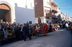 Main square: a local festival in honor of Saint Anthony | |
 Flag 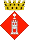 Coat of arms | |
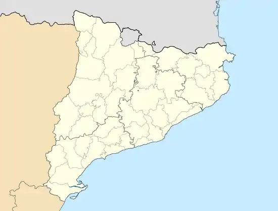 Santa Bàrbara Location in Catalonia | |
| Coordinates: 40°43′01″N 0°29′52″E | |
| Country | Spain |
| Community | Catalonia |
| Province | Tarragona |
| Comarca | Montsià |
| Government | |
| • mayor | Alfred Blanch Farnós (2015)[1] |
| Area | |
| • Total | 28.2 km2 (10.9 sq mi) |
| Elevation | 79 m (259 ft) |
| Population (2018)[3] | |
| • Total | 3,777 |
| • Density | 130/km2 (350/sq mi) |
| Demonym(s) | Planer, planera |
| Postal Code | 43138 |
| Area code(s) | (+34) ... |
| Vehicle registration | T |
| Website | santabarbara |
Santa Bàrbara is part of the Taula del Sénia free association of municipalities.
Geography
This town is located in a plain at the northern end of the Serra de Godall, at the crossing of the roads between Tortosa and Ulldecona and between Amposta and La Galera. It was an important resting point for wayfarers and transhumant cattle herders using the system of ancient passages known as lligallos in the past. The town had roadside inns where travelers could rest and recover from the day's journey and it still has some mid-range hotels and restaurants.
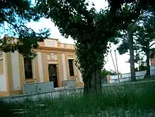
The RENFE railway line from Valencia to Tortosa used to pass through this town before 1990.[4] Since the Tortosa-Ferreries-Roquetes-Vinallop-Santa Bàrbara section of the line was eliminated, the rails were pulled off and the Santa Bàrbara train station buildings lie abandoned.
References
- "Ajuntament de Santa Bàrbara". Generalitat of Catalonia. Retrieved 2015-11-13.
- "El municipi en xifres: Santa Bàrbara". Statistical Institute of Catalonia. Retrieved 2015-11-23.
- Municipal Register of Spain 2018. National Statistics Institute.
- El Punt - El cruel divorci entre Tortosa i el tren
External links
 Media related to Santa Bàrbara, Montsià at Wikimedia Commons
- Pàgina web de l'Ajuntament
- Government data pages (in Catalan)
Places adjacent to Santa Bàrbara, Tarragona | ||||||||||
|---|---|---|---|---|---|---|---|---|---|---|
| ||||||||||
Municipalities of Montsià | ||
|---|---|---|