Moses Kill
The Moses Kill is an approximately 22.0-mile-long (35.4 km)[2] tributary stream of the Hudson River in New York state. The source is in the foothills of the Taconic Mountains in Hartford in Washington county. The stream flows thru the town and village of Argyle before entering the Hudson River at Fort Edward, just south of Griffin Island. Beginning in the late 1760s the Moses Kill's water was damed at a few locations to support several small mills near Argyle Village.[3]
| Moses Kill [1] Moss Kill, Moses Kil | |
|---|---|
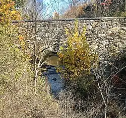
 Moses Kill passing underneath Route 197 1870 Stone Bridge in Argyle, New York | |
| Location | |
| Country | United States |
| State | New York |
| Region | Hudson Valley |
| County | Washington |
| Towns | Argyle, New York, |
| Physical characteristics | |
| Source | |
| • location | Hartford, New York |
| • coordinates | 43°11′21″N 73°56′38″W |
| • elevation | 720 ft (220 m) |
| Mouth | Hudson River at Fort Edward, New York |
• location | Fort Edward, New York |
• coordinates | 42°04′57″N 73°34′55″W |
• elevation | 118 ft (36 m) |
| Basin features | |
| River system | Hudson River |
| Tributaries | |
| • left | Dead Creek |
| • right | Gillis Brook |
See also
References
- U.S. Geological Survey Geographic Names Information System: Moses Kill
- U.S. Geological Survey. National Hydrography Dataset high-resolution flowline data. The National Map, accessed October 16, 2020
- The Argyle History Group (1996). I Remember...Argyle, A Book of Memories.
This article is issued from Wikipedia. The text is licensed under Creative Commons - Attribution - Sharealike. Additional terms may apply for the media files.