Mount Blue State Park
Mount Blue State Park is a public recreation area covering 7,489 acres (3,031 ha) in the town of Weld, Franklin County, Maine.[3] The state park's bifurcated land includes acreage on the west shore of Webb Lake as well as Mount Blue and other peaks to the east of the lake. The park is connected by road with the 10,555-acre (4,271 ha)[2] Tumbledown Public Lands, the site of Little Jackson Mountain, Tumbledown Mountain, and Tumbledown Pond, an alpine lake near the top of Tumbledown and Little Jackson mountains.[4] The park and public lands are managed by the Maine Department of Agriculture, Conservation and Forestry.
| Mount Blue State Park | |
|---|---|
IUCN category V (protected landscape/seascape) | |
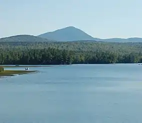 Webb Lake and Mount Blue | |
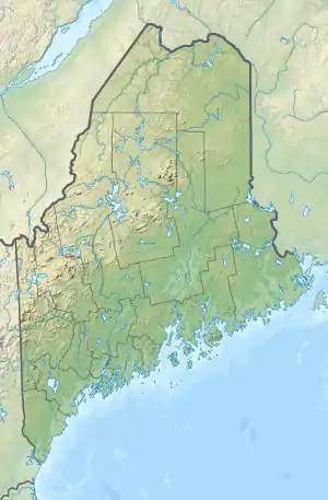 Location in Maine | |
| Location | Weld, Franklin, Maine, United States |
| Coordinates | 44°44′02″N 70°23′16″W[1] |
| Area | 7,489 acres (30.31 km2)[2] |
| Elevation | 1,214 ft (370 m)[1] |
| Established | 1955 |
| Operator | Maine Department of Agriculture, Conservation and Forestry |
| Website | Mount Blue State Park |
Wildlife
This park is home to mammalian species including moose, squirrels, white-tailed deer, foxes, black bears and coyotes.
History
During the 1930s, workers with the Works Progress Administration began developing the area that would become Mount Blue State Park. The state of Maine took possession from the U.S. Department of Agriculture in 1955.[5] In 2002, the park saw a 50% increase in size when the state purchased 2,468 acres from a subsidiary of McDonald Investment Company for $980,000. The funds used to purchase the land came from the Land for Maine’s Future program, the federal Land and Water Conservation Fund, the Maine Outdoor Heritage Fund and private donations. The land purchased included the 1,298-foot peak known as Hedgehog Hill.[6][7]
Activities and amenities
The park offers a nature center, camping at 136 campsites, swimming area, motorized and non-motorized boating, fishing, and hunting. The extensive trail system is used for hiking, horseback riding, cross-country skiing, snowmobiling, and ATV riding. The park is open year-round.[3]
References
- "Mount Blue State Park". Geographic Names Information System. United States Geological Survey.
- "State Parks, State Historic Sites and Public Reserved Lands" (PDF). Department of Agriculture, Conservation and Forestry. September 2016. Retrieved July 19, 2017.
- "Mount Blue State Park". Department of Agriculture, Conservation and Forestry. Retrieved July 26, 2014.
- Finan, Kelly. "Tumbledown Mountain" (PDF). Natural Heritage Hikes. Department of Agriculture, Conservation and Forestry. Retrieved June 15, 2015.
- "Mount Blue State Park and Tumbledown Public Lands Guide & Map" (PDF). Department of Agriculture, Conservation and Forestry. 2015. Retrieved July 19, 2017.
- "Over 2,400 acres for Mt. Blue State Park". The Trust for Public Land. January 7, 2002. Retrieved July 19, 2017.
- "Hedgehog Hill". Geographic Names Information System. United States Geological Survey.
External links
- Mount Blue State Park Department of Agriculture, Conservation and Forestry
- Mount Blue State Park and Tumbledown Public Lands Guide & Map Department of Agriculture, Conservation and Forestry
