Mount Epperly
Mount Epperly is a 4,359-metre-high (14,301 ft)[1] or perhaps 4,512-metre-high (14,803 ft)[2] mountain in the Sentinel Range, Ellsworth Mountains in Antarctica. It overlooks Cervellati Glacier to the northeast and Ramorino Glacier to the east-northeast. The peak was first climbed by Erhard Loretan, solo over the 2,100-metre-high (6,900 ft) south face, on December 1, 1994. Loretan returned the next year and reclimbed the route for a film. In 1999, the American climbers Conrad Anker and Jim Donini failed in their attempt over the west ridge.[3] The third successful ascent was by the Chilean Camilo Rada and Australian Damien Gildea via a new route over the south face in December 2007. Their GPS measurements on top suggested a height 153 m above the official one.[2]
| Mount Epperly | |
|---|---|
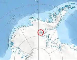 Location of Vinson Massif in Western Antarctica. | |
| Highest point | |
| Elevation | 4,359 m (14,301 ft) |
| Coordinates | 78°27′0″S 85°51′0″W |
| Geography | |
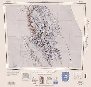 Central and southern Sentinel Range map
| |
| Location | Antarctica |
| Climbing | |
| First ascent | December 1, 1994 by Erhard Loretan |
See also
- Mountains in Antarctica
Maps
- Vinson Massif. Scale 1:250 000 topographic map. Reston, Virginia: US Geological Survey, 1988.
- Antarctic Digital Database (ADD). Scale 1:250000 topographic map of Antarctica. Scientific Committee on Antarctic Research (SCAR). Since 1993, regularly updated.
References
- "Antarctic Factsheet Geographical Statistics" (PDF). Natural Environment Research Council. Retrieved 6 May 2012.
- Damien Gildea, Twenty-Hour Epperly Push For New Route, GPS Height, Alpinist, 2008
- Gildea, Damien (1999). "Mountaineering in Antarctica". American Alpine Journal: 145. Retrieved 6 May 2012.
| General |
| .svg.png.webp) |
|---|---|---|
| Regions | ||
| Waterways | ||
| Famous explorers | ||