Mount Vernon, South Dakota
Mount Vernon is a city in Davison County, South Dakota, United States. The population was 462 at the 2010 census. It is part of the Mitchell, South Dakota Micropolitan Statistical Area.
Mount Vernon, South Dakota | |
|---|---|
| Motto(s): "Small Town But Big Opportunities" | |
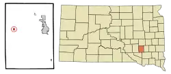 Location in Davison County and the state of South Dakota | |
| Coordinates: 43°42′44″N 98°15′41″W | |
| Country | United States |
| State | South Dakota |
| County | Davison |
| Incorporated | 1903[1] |
| Area | |
| • Total | 0.31 sq mi (0.80 km2) |
| • Land | 0.31 sq mi (0.80 km2) |
| • Water | 0.00 sq mi (0.00 km2) |
| Elevation | 1,411 ft (430 m) |
| Population | |
| • Total | 462 |
| • Estimate (2019)[4] | 436 |
| • Density | 1,415.58/sq mi (547.05/km2) |
| Time zone | UTC-6 (Central (CST)) |
| • Summer (DST) | UTC-5 (CDT) |
| ZIP code | 57363 |
| Area code(s) | 605 |
| FIPS code | 46-44100[5] |
| GNIS feature ID | 1256568[6] |
_(14590749598).jpg.webp)
The town takes its name from Mount Vernon, the estate of George Washington; an early variant name was Arlandtown.[7]
Geography
Mount Vernon is located at 43°42′44″N 98°15′41″W (43.712155, -98.261264).[8]
According to the United States Census Bureau, the city has a total area of 0.35 square miles (0.91 km2), all land.[9]
Mount Vernon has been assigned the ZIP code 57363 and the FIPS place code 44100.
Demographics
| Historical population | |||
|---|---|---|---|
| Census | Pop. | %± | |
| 1890 | 127 | — | |
| 1900 | 222 | 74.8% | |
| 1910 | 614 | 176.6% | |
| 1920 | 661 | 7.7% | |
| 1930 | 489 | −26.0% | |
| 1940 | 405 | −17.2% | |
| 1950 | 387 | −4.4% | |
| 1960 | 379 | −2.1% | |
| 1970 | 398 | 5.0% | |
| 1980 | 402 | 1.0% | |
| 1990 | 368 | −8.5% | |
| 2000 | 477 | 29.6% | |
| 2010 | 462 | −3.1% | |
| 2019 (est.) | 436 | [4] | −5.6% |
| U.S. Decennial Census[10] | |||
2010 census
As of the census[3] of 2010, there were 462 people, 178 households, and 125 families residing in the city. The population density was 1,320.0 inhabitants per square mile (509.7/km2). There were 205 housing units at an average density of 585.7 per square mile (226.1/km2). The racial makeup of the city was 92.6% White, 5.4% Native American, 0.4% Pacific Islander, and 1.5% from two or more races. Hispanic or Latino of any race were 2.2% of the population.
There were 178 households, of which 39.9% had children under the age of 18 living with them, 59.0% were married couples living together, 6.2% had a female householder with no husband present, 5.1% had a male householder with no wife present, and 29.8% were non-families. 25.8% of all households were made up of individuals, and 10.1% had someone living alone who was 65 years of age or older. The average household size was 2.60 and the average family size was 3.15.
The median age in the city was 37.4 years. 30.1% of residents were under the age of 18; 6.8% were between the ages of 18 and 24; 23.8% were from 25 to 44; 26.4% were from 45 to 64; and 12.8% were 65 years of age or older. The gender makeup of the city was 53.0% male and 47.0% female.
2000 census
As of the census[5] of 2000, there were 477 people, 177 households, and 127 families residing in the city. The population density was 1,489.3 people per square mile (575.5/km2). There were 189 housing units at an average density of 590.1 per square mile (228.0/km2). The racial makeup of the city was 98.11% White, 0.21% Native American, 1.68% from other races. Hispanic or Latino of any race were 1.68% of the population.
There were 177 households, out of which 40.7% had children under the age of 18 living with them, 63.3% were married couples living together, 6.2% had a female householder with no husband present, and 28.2% were non-families. 23.2% of all households were made up of individuals, and 11.9% had someone living alone who was 65 years of age or older. The average household size was 2.69 and the average family size was 3.23.
In the city, the population was spread out, with 31.9% under the age of 18, 6.7% from 18 to 24, 30.6% from 25 to 44, 18.0% from 45 to 64, and 12.8% who were 65 years of age or older. The median age was 35 years. For every 100 females, there were 99.6 males. For every 100 females age 18 and over, there were 91.2 males.
The median income for a household in the city was $36,806, and the median income for a family was $41,250. Males had a median income of $30,250 versus $17,500 for females. The per capita income for the city was $14,864. About 2.3% of families and 4.1% of the population were below the poverty line, including 1.3% of those under age 18 and 12.3% of those age 65 or over.
Notable people
- Chad Greenway, Minnesota Vikings linebacker
- Ralph Homan, businessman and member of the South Dakota House of Representatives
- Joshua Klumb businessman, farmer, and member of the South Dakota Senate
References
- "SD Towns" (PDF). South Dakota State Historical Society. Retrieved 2010-02-14.
- "2019 U.S. Gazetteer Files". United States Census Bureau. Retrieved July 30, 2020.
- "U.S. Census website". United States Census Bureau. Retrieved 2012-06-21.
- "Population and Housing Unit Estimates". United States Census Bureau. May 24, 2020. Retrieved May 27, 2020.
- "U.S. Census website". United States Census Bureau. Retrieved 2008-01-31.
- "US Board on Geographic Names". United States Geological Survey. 2007-10-25. Retrieved 2008-01-31.
- Federal Writers' Project (1940). South Dakota place-names, v.1-3. University of South Dakota. p. 52.
- "US Gazetteer files: 2010, 2000, and 1990". United States Census Bureau. 2011-02-12. Retrieved 2011-04-23.
- "US Gazetteer files 2010". United States Census Bureau. Archived from the original on 2011-02-20. Retrieved 2012-06-21.
- "Census of Population and Housing". Census.gov. Retrieved June 4, 2015.
Municipalities and communities of Davison County, South Dakota, United States | ||
|---|---|---|
| City | 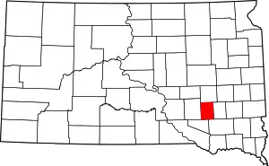 | |
| Town | ||
| CDP | ||
| ||