Muddy Branch
Muddy Branch is a tributary stream of the Potomac River in Montgomery County, Maryland, United States, located about 14 miles (23 km) northwest of Washington, D.C.
| Muddy Branch | |
|---|---|
 Muddy Branch Stream near Esworthy Rd | |
| Location | |
| Country | United States |
| State | Maryland |
| Counties | Montgomery |
| Physical characteristics | |
| Source | |
| • location | Gaithersburg, MD |
| Mouth | Potomac River |
• location | North of Pennyfield Lock, Potomac, MD |
• coordinates | 39°03′16″N 77°17′37″W |
| Length | 11.9 miles (19.2 km) |
Course
The headwaters of the stream originate in Gaithersburg, and the stream flows southwest for 11.9 miles (19.2 km),[1] through Muddy Branch Park and Blockhouse Point Conservation Park, under the Chesapeake and Ohio Canal near Pennyfield Lock, to the Potomac River.
Tributaries
- Decoverly Tributary
- Dufief Tributary
- Lakes Tributary
- Pennyfield Lock Tributary
- Potomac Grove Tributary
- Query Mill Tributary
- Quince Orchard Knolls Tributary
- Rich Branch
- Route 28 Tributary
Recreation
Parts of Muddy Branch flow through Blockhouse Point Conservation Park and the Muddy Branch Stream Valley Park. The Muddy Branch Greenway Trail is a 9 miles (14 km) long natural surface trail that runs from the Potomac River to Darnestown Road.[2] along Muddy Branch. There is a boat ramp on Muddy Branch just before it goes under the C & O canal that can be used by small boats (such as canoes and kayaks) to access the Potomac River.[3]
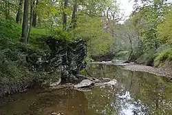
- Different parts of Muddy Branch
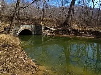 Muddy Branch, crossing under the Chesapeake and Ohio Canal, just before emptying into the Potomac River
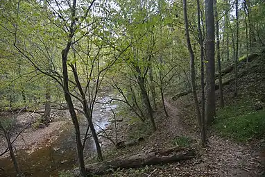 Muddy Branch Stream and the Muddy Branch Greenway Trail
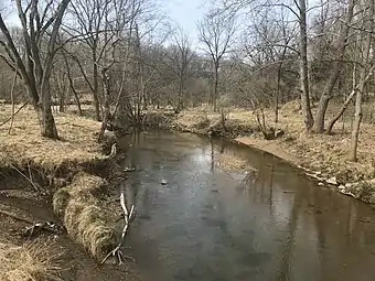 Muddy Branch near Quince Orchard Road in North Potomac, Maryland
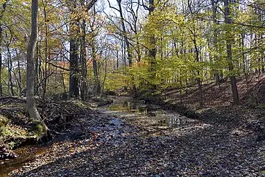 Muddy Branch Stream behind Morris Park, Gaithersburg, Maryland
See also
- List of Maryland rivers
References
- U.S. Geological Survey. National Hydrography Dataset high-resolution flowline data. The National Map, accessed August 15, 2011
- "Muddy Branch Greenway Trail". Montgomery County Department of Parks. 2019-10-22. Retrieved 2020-10-08.
- "Pennyfield Lock Neighborhood Conservation Area". Montgomery County Department of Parks. 2020-01-02. Retrieved 2020-10-21.
External links
- Muddy Branch and Watts Branch Subwatersheds Implementation Plan (2012) - Montgomery County Department of Environmental Protection
- Muddy Branch Alliance - Community watershed group