List of crossings of the Potomac River
This is a list of bridges and other crossings of the Potomac River and its North and South branches. Within each section, crossings are listed from the source moving downstream.
Potomac River
This list contains only crossings of the main channel. See also Washington Channel#Crossings and Boundary Channel#Crossings.
| Bridge | Route | Location | Coordinates | |
|---|---|---|---|---|
| West Virginia / Maryland | ||||
_crossing_the_Potomac_River_from_Paw_Paw%252C_Morgan_County%252C_West_Virginia_to_Allegany_County%252C_Maryland.jpg.webp) |
Paw Paw Bridge | Paw Paw / Allegany County | ||
| abandoned rail bridge | Western Maryland Railway | |||
| abandoned rail bridge | Western Maryland Railway | |||
| Upper Magnolia Cut Off Bridge | CSX Cumberland Subdivision | Magnolia / Allegany County | ||
| Lower Magnolia Cut Off Bridge | CSX Cumberland Subdivision | Magnolia / Allegany County | ||
| abandoned rail bridge | Western Maryland Railway | |||
| abandoned rail bridge | Western Maryland Railway | |||
| abandoned rail bridge | Western Maryland Railway | |||
| abandoned rail bridge | Western Maryland Railway | |||
 |
US 522 Bridge | Morgan County / Hancock | ||
| Lurgan Subdivision Bridge | CSX Lurgan Subdivision | |||
 |
US 11 Bridge | Falling Waters / Williamsport | ||
 |
I-81 Potomac River Bridge | Falling Waters / Williamsport | ||
| Railroad Bridge | Berkeley County / Williamsport | |||
 |
James Rumsey Bridge | Shepherdstown / Washington County | ||
.jpg.webp) |
Shepherdstown Railroad Bridge | Norfolk Southern | Shepherdstown / Washington County | |
.jpg.webp) |
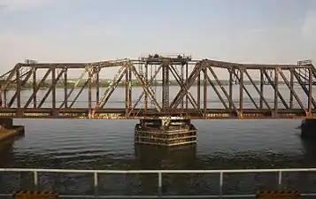
Old B&O Mainline Bridge | CSX Cumberland Subdivision | Harper's Ferry / Washington County | |
 |
Shenandoah Sub Bridge | CSX Shenandoah Subdivision | Harper's Ferry / Washington County | |
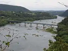
| Bollman Truss Bridge (abutments)[1] | CSX | Harper's Ferry / Washington County | ||
| Virginia / Maryland | ||||
 |
Sandy Hook Bridge | Loudoun Heights / Washington County | ||
 |
Brunswick Bridge | Lovettsville / Brunswick | ||
 |
Point of Rocks Bridge | Loudoun County / Point of Rocks | ||
 |
White's Ferry | Loudoun County / Montgomery County | ||
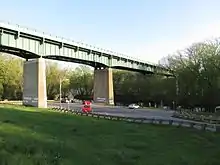
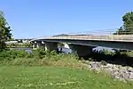
_connecting_Montgomery_County%252C_Maryland_and_Fairfax_County%252C_Virginia_from_the_south_bank_of_the_Potomac_River.jpg.webp) |
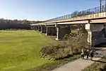
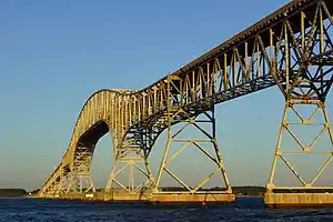
American Legion Memorial Bridge | Fairfax County / Montgomery County | 38°58′09″N 77°10′46″W | |
| Virginia / District of Columbia | ||||
 |
Chain Bridge | Clara Barton Parkway |
Arlington / Washington, D.C. | 38°55′47″N 77°06′59″W |
.jpg.webp) |
Francis Scott Key Bridge | Arlington / Georgetown | 38°54′09″N 77°04′12″W | |
| Rosslyn Tunnel | Arlington / Georgetown | |||
_in_Washington%252C_D.C..jpg.webp) |
Theodore Roosevelt Bridge | Arlington / Washington, D.C. | 38°53′32″N 77°03′36″W | |
 |
Arlington Memorial Bridge | Washington, D.C. | 38°53′14″N 77°03′20″W | |
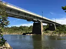
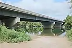
_as_it_crosses_the_Potomac_River_to_Washington%252C_D.C._from_the_river_shore_just_north_of_the_bridge_in_Arlington_County%252C_Virginia.jpg.webp) |
George Mason Memorial Bridge | Arlington / Washington, D.C. | 38°52′34″N 77°03′32″W | |
 |
Rochambeau Memorial Bridge | Arlington / Washington, D.C. | 38°52′33″N 77°02′30″W | |
_as_it_crosses_the_Potomac_River_between_Arlington_County%252C_Virginia_and_Washington%252C_D.C..jpg.webp) |
Arland D. Williams Jr. Memorial Bridge | Arlington / Washington, D.C. | 38°52′31″N 77°02′25″W | |
 |
Charles R. Fenwick Bridge | Arlington / Washington, D.C. | 38°52′29″N 77°02′23″W | |
 |
Long Bridge | CSX RF&P Subdivision | Arlington / Washington, D.C. | 38°52′28″N 77°02′19″W |
| Virginia / Maryland | ||||
 |
Woodrow Wilson Bridge | Alexandria / Prince George's County | 38°47′36″N 77°01′59″W | |
 |
Governor Harry W. Nice Memorial Bridge | King George County / Charles County | 38°21′42″N 76°59′50″W | |
North Branch Potomac River
Dams
| Dam | Impoundment name | Location (WV/MD) | Coordinates |
|---|---|---|---|
| Jennings Randolph Dam | Jennings Randolph Lake | Mineral County / Garrett County | 39°25′56″N 79°07′22″W |
| NewPage Dam | The Boons | Mineral County / Luke | 39°28′21″N 79°03′37″W |
| Cumberland Flood Control Dam | Kelly Springfield Eddy | Ridgeley / Cumberland | 39°38′55″N 78°45′57″W |
Bridges
| Bridge | Route | Location (WV/MD) | Coordinates |
|---|---|---|---|
| Kempton Bridge | / Kempton | 39°12′23″N 79°29′20″W | |
| Wilson Bridge | Wilson | 39°15′13″N 79°23′55″W | |
| Bayard Bridge | Bayard / | 39°16′27″N 79°22′11″W | |
| US 50 Bridge | Gormania / Gorman | 39.29278°N 79.34472°W | |
| rail bridge | CSX Thomas Subdivision | ||
| Kitzmiller Bridge | Blaine / Kitzmiller | 39°23′13″N 79°10′51″W | |
| rail bridge | CSX Thomas Subdivision | ||
| rail bridge | CSX Thomas Subdivision | ||
| B&O Railroad Stone Arch Bridge | CSX Mountain Subdivision | Beryl / Bloomington | 39.476912°N 79.068246°W |
| WV 46 Bridge | Beryl / Bloomington | 39.479292°N 79.068378°W | |
| rail bridge | CSX Thomas Subdivision | ||
| Abandoned Bridge | Piedmont | ||
| NewPage Paper Bridge | NewPage Corporation paper mill | Piedmont / Luke | |
| Piedmont Bridge | Piedmont / Westernport | ||
| World War II Memorial Bridge | Keyser / McCoole | ||
| 21st B&O Railroad Bridge | CSX | Keyser | |
| Route 956 Bridge | Rocket Center / Pinto | 39°33′44″N 78°50′52″W | |
| Western Maryland Scenic Railroad Bridge | Western Maryland Scenic Railroad | Ridgeley / Cumberland | |
| Ridgeley Bridge | Ridgeley / Cumberland | ||
| C&O Canal Parkway Bridge | Wiley Ford / Cumberland | 39.62158°N 78.773828°W | |
| rail bridge | CSX Cumberland Subdivision | ||
| Low Water Toll Bridge | Green Spring / Oldtown | 39.537382°N 78.613458°W |
South Branch Potomac River
| Bridge | Route | Location | Coordinates | |
|---|---|---|---|---|
| Virginia | ||||
| Hightown | ||||
| Blue Grass | ||||
 |
Forks of Waters | |||
| West Virginia | ||||
| CR 25 Bridge | Cave / Moatstown | 38°33′42″N 79°25′46″W | ||
| Johnstown Road Bridge | Franklin | 38°36′32″N 79°21′12″W | ||
| Dickinson Mountain Road Connector Bridge | Franklin | 38°38′09″N 79°20′15″W | ||
| CR 220/12 Bridge | Franklin | 38°38′22″N 79°19′55″W | ||
| US 33 Bridge | Franklin | 38°39′35″N 79°19′06″W | ||
 |
River Mountain Lane Bridge | |||
| Squire Lane Bridge | ||||
| Schmucker Road Bridge | Upper Tract | 38°47′12″N 79°16′00″W | ||
| Upper Tract Bridge | Upper Tract | 38°48′21″N 79°16′35″W | ||
 |
Petersburg Bridge | Petersburg | 38°59′18″N 79°07′30″W | |
 |
Petersburg Gap Bridge | Welton | 39°00′10″N 79°04′46″W | |
 |
Fisher Bridge | Fisher/Moorefield | 39°03′01″N 78°59′35″W | |
 |
Richard Lee "Dickie" Moyers Veterans Memorial Bridge | Moorefield | 39°04′57″N 78°58′21″W | |
 |
Old Fields Bridge | Old Fields | 39°06′13″N 78°57′34″W | |
| Sycamore Wooden Tressel | South Branch Valley Railroad | Sycamore | 39°09′09″N 78°54′52″W | |
| Sector-Glebe Bridge (Partially Destroyed) | Sector/Glebe | 39°13′32″N 78°51′15″W | ||
| Romney Bridge | Romney | 39°20′21″N 78°46′33″W | ||
| Valley View Wooden Tressel | South Branch Valley Railroad | Romney | 39°21′14″N 78°45′57″W | |
| Ridgedale Wooden Tressel | South Branch Valley Railroad | Ridgedale | 39°24′56″N 78°43′48″W | |
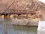
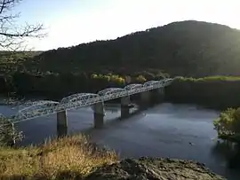
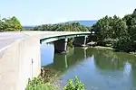
_crossing_the_John_Blue_Bridge_over_the_South_Branch_Potomac_River_from_Grace%252C_Hampshire_County%252C_West_Virginia_into_Blues_Beach%252C_Hampshire_County%252C_West_Virginia.jpg.webp) |
John Blue Bridge | Blues Beach | 39°25′33″N 78°42′56″W | |
| Millesons Mill Bridge | Millesons Mill | 39°26′50″N 78°39′14″W | ||
| B&O Railroad Bridge | B&O Railroad | Mouth, Green Spring | 39°31′40″N 78°35′18″W | |
North Fork South Branch Potomac River
Listed heading downstream from source to mouth at the South Branch Potomac River.
| Bridge | Route | Location (WV) | Coordinates | |
|---|---|---|---|---|
| CR 19 Bridge South | Cherry Grove | 38°35′18″N 79°32′47″W | ||
| Bridge North | Cherry Grove | 38°37′20″N 79°32′20″W | ||
| Snowy Mountain Road Bridge | Cherry Grove | 38°38′11″N 79°31′12″W | ||
| Teter Gap Road Bridge | Circleville | 38°39′10″N 79°30′45″W | ||
| Circleville Bridge | Circleville | 38°40′20″N 79°29′23″W | ||
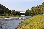
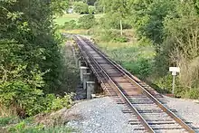
_crossing_the_North_Fork_South_Branch_Potomac_River_in_Judy_Gap%252C_Pendleton_County%252C_West_Virginia.jpg.webp) |
Judy Gap Bridge | Judy Gap | 38°42′24″N 79°27′56″W | |
| Riverton Bridge | Riverton | 38°44′35″N 79°26′09″W | ||
| Germany Valley Limestone Bridge | Macksville | 38°47′17″N 79°24′25″W | ||
| Harper Gap Road Bridge | Macksville | 38°48′41″N 79°23′35″W | ||
| Roy Gap Road Bridge | Seneca Rocks | 38°49′56″N 79°22′23″W | ||
| Smoke Hole Road Bridge | Cabins | 38°59′04″N 79°14′02″W | ||
South Fork South Branch Potomac River
| Bridge | Route | Location | Coordinates | |
|---|---|---|---|---|
| Virginia | ||||
| 38.4153°N 79.3774°W | ||||
| Palo Alto | 38.4235°N 79.3706°W | |||
| West Virginia | ||||
| Sweetwater Spring Road | ||||
| Buck Hill Lane | ||||
| driveway | ||||
| Harveys Lane | ||||
| 38.4769°N 79.3288°W | ||||
| driveway | ||||
| Sugar Grove | 38.5130°N 79.3106°W | |||
| Honeycomb Lane | ||||
| Puffenbarger Lane | ||||
| Propst Memories Lane | ||||
| Propstburg Road | ||||
| Cassell Lane | ||||
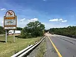
| Brandywine | ||||
_at_the_under-construction_bridge_over_the_South_Fork_South_Branch_Potomac_River_in_Brandywine%252C_Pendleton_County%252C_West_Virginia.jpg.webp) |
Brandywine | 38.6310°N 79.2438°W | ||
| Siple Lane | ||||
| Oak Flat | 38.6740°N 79.2030°W | |||
| Fort Seybert | 38.6950°N 79.1906°W | |||
| 39.0562°N 78.9704°W | ||||
| Zirk Farm Road | ||||
| driveway | ||||
| Peru Hollow Road | ||||
| Alum Road | ||||
| Blue Rock Lane | ||||
| driveway | ||||
| driveway | ||||
| Bass Lane | ||||
| Milam, West Virginia | 38.7977°N 79.1078°W | |||
| driveway | ||||
 |
South Branch Valley Railroad | Moorefield | 39.0533°N 78.9663°W | |
 |
Wendell Del Hester Memorial Bridge | Moorefield | 39.0562°N 78.9704°W | |
References
- Paula Stoner Dickey and Robert M. Vogel (June 26, 1973). "National Register of Historic Places Nomination: B & O Railroad Potomac River Crossing" (pdf). National Park Service. Cite journal requires
|journal=(help)
This article is issued from Wikipedia. The text is licensed under Creative Commons - Attribution - Sharealike. Additional terms may apply for the media files.