Municipality of the District of Clare
Clare, officially named the Municipality of the District of Clare, is a district municipality in western Nova Scotia, Canada. Statistics Canada classifies the district municipality as a municipal district.
Clare | |
|---|---|
District municipality | |
| Municipality of the District of Clare Municipalité du district de Clare | |
 Seal | |
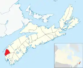 Location of the Municipality of the District of Clare | |
| Coordinates: 44.333333°N 66.116667°W | |
| Country | |
| Province | |
| County | Digby |
| Incorporated | April 17, 1879 |
| Electoral Districts Federal | West Nova |
| Provincial | Clare |
| Government | |
| • Type | District of Clare Municipal Council |
| • County seat | Little Brook |
| • Warden | Ronnie LeBlanc[1] |
| Area | |
| • Land | 852.55 km2 (329.17 sq mi) |
| Population | |
| • Total | 8,018 |
| • Density | 9.4/km2 (24/sq mi) |
| • Change 2011-16 | |
| Time zone | UTC-4 (AST) |
| • Summer (DST) | UTC-3 (ADT) |
| Area code(s) | 902 - 769,837,645,778 |
| Dwellings | 4,681 |
| Median Income* | $41,450 CDN |
| Website | Official website |
| |
Geography
The Municipality of the District of Clare occupies the western half of Digby County. Most of the municipality's settled areas are located along St. Marys Bay, a sub-basin of the Gulf of Maine.
History
The township was settled in 1768 by Acadian families who had returned to Nova Scotia from exile.[4] Prior to the establishment of Clare the Mi'kmaw knew the area as Wagweiik. The mouth of Salmon River is thought to be a traditional summer settlement of the Mi'kmaw and several artifacts have been found there, as well as at Meteghan, Major's Point and other sites [2]. Place names like Hectanooga, Mitihikan (Meteghan), and Chicaben (Church Point) are found in the area. They also had a principal settlement by River Allen near Cape Sainte-Marie used for fishing and as a canoe route [3]. The Mi'kmaw also used a fishing weir system for catching mackerel and herring that they taught to the new settlers, which they continued to use until well into the 1900s, and fish drying techniques that continue today. They also caught eels, seals, clams, urchins and other sea life, as well as berries, medicinal plants and other coastal resources. As new settlers arrived in the 1760s-1780s, the Mi'kmaw were instrumental in helping the new Acadians survive and become skilled in surviving the harsh winters along the coast. By the 1800s most Mi'kmaw had left the area to live on the Reserve in Bear River, while still returning for fishing, hunting, trade and ceremony throughout the year. It was named "Clare" by then Lieutenant Governor of Nova Scotia, Michael Francklin. The name comes from the County Clare in Ireland.[4]
Present day
The municipality is inhabited by many Acadians and their descendants and conducts its business in both English and French, although the official language is English and both languages are used. The only French university in the province of Nova Scotia, Université Sainte-Anne, is located in Church Point (Pointe-de-l'Église / Chicoben) and 47% of the adult population has a postsecondary education. The area hosts the oldest and largest annual Acadian Festival, as well as Nova Scotia's first Gran Fondo cycling event, which was cancelled in 2020 due to COVID-19.
Demographics
In the 2016 Census of Population conducted by Statistics Canada, the Municipality of the District of Clare recorded a population of 8,018 living in 3,691 of its 4,681 total private dwellings, a change of -3.6% from its 2011 population of 8,319. With a land area of 852.55 km2 (329.17 sq mi), it had a population density of 9.4/km2 (24.4/sq mi) in 2016.[5]
|
| ||||||||||||||||||||||||||||||||||||||||||
| Ethnic Origin | Population | Pct (%) |
|---|---|---|
| French | 4,405 | 50.9% |
| Canadian | 4,065 | 47.0% |
| Acadian | 1,950 | 22.5% |
| English | 1,380 | 16.0% |
| Irish | 755 | 8.7% |
| Scottish | 645 | 7.5% |
| Métis | 505 | 5.8% |
| First Nations | 345 | 4.0% |
| German | 265 | 3.1% |
| Ethnic Origin | Population | Pct (%) |
|---|---|---|
| French | 3380 | 42.1% |
| Canadian | 3795 | 47.3% |
| Acadian | 2215 | 27.6% |
| English | 1,310 | 16.3% |
| Irish | 860 | 10.7% |
| Scottish | 570 | 7.1% |
| Métis | 1395 | 17.3% |
| First Nations | 485 | 6.0% |
| German | 260 | 3.2% |
Communities
- Bangor
- Bear Cove
- Beaver River
- Belliveaus Cove
- Briar Lake
- Cape St. Mary's
- Church Point
- Comeauville
- Concession
- Corberrie
- Easton
- Grosses Coques
- Hassett
- Havelock
- Hectanooga
- Lake Doucette
- Little Brook
- Mavillette
- Maxwellton
- Maxwellton Station
- Mayflower
- Meteghan
- Meteghan River
- Meteghan Station
- Moody's Corner
- New Edinburgh
- New Tusket
- Richfield
- Salmon River
- Saulnierville
- Saulnierville Station
- Southville
- St. Alphonse de Clare
- St. Benoni
- St. Bernard
- St. Joseph
- St. Martin de Clare
- Weaver Settlement
- Woodvale
Access routes
Highways and numbered routes that run through the district municipality, including external routes that start or finish at the municipal boundary:[8]
Culture
Musical groups from the area include:
- Grand Dérangement
- Blou
- Radio Radio
- BeauPhare
- DPS
- Sweet Tuesday
- Cy
The song M'en allant par Saulnierville Station written by Denis Comeau and recorded by Suroît is a song about the local community of Saulnierville Station.
Musicians from the area include:
- P'tit Belliveau
- Arthur Comeau
- Johnny Comeau
- Jacobus
- Marc à Paul à Jos
- Kenneth Saulnier
Filmmaker:
References
- "Warden Ronnie LeBlanc bio". Municipality of the District of Clare. Retrieved July 18, 2017.
- 2006 Statistics Canada Community Profile: Clare Municipal District, Nova Scotia
- Statistics Canada Population and dwelling counts, for Canada and census subdivisions (municipalities), 2006 and 2001 censuses - 100% data
- Brown, Thomas J. Place-names of the Province of Nova Scotia. Halifax, Nova Scotia: Royal Print & Litho. p. 85.
- "Population and dwelling counts, for Canada, provinces and territories, and census subdivisions (municipalities), 2016 and 2011 censuses – 100% data (Nova Scotia)". Statistics Canada. February 8, 2017. Retrieved February 12, 2017.
- Statistics Canada: 1996, 2001, 2006 census
- 2006 Statistics Canada Census Ethnocultural Portrait of Canada: Clare Municipal District, Nova Scotia
- Atlantic Canada Back Road Atlas ISBN 978-1-55368-618-7 Page 84
External links
Places adjacent to Municipality of the District of Clare | ||||||||||
|---|---|---|---|---|---|---|---|---|---|---|
| ||||||||||
| Historical counties | |
|---|---|
| Economic regions | |
| Regional municipalities | |
| County municipalities | |
| District municipalities | |
| Towns | |
| Villages | |
| Lists | |
| |