Westville, Nova Scotia
Westville is a town in Pictou County, Nova Scotia, Canada. It is located immediately west of Stellarton and about four kilometres southwest of New Glasgow, the major town in the area.
Westville | |
|---|---|
| Nickname(s): The Gateway to Northern Nova Scotia | |
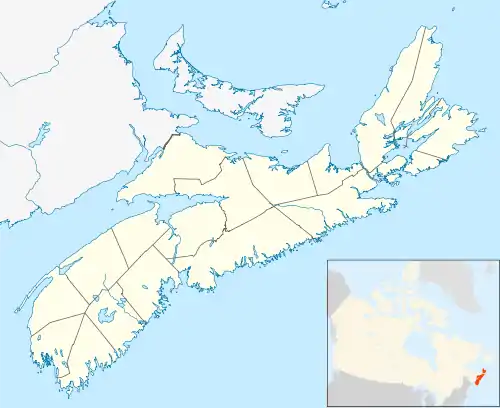 Westville Location within Nova Scotia | |
| Coordinates: 45°33′N 62°42′W | |
| Country | |
| Province | |
| Municipality | Pictou County |
| Incorporated | August 20, 1894 |
| Government | |
| • Mayor | Lennie White |
| • Governing Body | Westville Council |
| • MLA | Tim Houston (PC) |
| • MP | Sean Fraser (L) |
| Area (2016)[1] | |
| • Total | 14.23 km2 (5.49 sq mi) |
| Elevation | 70.1 m (230.0 ft) |
| Population | |
| • Total | 3,628 |
| • Density | 254.9/km2 (660/sq mi) |
| Demonym(s) | Westvillian |
| Time zone | UTC-4 (AST) |
| • Summer (DST) | UTC-3 (ADT) |
| Postal code span | B0K 2A0 |
| Area code(s) | 902 |
| Telephone Exchange | 396, 695 |
| NTS Map | 011E10 |
| GNBC Code | CBOLU |
| Website | westville.ca |
History
Originally called Acadian Village,[2] the name Westville was chosen because the community was west of the Albion Mines (now Stellarton).[3]
Westville has a long history of coal mining dating back to 1864 when coal was first discovered. The opening of the Acadia Mine followed in 1866. Westville, along with Stellarton, was once home to a thriving coal mining industry. At its peak, during World War I, Westville boasted three underground workings; the Black Diamond, the Acadia, and the Drummond. Westville was the site of the Drummond Mine explosion on May 13, 1873.
The last underground mine, the Drummond pit, closed in the 1970s. Extensive open-pit mining on the Drummond and Acadia sites was carried out throughout the 1980s and 1990s, by Pioneer Coal Limited of Antigonish, Nova Scotia.
In the early 1900s Westville also boasted the largest natural ice skating rink east of Montreal. Today the miner's monument at Acadia Park honoring those touched by the town's mining disasters, and a community centre is all that remains of its proud coal mining heritage. The war memorial was sculpted by the renowned Emanuel Hahn.
Like many coal towns Westville was a hotbed of sports. Baseball was very popular among the miners. One of the Westville baseball teams was crowned Maritime champion in 1927 and the legendary Babe Ruth visited the town in 1936 and hit a ball over the centre field fence. The town also sponsored championship cricket, lacrosse, football and hockey teams.
Demographics

In the 2016 Census of Population conducted by Statistics Canada, the Town of Westville recorded a population of 3,628 living in 1,586 of its 1,698 total private dwellings, a change of -4.5% from its 2011 population of 3,798. With a land area of 14.23 km2 (5.49 sq mi), it had a population density of 255.0/km2 (660.3/sq mi) in 2016.[1]
Amenities
While mainly a bedroom community, Westville's Main Street features banks, shops, restaurants and other amenities. A Nova Scotia highway rest stop was opened at the end of Cowan Street off exit 21 of Highway 104, part of the Trans-Canada Highway.
One of the largest Canada Day celebrations in Atlantic Canada takes place in Westville. The five-day event includes a county fair, street parade, and annual guest bands from around the world. The year 2007 marked the 100th anniversary of Westville's Canada Day celebrations.
Notable residents
- Kris MacFarlane, the drummer of Great Big Sea
- Russell MacEwan, lawyer, Member of Parliament and judge
- Alvah Mayo chess master
Navigator
Places adjacent to Westville, Nova Scotia | ||||||||||
|---|---|---|---|---|---|---|---|---|---|---|
| ||||||||||
References
- "Population and dwelling counts, for Canada, provinces and territories, and census subdivisions (municipalities), 2016 and 2011 censuses – 100% data (Nova Scotia)". Statistics Canada. February 8, 2017. Retrieved February 12, 2017.
- Fergusson, C. Bruce (1967). Place Names of Nova Scotia. Canada: Province of Nova Scotia. p. 729.
- Simpson, Doug, ed. (1986). Celebrating Our Heritage; The History of Westville. Antigonish, NS: Scotia Design Publications. p. 12. ISBN 0-920147-00-3.
WESTVILLE was chosen because the community was west of the Albion Mines which was the former name of Stellarton.
- , Censuses 1871-1931
- , Census 1941-1951
- Census 1956-1961
- , Census 1961
- Archived 2013-10-05 at the Wayback Machine, Censuses 1981-2001
- "I:\ecstats\Agency\BRIAN\census2" (PDF). Archived from the original (PDF) on 2013-10-05. Retrieved 2010-01-20.
External links
| Historical counties | |
|---|---|
| Economic regions | |
| Regional municipalities | |
| County municipalities | |
| District municipalities | |
| Towns | |
| Villages | |
| Lists | |
| |