Nabire
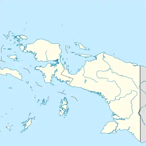
Nabire is a town in the Indonesian province of Papua, at the western end of New Guinea. The town is the administrative seat of the Nabire Regency. It is served by Nabire Airport.[2]
Nabire | |
|---|---|
 Nabire Location in Western New Guinea | |
| Coordinates: 3.368183°S 135.496406°E | |
| Country | |
| Region | Western New Guinea |
| Province | |
| Regency | Nabire Regency |
| Elevation | 6 m (20 ft) |
| Population (2010) | |
| • Metro | 74,197[1] |
| Time zone | UTC+9 (Indonesia Eastern Time) |
| Area code | (+62) 984 |
Geography
The town lies on the northern coast of the island on Cenderawasih Bay.
Climate
Nabire has a tropical rainforest climate (Af) with heavy to very heavy rainfall year-round.
| Climate data for Nabire | |||||||||||||
|---|---|---|---|---|---|---|---|---|---|---|---|---|---|
| Month | Jan | Feb | Mar | Apr | May | Jun | Jul | Aug | Sep | Oct | Nov | Dec | Year |
| Average high °C (°F) | 31.3 (88.3) |
31.3 (88.3) |
31.2 (88.2) |
31.0 (87.8) |
30.5 (86.9) |
29.4 (84.9) |
28.6 (83.5) |
28.8 (83.8) |
29.4 (84.9) |
30.2 (86.4) |
31.1 (88.0) |
31.3 (88.3) |
30.3 (86.6) |
| Daily mean °C (°F) | 27.0 (80.6) |
27.0 (80.6) |
27.0 (80.6) |
27.0 (80.6) |
26.8 (80.2) |
25.9 (78.6) |
25.3 (77.5) |
25.5 (77.9) |
25.9 (78.6) |
26.4 (79.5) |
27.0 (80.6) |
27.0 (80.6) |
26.5 (79.7) |
| Average low °C (°F) | 22.8 (73.0) |
22.8 (73.0) |
22.9 (73.2) |
23.0 (73.4) |
23.1 (73.6) |
22.5 (72.5) |
22.1 (71.8) |
22.2 (72.0) |
22.4 (72.3) |
22.7 (72.9) |
23.0 (73.4) |
22.8 (73.0) |
22.7 (72.8) |
| Average precipitation mm (inches) | 368 (14.5) |
372 (14.6) |
402 (15.8) |
295 (11.6) |
300 (11.8) |
254 (10.0) |
268 (10.6) |
317 (12.5) |
259 (10.2) |
273 (10.7) |
244 (9.6) |
305 (12.0) |
3,657 (143.9) |
| Source: Climate-Data.org[3] | |||||||||||||
Attractions
Nabire a tourist resort, with numerous attractions, including:
- sea garden of Cenderawasih bay with 130 species of coral,
- Wahario Beach also known as Gedo Beach Youth Tourism Park, is located in Sanoba Village.[4]
- Pepaya island with ideal conditions for diving,
- hot springs, water temperature up to 80 ° C.
Notable inhabitants
See also
References
- "Population of Indonesia by Village: Result of 2010 Population Census" (PDF). Statistics Indonesia. Archived from the original (PDF) on 6 April 2013. Retrieved 2020-07-23.
- Nabire airport (Nabire)
- "Climate: Nabire". Climate-Data.org. Retrieved July 25, 2020.
- Pantai Wahario
This article is issued from Wikipedia. The text is licensed under Creative Commons - Attribution - Sharealike. Additional terms may apply for the media files.