Nansang
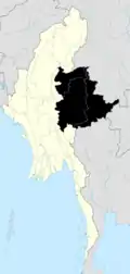
Nansang (Burmese: ဝဵင်းၼမ်ႉၸၢင်) is a town in Loilen District of Shan State in eastern Burma. It is the seat of Nansang Township. It is the biggest city of the eastern central of the Shan State in Myanmar. It is 72 miles away from Taunggyi. A pagoda lies in the southern part of the town. It is also known as Taung Paw Pagoda.
Namsang
ဝဵင်းၼမ်ႉၸၢင် နမ့်စန်မြို့နယ် | |
|---|---|
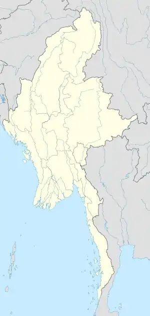 Namsang Location in Burma | |
| Coordinates: 20°53′20″N 97°44′10″E | |
| Country | |
| State | |
| District | Loilem District |
| Elevation | 992 m (3,255 ft) |
| Population | |
| • Total | 70,000 |
| • Ethnicities | Tai Pa-O Burmese Chinese Shan Burmese Indians Gurkha |
| • Religions | Buddhism Christianity Islam |
| Time zone | UTC+6.30 (MST) |
| Area code(s) | 06161 |
Population and Ethnic
Most people are Buddhist. There are nearly thirty Buddhist monasteries. This region has a population of 70,000 people, most of whom are villagers engaged in agriculture. Only 20,000 people live in town. Most people are Shan. There is chauvinism for few people (Burmese, Paoh, Yinn, Ta'ang, Lahu, Lisu, etc).
Education
Public School
- No(1) Basic Education High School[2]
- No(2) Basic Education High School (Myoma)
- Myo Oo Basic Education Sub High School
- No(5) Basic Education Sub High School
- Air Army Basic Education High School
Private School
- Kaung Myat Private High School[3]
- Brightstar Private Basic School
- Pyin Nyar Young Chi Private Basic School
Health Centre
Public Health
- General Hospital (25 Bedded)[4]
- Army Hospital , 8th MB (100 Bedded)[5]
Transport
Airport
It is served by Nansang Airport, where a former RAF base was located and Myanmar Air Force base.[8]
Buses ang Taxis
It is well-connected by road, lying at the junction of National Highway 4 and National Highway 45 which connects it to Mong Ton and the Thai border.[9][10]
Railway
Since 1995 it has been served by a station on the Myanmar Railways network.[11]
Regional Military Commands (RMC)

For better command and communication, the Tatmadaw formed Regional Military Commands (တိုင်း စစ်ဌာနချုပ်) structure in 1958. Until 1961, there were only two regional commands, they were supported by 13 Infantry brigades and an infantry division. In October 1961, new regional military commands were opened and leaving only two independent infantry brigades. In June 1963, the Naypyidaw Command was temporarily formed in Yangon with the deputy commander and some staff officers drawn from Central Command. It was reorganised and renamed as Yangon Command on 1 June 1965.
A total of 337 infantry and light infantry battalions organised in Tactical Operations Commands, 37 independent field artillery regiments supported by affiliated support units including armoured reconnaissance and tank battalions. RMCs are similar to corps formations in Western armies. The RMCs, commanded by major general rank officer, are managed through a framework of Bureau of Special Operations (BSOs), which are equivalent to Field Army Group in Western terms..
Eastern Central Command Namsang

Eastern Central Command(အရှေ့အလယ်ပိုင်းတိုင်းစစ်ဌာနချုပ်) is saturated Middle Shan state in Namsang. Formed in 2011 Infantry Battalions.[12]
Air Bases

Myanmar Air Force also utilised civilian airfields as front-line air fields in case of foreign invasion.[13]
Climate
Namsang has a humid subtropical climate (Köppen climate classification Cwa), closely bordering a subtropical highland climate (Cwb). There is a winter dry season (December–March) and a summer wet-season (April–November). Temperatures are warm throughout the year; the winter months (December–February) are milder but the nights can be quite cool.[14]
| Climate data for Namsang (1981–2010, extremes 2001–2010) | |||||||||||||
|---|---|---|---|---|---|---|---|---|---|---|---|---|---|
| Month | Jan | Feb | Mar | Apr | May | Jun | Jul | Aug | Sep | Oct | Nov | Dec | Year |
| Record high °C (°F) | 28.5 (83.3) |
30.0 (86.0) |
33.0 (91.4) |
36.0 (96.8) |
35.5 (95.9) |
31.5 (88.7) |
29.5 (85.1) |
29.5 (85.1) |
29.5 (85.1) |
30.0 (86.0) |
29.5 (85.1) |
27.5 (81.5) |
36.0 (96.8) |
| Average high °C (°F) | 23.8 (74.8) |
26.0 (78.8) |
29.0 (84.2) |
30.2 (86.4) |
27.7 (81.9) |
26.6 (79.9) |
26.0 (78.8) |
25.5 (77.9) |
25.5 (77.9) |
25.0 (77.0) |
23.5 (74.3) |
22.3 (72.1) |
25.9 (78.6) |
| Average low °C (°F) | 4.2 (39.6) |
6.8 (44.2) |
10.7 (51.3) |
14.0 (57.2) |
15.1 (59.2) |
16.1 (61.0) |
16.2 (61.2) |
15.8 (60.4) |
14.7 (58.5) |
13.0 (55.4) |
9.2 (48.6) |
5.2 (41.4) |
11.8 (53.2) |
| Record low °C (°F) | −4.0 (24.8) |
−2.0 (28.4) |
1.0 (33.8) |
5.0 (41.0) |
8.0 (46.4) |
10.0 (50.0) |
10.0 (50.0) |
10.0 (50.0) |
9.0 (48.2) |
4.5 (40.1) |
−2.0 (28.4) |
−4.0 (24.8) |
−4.0 (24.8) |
| Average rainfall mm (inches) | 6.5 (0.26) |
9.3 (0.37) |
12.9 (0.51) |
62.3 (2.45) |
252.4 (9.94) |
418.4 (16.47) |
429.9 (16.93) |
391.2 (15.40) |
262.1 (10.32) |
176.1 (6.93) |
79.4 (3.13) |
13.7 (0.54) |
2,114.2 (83.24) |
| Source: Norwegian Meteorological Institute[15] | |||||||||||||
List of Banks being operated
| Name | Address | Phone |
|---|---|---|
| Myanmar Economic Bank | Pyi Htaung Su Road, 3 Quater, Namsang | 081-2380789, 081-2380164 |
| KBZ Bank | Pyi Htaung Su Road, 3 Quater , Namsang | 081-2380824, 081-2380825, 081-2380826 |
| MAB Bank | Pyi Htaung Su Road, 3 Quarter , Namsang | 081-2380831 |
| Myawaddy Bank | Pyi Htaung Su Road, 3 Quater , Namsang | 081-2380846 |
| AYA Bank | Pyi Htaung Su Road, 3 Quarter , Namsang | |
| Source: Central Bank of Myanmar's List of Private Banks | ||
References
- GoogleEarth
- https://www.kanbawzatainews.com/2017/05/blog-post_41.html?m=1
- https://burma.irrawaddy.com/lifestyle/trend/2019/08/03/199817.html
- https://www.kanbawzatainews.com/2020/04/ns.gov.covid-19.html?m=1
- https://cincds.gov.mm/node/597
- https://www.facebook.com/799534773519222/posts/1647384822067542/?d=n
- https://vymaps.com/MM/551724958369245/
- Bond, Charles R.; Anderson, Terry H. (1 October 1988). A Flying Tiger's Diary. Texas A&M University Press. p. 118. ISBN 978-0-89096-408-8. Retrieved 28 September 2011.
- Maps (Map). Google Maps.
|access-date=requires|url=(help) - Bing Maps (Map). Microsoft and Harris Corporation Earthstar Geographics LLC.
|access-date=requires|url=(help) - https://www.kanbawzatainews.com/2020/03/ns.airport.html
- https://cincds.gov.mm/node/4298
- https://www.shanstate.gov.mm/index.php?option=com_content&view=article&id=1969:2018-04-24-04-32-12&catid=50&Itemid=276
- https://www.worldweatheronline.com/namsang-weather/shan-state/mm.aspx
- "Myanmar Climate Report" (PDF). Norwegian Meteorological Institute. pp. 23–36. Archived from the original (PDF) on 8 October 2018. Retrieved 1 December 2018.
External links
Capital: Loilem | |
|