National Park, New Zealand
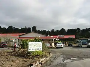
National Park is a small town on the North Island Central Plateau in New Zealand. Also known as National Park Village, it is the highest urban township in New Zealand, at 825 metres. Its name derives from its location just outside the boundary of Tongariro National Park, New Zealand's first national park, and its only national park from its creation in 1887 until 1900. The village has great views of Mount Tongariro, Mount Ngauruhoe (Mount Doom in the Lord of the Rings film trilogy), and Mount Ruapehu.
National Park
Waimarino (Māori) | |
|---|---|
Village | |
 National Park | |
| Coordinates: 39°10′25″S 175°23′50″E | |
| Country | New Zealand |
| Region | Manawatū-Whanganui region |
| Territorial authority | Ruapehu District |
| Named for | Proximity to Tongariro National Park |
| Population (2013 census) | |
| • Total | 174 |
| Postcode | 3948 |
| Area code(s) | 07 |
The town is sited next to the North Island Main Trunk railway line and close to the junction of State Highways 4 and 47, halfway between Raetihi and Taumarunui and 45 kilometres southwest of the southern shore of Lake Taupo. It is 20 minutes drive to the country's biggest skifields, Whakapapa and 50 minutes drive to Turoa on the slopes of the active volcano, Mount Ruapehu. To the west is Whanganui National Park.
The town is administered by the Ruapehu District Council. One councillor is elected for the National Park Ward,[1] and there is a National Park Community Board.[2] On a national level, National Park is part of the Rangitīkei general electorate and the Te Tai Hauāuru Māori electorate.[3]
Tourism is its main industry, with 1,500 visitor beds in commercial accommodation and private chalets. In the summer the village is a popular base for Tongariro and Whanganui National Park for hiking, biking and kayaking. National Park Village. Transport leaves daily (weather permitting) for the Tongariro Alpine Crossing, known as the best one day alpine trek in New Zealand.
KiwiRail's Northern Explorer train stops at the National Park Railway Station on its journey between Auckland and Wellington. There is a licensed cafe on the platform. To the northwest of the town the railway performs the convoluted dance that is the Raurimu Spiral, one of New Zealand's most impressive feats of engineering.
Originally the town was known as Waimarino (calm waters). In 1926 the New Zealand Railways renamed the railway station as National Park. This was to avoid confusion with other Waimarino entities, and also the name had come into common usage from its location close to Tongariro National Park. This change has since been confusing, as there are many National Parks in New Zealand.
The opening of the Main Trunk line in 1908 created a vast opportunity to log and mill the large trees in the native forests, with 30 saw mills and associated bush tramways established in the National Park area alone. With the arrival of caterpillar tractors in the 1930s the extraction process was accelerated with National Park station having one of the greatest throughputs of timber in New Zealand. Today Tongariro Timber is the last surviving mill operating at National Park.
In the 1960s National Park became the railhead for all the heavy equipment and machinery for the Tongariro Power Scheme Development with local pumice roads substantially upgraded to take the heavy traffic.
National Park School was established in 1925. Its fortunes have fluctuated with the cycles of activity in the area. Today it is thriving with a more stable population and the establishment of its Ski Elite programme whereby pupils take can up residence in the village for the winter combining studies with skiing and snowboarding development programmes.
Climate
Under the Köppen-Geiger climate classification, National Park has an oceanic climate (Cfb). February is the warmest month, with an average temperature of 14.8 °C, while July is the coldest month with an average temperature of 4.5 °C. Due to an altitude of 822 metres, winters are cold, and generally winter afternoons stay below 10 °C. Frosts are common from May to September, although they can occur during the warmer months. Snow is also a common occurrence in the colder months, sometimes accumulating for several days on end. The summer temperatures are also stunted due to the village's altitude, resulting in cool nights and mild to warm days. The mountains around the village are popular for hiking and mountain biking during the summer. The summer afternoon temperatures often exceed 20 °C, and sometimes reaching 25 °C. The wettest month is July, with 225 mm of precipitation, while February is the driest, with an average of 115 mm, making the climate of National Park lean towards a cool-summer Mediterranean climate (Csb). Overall, the year-round average temperature is 9.6 °C.
| Climate data for National Park, Manawatu-Whanganui, 822 m | |||||||||||||
|---|---|---|---|---|---|---|---|---|---|---|---|---|---|
| Month | Jan | Feb | Mar | Apr | May | Jun | Jul | Aug | Sep | Oct | Nov | Dec | Year |
| Average high °C (°F) | 19.9 (67.8) |
20.2 (68.4) |
18.1 (64.6) |
15.0 (59.0) |
11.7 (53.1) |
9.2 (48.6) |
8.4 (47.1) |
9.3 (48.7) |
11.1 (52.0) |
13.4 (56.1) |
15.7 (60.3) |
17.9 (64.2) |
14.2 (57.6) |
| Daily mean °C (°F) | 14.6 (58.3) |
14.8 (58.6) |
13.1 (55.6) |
10.4 (50.7) |
7.5 (45.5) |
5.4 (41.7) |
4.5 (40.1) |
5.4 (41.7) |
7.0 (44.6) |
9.0 (48.2) |
11.0 (51.8) |
12.9 (55.2) |
9.6 (49.3) |
| Average low °C (°F) | 9.3 (48.7) |
9.4 (48.9) |
8.2 (46.8) |
5.8 (42.4) |
3.4 (38.1) |
1.7 (35.1) |
0.7 (33.3) |
1.5 (34.7) |
3.0 (37.4) |
4.7 (40.5) |
6.3 (43.3) |
8.0 (46.4) |
5.2 (41.4) |
| Average rainfall mm (inches) | 156 (6.1) |
115 (4.5) |
156 (6.1) |
155 (6.1) |
207 (8.1) |
218 (8.6) |
225 (8.9) |
207 (8.1) |
210 (8.3) |
184 (7.2) |
170 (6.7) |
188 (7.4) |
2,191 (86.3) |
| Source: Climate-data.org[4] | |||||||||||||
Education
National Park School is a co-educational state primary school for Year 1 to 8 students,[5] with a roll of 43 as of March 2020.[6]
References
- "Ruapehu District Council". Ruapehu District Council. Retrieved 13 December 2015.
- "National Park Community Board". Ruapehu District Council. Retrieved 13 December 2015.
- "Find my electorate". Electoral Commission. Retrieved 30 March 2016.
-
[en.climate-data.org "Climate-data.org – Climate Data for Cities Worldwide"] Check
|url=value (help). openstreetmap.org. Retrieved 19 December 2019. - "Ministry of Education School Profile". educationcounts.govt.nz. Ministry of Education.
- "Education Review Office Report". ero.govt.nz. Education Review Office.