National Register of Historic Places listings in East Hampton (town), New York
This list is intended to provide a comprehensive listing of entries in the National Register of Historic Places in the Town of East Hampton, New York. The locations of National Register properties for which the latitude and longitude coordinates are included below, may be seen in a Google map.[1]
Listings
| [2] | Name on the Register | Image | Date listed[3] | Location | City or town | Description |
|---|---|---|---|---|---|---|
| 1 | Amagansett U.S. Life-Saving and Coast Guard Station |  Amagansett U.S. Life-Saving and Coast Guard Station |
July 27, 2018 (#100002743) |
160 Atlantic Ave. 40°58′13″N 72°07′31″W |
Amagansett | One of 20 such stations built by 1902 using the Quonochontaug Type; station's agents played a key role in 1942 interception of German saboteurs. |
| 2 | AN/FPS-35 Radar Tower and Antenna |  AN/FPS-35 Radar Tower and Antenna |
June 4, 2002 (#02000615) |
Montauk Point State Parkway 41°03′45″N 71°52′28″W |
Montauk | Only surviving long-range radar station of 12 built by Sperry Corporation in the 1960s |
| 3 | Caleb Bragg Estate | 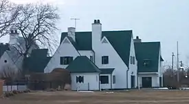 Caleb Bragg Estate |
November 2, 1987 (#87001895) |
Star Island Road 41°04′19″N 71°56′02″W |
Montauk | |
| 4 | Briar Patch Road Historic District | 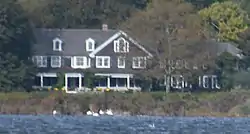 Briar Patch Road Historic District |
July 21, 1988 (#88001029) |
End of Briar Patch Road along Georgica Pond 40°56′33″N 72°13′41″W |
East Hampton | |
| 5 | Buell's Lane Historic District | 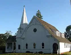 Buell's Lane Historic District |
July 21, 1988 (#88001027) |
47-114 Buell's Lane 40°57′33″N 72°11′56″W |
East Hampton | |
| 6 | Cedar Island Lighthouse | 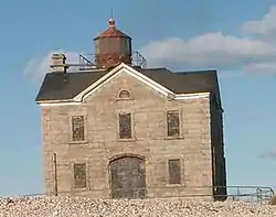 Cedar Island Lighthouse |
April 18, 2003 (#03000248) |
Cedar Point Road 41°02′26″N 72°15′39″W |
Northwest Harbor | |
| 7 | East Hampton Railroad Station | 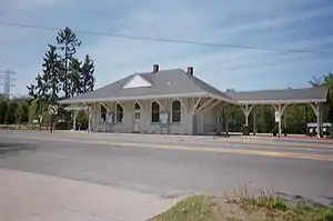 East Hampton Railroad Station |
June 2, 2000 (#00000581) |
Railroad Avenue, between Race and Newtown Lanes 40°58′00″N 72°11′36″W |
East Hampton | |
| 8 | East Hampton Village District | 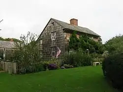 East Hampton Village District |
May 2, 1974 (#74001309) |
Bounded by Main Street and James and Woods Lanes 40°57′17″N 72°11′28″W |
East Hampton | |
| 9 | Egypt Lane Historic District | 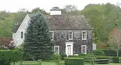 Egypt Lane Historic District |
July 21, 1988 (#88001031) |
111, 117, and 129 Egypt Lane 40°57′30″N 72°10′39″W |
East Hampton | |
| 10 | Gardiners Island Windmill |  Gardiners Island Windmill |
December 27, 1978 (#78001912) |
On Gardiners Island 41°05′28″N 72°06′40″W |
Gardiners Island | |
| 11 | Hayground Windmill | 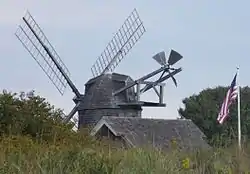 Hayground Windmill |
December 27, 1978 (#78001913) |
At Windmill Lane 40°57′17″N 72°09′57″W |
East Hampton | |
| 12 | H.M.S. CULLODEN Shipwreck Site |  H.M.S. CULLODEN Shipwreck Site |
March 5, 1979 (#79003795) |
Culloden Point 41°04′13″N 71°57′36″W |
Montauk | |
| 13 | Hook Windmill | 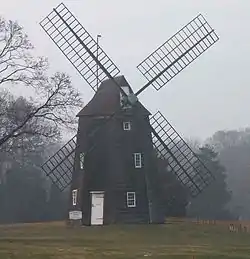 Hook Windmill |
December 27, 1978 (#78001914) |
North Main Street 40°57′56″N 72°11′02″W |
East Hampton | |
| 14 | Jericho Historic District | 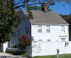 Jericho Historic District |
July 21, 1988 (#88001028) |
Montauk Highway 40°57′04″N 72°13′00″W |
East Hampton | |
| 15 | Jones Road Historic District | 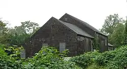 Jones Road Historic District |
July 21, 1988 (#88001030) |
Along Jones Road from Apaquogue Road to Lily Pond Lane 40°56′31″N 72°12′42″W |
East Hampton | |
| 16 | Miss Amelia's Cottage | 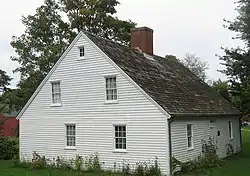 Miss Amelia's Cottage |
February 25, 1994 (#94000070) |
N side Main Street, at the jct. of Windmill Lane, Town of East Hampton 40°58′26″N 72°08′39″W |
Amagansett | |
| 17 | Montauk Association Historic District | Montauk Association Historic District |
October 22, 1976 (#76001282) |
E of Montauk off NY 27 on DeForest Road 41°02′38″N 71°54′24″W |
Montauk | Seven Shingle style houses nestle by the seashore. |
| 18 | Montauk Manor | Montauk Manor |
August 23, 1984 (#84002995) |
Fairmont Avenue 41°02′54″N 71°56′59″W |
Montauk | |
| 19 | Montauk Point Light | 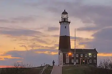 Montauk Point Light |
July 7, 1969 (#69000142) |
Montauk Point, 2000 Montauk Hwy. 41°04′15″N 71°51′25″W |
Montauk | designated a National Historic Landmark March 2, 2012 |
| 20 | Montauk Tennis Auditorium | 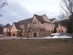 Montauk Tennis Auditorium |
February 8, 1988 (#88000052) |
Flamingon Avenue and Edgemere Street 41°03′01″N 71°57′04″W |
Montauk | |
| 21 | Thomas Moran House | 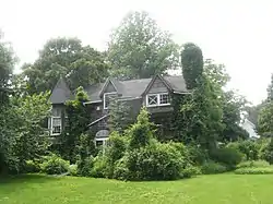 Thomas Moran House |
October 15, 1966 (#66000574) |
Main Street 40°57′14″N 72°11′40″W |
East Hampton | |
| 22 | North Main Street Historic District | 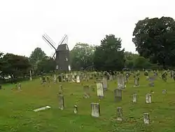 North Main Street Historic District |
July 21, 1988 (#88001025) |
North Main Street 40°57′55″N 72°11′03″W |
East Hampton | |
| 23 | Pantigo Road Historic District |  Pantigo Road Historic District |
July 21, 1988 (#88001026) |
Along Pantigo Road from Egypt Lane and Accabonac Road to Amy's Lane 40°57′59″N 72°10′40″W |
East Hampton | |
| 24 | Ambrose Parsons House | 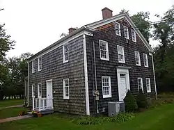 Ambrose Parsons House |
November 7, 1995 (#95001276) |
Springs-Fireplace Road at jct. with Old Stone Highway, Town of East Hampton 41°01′14″N 72°09′26″W |
Springs | |
| 25 | Pleasants House | 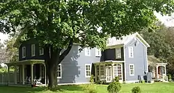 Pleasants House |
February 2, 1984 (#84002999) |
NY 27 40°58′32″N 72°08′23″W |
Amagansett | |
| 26 | Jackson Pollock House and Studio | 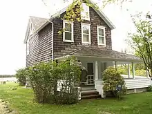 Jackson Pollock House and Studio |
April 19, 1994 (#94001193) |
830 Fireplace Road 41°01′25″N 72°09′19″W |
Springs | |
| 27 | Sag Harbor Hills, Azurest, and Ninevah Beach Subdivisions Historic District |  Sag Harbor Hills, Azurest, and Ninevah Beach Subdivisions Historic District |
July 10, 2019 (#100004217) |
Roughly Richards Dr., Hemstead St., Lincoln St., Harding Terr., & Terry Dr. 40°59′48″N 72°16′36″W |
Sag Harbor | One of the earliest African American beachfront communities in the U.S., and one of the few to remain so |
| 28 | Saint Thomas' Chapel | 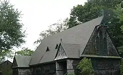 Saint Thomas' Chapel |
February 14, 1997 (#97000065) |
Main Street, jct. with Indian Wells Plain Highway 40°58′23″N 72°08′39″W |
Amagansett | |
| 29 | Stephen Sherrill House | 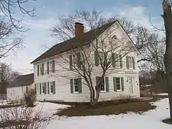 Stephen Sherrill House |
January 4, 1996 (#95001486) |
4 Fireplace Road 40°58′22″N 72°10′53″W |
East Hampton | |
| 30 | Thomas Strong House | Thomas Strong House |
January 5, 2005 (#04001451) |
100 Wainscott Hollow Road 40°56′12″N 72°15′08″W |
Wainscott | |
| 31 | Wainscott Windmill | 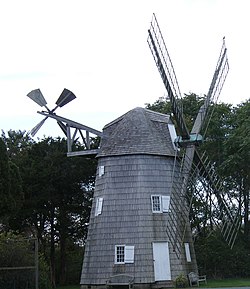 Wainscott Windmill |
December 27, 1978 (#78001915) |
On Georgica Association grounds 40°56′01″N 72°14′16″W |
Wainscott |
See also
| Wikimedia Commons has media related to National Register of Historic Places in Suffolk County, New York. |
References
- The latitude and longitude information provided is primarily from the National Register Information System, and has been found to be fairly accurate for about 99% of listings. For 1%, the location info may be way off. We seek to correct the coordinate information wherever it is found to be erroneous. Please leave a note in the Discussion page for this article if you believe any specific location is incorrect.
- Numbers represent an alphabetical ordering by significant words. Various colorings, defined here, differentiate National Historic Landmarks and historic districts from other NRHP buildings, structures, sites or objects.
- The eight-digit number below each date is the number assigned to each location in the National Register Information System database, which can be viewed by clicking the number.
External links
- NRHP applications for New York State sites (Note, interface works best with Microsoft Internet Explorer browser; hit "Results" after searching, to actually see the results).
| Topics |  | |
|---|---|---|
| Lists by county |
| |
| Lists by city | ||
| Other lists | ||
| ||
This article is issued from Wikipedia. The text is licensed under Creative Commons - Attribution - Sharealike. Additional terms may apply for the media files.