National Register of Historic Places listings in Fulton County, New York
List of the National Register of Historic Places listings in Fulton County, New York
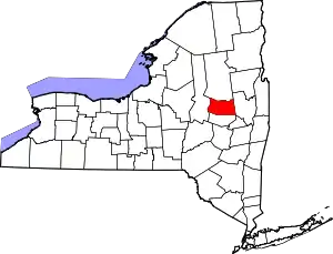
Location of Fulton County in New York
This is intended to be a complete list of properties and districts listed on the National Register of Historic Places in Fulton County, New York. The locations of National Register properties and districts (at least for all showing latitude and longitude coordinates below) may be seen in a map by clicking on "Map of all coordinates".[1] Two listings, Johnson Hall and Adirondack Park, are further designated National Historic Landmarks of the United States.
- This National Park Service list is complete through NPS recent listings posted January 29, 2021.[2]
| Albany (Albany) – Allegany – Bronx – Broome – Cattaraugus – Cayuga – Chautauqua – Chemung – Chenango – Clinton – Columbia – Cortland – Delaware – Dutchess (Poughkeepsie, Rhinebeck) – Erie (Buffalo) – Essex – Franklin – Fulton – Genesee – Greene – Hamilton – Herkimer – Jefferson – Kings – Lewis – Livingston – Madison – Monroe (Rochester) – Montgomery – Nassau – New York (Below 14th Street, 14th to 59th Streets, 59th to 110th Streets, Above 110th Street, Islands) – Niagara – Oneida – Onondaga – Ontario – Orange – Orleans – Oswego – Otsego – Putnam – Queens – Rensselaer – Richmond – Rockland – St. Lawrence – Saratoga – Schenectady – Schoharie – Schuyler – Seneca – Steuben – Suffolk – Sullivan – Tioga – Tompkins – Ulster – Warren – Washington – Wayne – Westchester (Northern, Southern, New Rochelle, Peekskill, Yonkers) – Wyoming – Yates |
Listings county-wide
| [3] | Name on the Register | Image | Date listed[4] | Location | City or town | Description |
|---|---|---|---|---|---|---|
| 1 | Adirondack Forest Preserve | 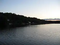 Adirondack Forest Preserve |
October 15, 1966 (#66000891) |
NE New York State 43°58′43″N 74°18′42″W |
Adirondack State Forest Preserve | |
| 2 | Chamberlain Benjamin House | 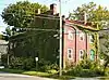 Chamberlain Benjamin House |
August 12, 1999 (#99000989) |
100 Market St. 43°00′15″N 74°22′22″W |
Johnstown | |
| 3 | Dolge Company Factory Complex | 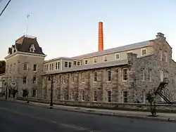 Dolge Company Factory Complex |
September 17, 1974 (#74001238) |
S. Main St. 43°06′07″N 74°46′09″W |
Dolgeville | |
| 4 | Downtown Gloversville Historic District |  Downtown Gloversville Historic District |
September 12, 1985 (#85002367) |
Roughly bounded by Spring, Prospect, E. Fulton, N. and S. Main and Elm Sts. 43°03′03″N 74°20′43″W |
Gloversville | |
| 5 | First United Methodist Church | 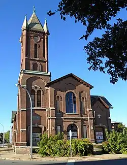 First United Methodist Church |
February 20, 1998 (#98000128) |
7 Elm St. at Bleecker Sq. 43°03′07″N 74°20′48″W |
Gloversville | |
| 6 | Fulton County Courthouse | 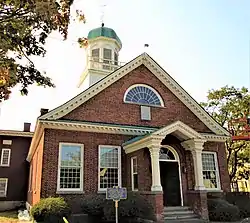 Fulton County Courthouse |
July 24, 1972 (#72000841) |
N. William St. 43°00′24″N 74°22′32″W |
Johnstown | |
| 7 | Fulton County Jail | Fulton County Jail |
October 19, 1981 (#81000404) |
Perry and Montgomery Sts. 43°00′11″N 74°22′16″W |
Johnstown | |
| 8 | Garoga Site |  Garoga Site |
July 22, 1980 (#80002613) |
Address Restricted |
Ephratah | |
| 9 | Gloversville Armory | 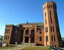 Gloversville Armory |
March 2, 1995 (#95000081) |
87 Washington St. 43°03′00″N 74°20′26″W |
Gloversville | |
| 10 | Gloversville Free Library | 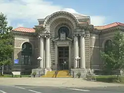 Gloversville Free Library |
May 24, 1976 (#76001219) |
58 E. Fulton St. 43°03′01″N 74°20′36″W |
Gloversville | |
| 11 | Hotel Broadalbin | 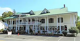 Hotel Broadalbin |
May 4, 2011 (#11000252) |
59 W. Main St. 43°03′24″N 74°11′57″W |
Broadalbin | New listing; refnum 11000252 |
| 12 | Johnson Hall | 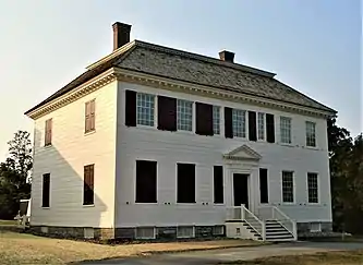 Johnson Hall |
October 15, 1966 (#66000520) |
Hall St. 43°00′54″N 74°22′58″W |
Johnstown | |
| 13 | Johnstown Colonial Cemetery |  Johnstown Colonial Cemetery |
March 9, 1998 (#98000129) |
Jct. of W. Green and N. Market Sts. 43°00′30″N 74°22′23″W |
Johnstown | |
| 14 | Kane Mountain Fire Observation Station | 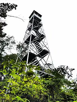 Kane Mountain Fire Observation Station |
September 23, 2001 (#01001033) |
Kane Mountain 43°10′29″N 74°31′04″W |
Caroga | |
| 15 | Kingsboro Historic District | 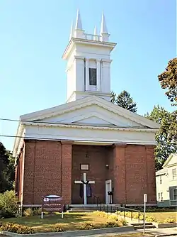 Kingsboro Historic District |
February 24, 1975 (#75001190) |
Area surrounding Kingsboro Ave. Park to N side of cemetery and S to include both sides of Gregory St. 43°04′01″N 74°20′12″W |
Gloversville | |
| 16 | Klock Site | Klock Site |
July 22, 1980 (#80002614) |
Address Restricted |
Ephratah | |
| 17 | Knox Mansion | 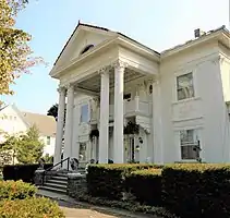 Knox Mansion |
February 28, 2008 (#08000101) |
104 W. 2nd Ave. 43°00′02″N 74°22′28″W |
Johnstown | |
| 18 | Gustav Levor House |  Gustav Levor House |
June 10, 2005 (#05000572) |
23 Prospect Ave. 43°03′11″N 74°20′30″W |
Gloversville | |
| 19 | Log Cabin Church | 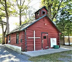 Log Cabin Church |
March 18, 1999 (#99000350) |
413 Progress Rd. 43°02′35″N 74°17′33″W |
Mayfield | |
| 20 | Northville Historic District | 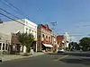 Northville Historic District |
May 7, 2014 (#14000191) |
Roughly Main, Division & Bridge Sts. 43°13′13″N 74°10′18″W |
Northville | Historic core of lower Adirondack town |
| 21 | Smith Pagerie Site | Smith Pagerie Site |
April 22, 1980 (#80002615) |
Address Restricted |
Ephratah | |
| 22 | Oliver Rice House | 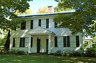 Oliver Rice House |
February 10, 1995 (#95000046) |
Old NY 30, E side 43°06′00″N 74°16′40″W |
Mayfield | |
| 23 | Oppenheim and St. Johnsville Union Society Church | July 19, 2010 (#10000485) |
110 County Highway 108 43°02′27″N 74°43′16″W |
Crum Creek vicinity | New listing; refnum 10000485 | |
| 24 | Sacandaga Railroad Station | 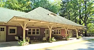 Sacandaga Railroad Station |
March 7, 2003 (#03000094) |
136 McKinley Ave. 43°13′01″N 74°11′09″W |
Sacandaga Park | |
| 25 | Godfrey Shew House | July 12, 2006 (#06000574) |
1632 S. Shore Rd. 43°08′43″N 74°07′26″W |
Fish House | ||
| 26 | St. John's Episcopal Church | 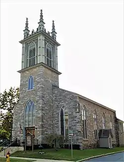 St. John's Episcopal Church |
September 24, 2004 (#04001054) |
1 North Market St. 43°00′24″N 74°22′24″W |
Johnstown | |
| 27 | US Post Office-Johnstown | US Post Office-Johnstown |
May 11, 1989 (#88002337) |
14 N. William St. 43°00′26″N 74°22′27″W |
Johnstown |
See also
| Wikimedia Commons has media related to National Register of Historic Places in Fulton County, New York. |
References
- The latitude and longitude information provided in this table was derived originally from the National Register Information System, which has been found to be fairly accurate for about 99% of listings. Some locations in this table may have been corrected to current GPS standards.
- "National Register of Historic Places: Weekly List Actions". National Park Service, United States Department of the Interior. Retrieved on January 29, 2021.
- Numbers represent an alphabetical ordering by significant words. Various colorings, defined here, differentiate National Historic Landmarks and historic districts from other NRHP buildings, structures, sites or objects.
- The eight-digit number below each date is the number assigned to each location in the National Register Information System database, which can be viewed by clicking the number.
External links
| Topics | 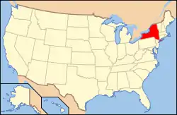 | |
|---|---|---|
| Lists by county |
| |
| Lists by city | ||
| Other lists | ||
| ||
This article is issued from Wikipedia. The text is licensed under Creative Commons - Attribution - Sharealike. Additional terms may apply for the media files.