National Register of Historic Places listings in Southampton (town), New York
This list is intended to provide a comprehensive listing of entries in the National Register of Historic Places in the Town of Southampton, New York. The locations of National Register properties for which the latitude and longitude coordinates are included below, may be seen in an online map.[1]
Current listings
| [2] | Name on the Register | Image | Date listed[3] | Location | City or town | Description |
|---|---|---|---|---|---|---|
| 1 | Balcastle | 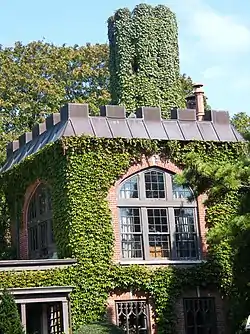 Balcastle |
October 2, 1986 (#86002722) |
NW corner of Herrick and Little Plains Roads 40°53′02″N 72°23′04″W |
Southampton | |
| 2 | Beach Road Historic District | Beach Road Historic District |
October 2, 1986 (#86002723) |
Between Shinnecock and Halsely Neck Roads on Beach Road at Barrier Beach 40°51′44″N 72°25′03″W |
Southampton | |
| 3 | Beebe Windmill | 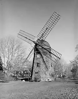 Beebe Windmill |
December 27, 1978 (#78001918) |
SE corner of Ocean Road and Hildreth Avenue 40°56′03″N 72°18′05″W |
Bridgehampton | |
| 4 | James Benjamin Homestead | 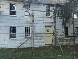 James Benjamin Homestead |
August 13, 1986 (#86001510) |
1182 Flanders Road 40°54′11″N 72°37′04″W |
Flanders | |
| 5 | The Big Duck |  The Big Duck |
April 28, 1997 (#97000164) |
NY 24, NW of jct. with Bellows Pond Road, Town of Southampton 40°54′25″N 72°37′20″W |
Flanders | Moved two miles northwest of previous location in 2007 |
| 6 | Big Duck Ranch |  Big Duck Ranch |
September 12, 2008 (#08000866) |
1012 NY 24 40°54′27″N 72°37′23″W |
Flanders | Also called the Maurer Duck Farm; Used for The Big Duck (see above), after nearly several moves along Flanders Road |
| 7 | Dr. Wesley Bowers House | October 2, 1986 (#86002699) |
Beach Road (just west of "Road C") 40°51′19″N 72°26′01″W |
Southampton | ||
| 8 | James L. Breese House | 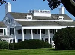 James L. Breese House |
April 18, 1980 (#80002778) |
155 Hill Street 40°53′06″N 72°23′56″W |
Southampton | |
| 9 | Bridgehampton Presbyterian Church | _Presbyterian_Church_Entrance.jpg.webp) Bridgehampton Presbyterian Church |
February 14, 2017 (#100000649) |
2429 Montauk Hwy. 40°56′10″N 72°18′12″W |
Bridgehampton | |
| 10 | William Cauldwell House | May 4, 2009 (#09000305) |
51 Peconic Avenue 40°59′24″N 72°22′21″W |
Noyack | ||
| 11 | William Merritt Chase Homestead | 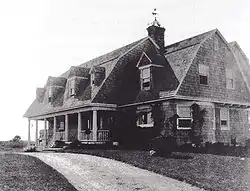 William Merritt Chase Homestead |
June 16, 1983 (#83001808) |
Canoe Place Road and Bathing Beach Road (east of Peconic Road) 40°53′15″N 72°28′38″W |
Shinnecock Hills | |
| 12 | COIMBRA (shipwreck and remains) | September 25, 2013 (#13000779) |
Address Restricted |
Westhampton | From World War II Shipwrecks along the East Coast and Gulf of Mexico MPS | |
| 13 | William Corwith House | 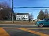 William Corwith House |
July 13, 2013 (#13000463) |
2368 Montauk Hwy. 40°56′10″N 72°18′21″W |
Bridgehampton | Currently the headquarters of the Bridgehampton Historical Society |
| 14 | Crowther House | 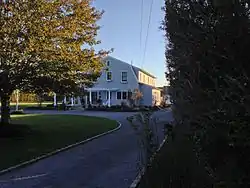 Crowther House |
March 21, 1985 (#85000630) |
97 Beach Lane 40°48′16″N 72°38′03″W |
Westhampton Beach | |
| 15 | William A. Farnum Boathouse | November 9, 2017 (#100001809) |
52 Actor's Colony Rd. 41°02′08″N 72°18′26″W |
Sag Harbor | 1915 boathouse is sole surviving intact structure associated with the life of early 20th century movie star William Farnum | |
| 16 | First Presbyterian Church | 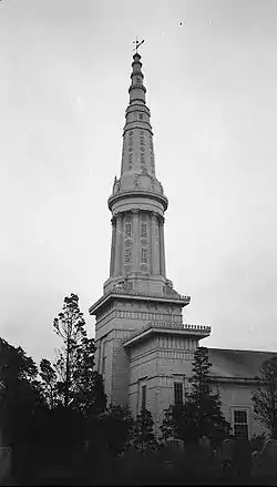 First Presbyterian Church |
April 19, 1994 (#94001194) |
44 Union Street 40°59′50″N 72°17′39″W |
Sag Harbor | Egyptian revival church designed by Minard Lafever; steeple lost in 1938 hurricane |
| 17 | Foster-Meeker House | 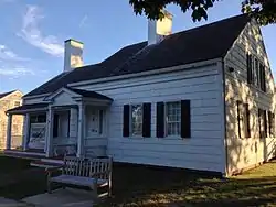 Foster-Meeker House |
August 26, 2009 (#09000656) |
101 Mill Road 40°48′44″N 72°38′36″W |
Westhampton Beach | |
| 18 | Capt. C. Goodale House | 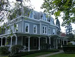 Capt. C. Goodale House |
October 2, 1986 (#86002725) |
300 Hampton Road 40°53′29″N 72°22′51″W |
Southampton | |
| 19 | Jagger House | 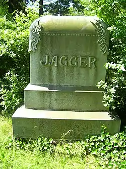 Jagger House |
December 12, 1978 (#78001920) |
Old Montauk Highway 40°49′00″N 72°40′38″W |
Westhampton | |
| 20 | Maycroft | February 24, 1995 (#95000158) |
Ferry Road (NY 114) 41°00′33″N 72°18′35″W |
North Haven | ||
| 21 | North Main Street Historic District | 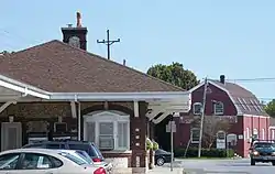 North Main Street Historic District |
October 2, 1986 (#86002730) |
North Main Street near CR 39 and Railroad Station Plaza 40°53′45″N 72°23′27″W |
Southampton | |
| 22 | Quogue Cemetery | December 11, 2013 (#13000914) |
58 Lamb Ave 40°49′01″N 72°36′18″W |
Quogue | Graves of early settlers date to mid-18th century, with distinctive period funerary art. | |
| 23 | Quogue Historic District | 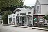 Quogue Historic District |
February 2, 2016 (#15001028) |
Quogue Historic District 40°49′07″N 72°36′15″W |
Quogue | District covering most of village shows slow transition from agricultural town to seaside vacation destination. |
| 24 | Quogue Life-Saving Station | 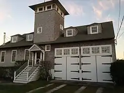 Quogue Life-Saving Station |
May 27, 1999 (#99000640) |
78 Dune Road 40°48′26″N 72°36′00″W |
Quogue | |
| 25 | Rev. Paul Cuffee Gravesite |  Rev. Paul Cuffee Gravesite |
October 8, 2010 (#10000852) |
North side of Montauk Highway opposite 216 East Montauk Highway 40°52′56″N 72°30′39″W |
Hampton Bays | Cemeteries of the Town of Southampton, 1640-1930 MPS |
| 26 | Rogers Mansion Museum Complex | 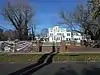 Rogers Mansion Museum Complex |
January 10, 2012 (#11001010) |
17 Meetinghouse Ln. Coordinates missing |
Southampton | 1843 Greek Revival mansion built for whaling captain; now used as the Southampton History Museums |
| 27 | Nathaniel Rogers House | 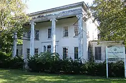 Nathaniel Rogers House |
March 15, 2005 (#05000170) |
2539 Montauk Highway 40°56′15″N 72°18′04″W |
Bridgehampton | |
| 28 | Rosemary Lodge | 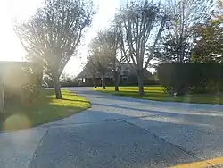 Rosemary Lodge |
January 14, 2000 (#99001681) |
322 Rose Hill Road 40°54′39″N 72°20′19″W |
Water Mill | |
| 29 | Sag Harbor Village District | 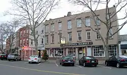 Sag Harbor Village District |
July 20, 1973 (#73001274) |
Roughly bounded by Sag Harbor, Rysam, Hamilton, Marsden, Main and Long Island Avenues 40°59′50″N 72°17′44″W |
Sag Harbor | |
| 30 | Sagaponack Historic District | 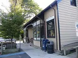 Sagaponack Historic District |
June 2, 2000 (#00000582) |
Roughly along Main Street 40°55′29″N 72°16′40″W |
Sagaponack | |
| 31 | Shinnecock Hills Golf Club |  Shinnecock Hills Golf Club |
September 29, 2000 (#00001211) |
Between County Road and Sebonac Road 40°53′46″N 72°26′28″W |
Southampton | |
| 32 | Southampton Village Historic District | 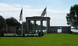 Southampton Village Historic District |
April 25, 1988 (#86002726) |
Roughly bounded by Hill and Main Streets, Old Town Road, Atlantic Ocean, Coopers Neck and Halsey Neck Lanes 40°52′37″N 72°23′35″W |
Southampton | |
| 33 | Ellis Squires Jr. House |  Ellis Squires Jr. House |
November 9, 2017 (#100001811) |
186 and 190 Newtown Rd. 40°53′48″N 72°31′35″W |
Hampton Bays | 1785 Federal style building is oldest surviving house in Hampton Bays |
| 34 | US Post Office-Westhampton Beach | 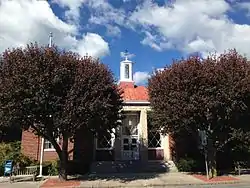 US Post Office-Westhampton Beach |
May 11, 1989 (#88002446) |
170 Main Street[4] 40°48′36″N 72°38′28″W |
Westhampton Beach | |
| 35 | Water Mill | 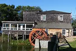 Water Mill |
October 13, 1983 (#83004175) |
Old Mill Road 40°54′33″N 72°21′24″W |
Water Mill | |
| 36 | Wickapogue Road Historic District | 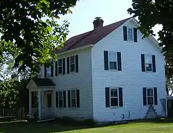 Wickapogue Road Historic District |
October 2, 1986 (#86002697) |
Wickapogue Road between Narrow Lane and Cobb Road 40°53′01″N 72°22′03″W |
Southampton | |
| 37 | Windmill at Water Mill | 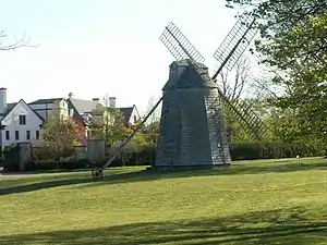 Windmill at Water Mill |
December 27, 1978 (#78001919) |
NY 27 and Halsey Lane 40°54′34″N 72°21′15″W |
Water Mill |
Former listing
| [2] | Name on the Register | Image | Date listed | Date removed | Location | Summary |
|---|---|---|---|---|---|---|
| 1 | Captain Mercator Cooper House |  Captain Mercator Cooper House |
October 2, 1986 (#86002724) | January 15, 1987 | 81 Windmill Lane |
See also
| Wikimedia Commons has media related to National Register of Historic Places in Suffolk County, New York. |
References
- The latitude and longitude information provided is primarily from the National Register Information System, and has been found to be fairly accurate for about 99% of listings. For 1%, the location info may be way off. We seek to correct the coordinate information wherever it is found to be erroneous. Please leave a note in the Discussion page for this article if you believe any specific location is incorrect.
- Numbers represent an alphabetical ordering by significant words. Various colorings, defined here, differentiate National Historic Landmarks and historic districts from other NRHP buildings, structures, sites or objects.
- The eight-digit number below each date is the number assigned to each location in the National Register Information System database, which can be viewed by clicking the number.
- Address based on USPS website. Accessed April 2, 2016.
External links
- NRHP applications for New York State sites (Note, interface works best with Microsoft Internet Explorer browser; hit "Results" after searching, to actually see the results).
| Topics |  | |
|---|---|---|
| Lists by county |
| |
| Lists by city | ||
| Other lists | ||
| ||
This article is issued from Wikipedia. The text is licensed under Creative Commons - Attribution - Sharealike. Additional terms may apply for the media files.