National Register of Historic Places listings in Wilmington, Delaware
This is a list of properties listed on the National Register of Historic Places in Wilmington, Delaware:[1]
For reasons of size, the listings in New Castle County are divided into three lists: those in Wilmington, other listings in northern New Castle County (north of the Chesapeake and Delaware Canal), and those in southern New Castle County (south of the Chesapeake and Delaware Canal).
There are 395 properties and districts listed on the National Register in the county. Of these, 87 are in Wilmington. Five of these sites are further designated as National Historic Landmarks. The locations of National Register properties and districts for which the latitude and longitude coordinates are included below, may be seen in an online map.[2]
- This National Park Service list is complete through NPS recent listings posted January 29, 2021.[3]
Contents: Divisions in Delaware
| Northern New Castle | Southern New Castle | Kent | Sussex |
Current listings
| [4] | Name on the Register[5] | Image | Date listed[6] | Location | Description |
|---|---|---|---|---|---|
| 1 | American Vulcanized Fibre Company-Wilmington Plant | 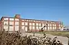 American Vulcanized Fibre Company-Wilmington Plant |
October 19, 2020 (#100005688) |
700 Maryland Ave. 39°44′15″N 75°33′59″W |
|
| 2 | Augustine Paper Mill | 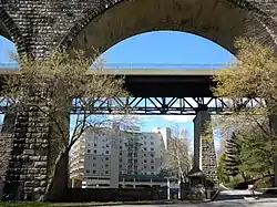 Augustine Paper Mill |
August 3, 1978 (#78000909) |
N. Brandywine Park Dr. 39°45′43″N 75°33′25″W |
|
| 3 | Bancroft and Sons Cotton Mills | 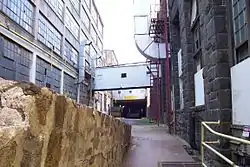 Bancroft and Sons Cotton Mills |
December 20, 1984 (#84000439) |
Rockford Rd. 39°46′06″N 75°33′47″W |
|
| 4 | Baynard Boulevard Historic District | 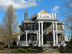 Baynard Boulevard Historic District |
July 26, 1979 (#79000631) |
Baynard Blvd. between 18th St. and Concord Ave. 39°45′29″N 75°32′39″W |
|
| 5 | Bellevue Range Rear Light Station | .jpg.webp) Bellevue Range Rear Light Station |
April 26, 2006 (#06000313) |
Christina River northern side, 0.3 mile west of Delaware River, 50 feet south of Cherry Island 39°43′13″N 75°31′04″W |
|
| 6 | Brandywine Park | 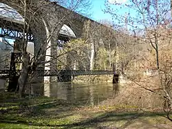 Brandywine Park |
December 22, 1976 (#76000574) |
Roughly bounded by Augustine, 18th, and Market Sts. and Lovering Ave. 39°45′27″N 75°33′13″W |
|
| 7 | Brandywine Village Historic District | 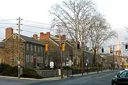 Brandywine Village Historic District |
February 24, 1971 (#71000229) |
Roughly bounded by Brandywine Creek, Tatnall, 22nd, Gordon Sts., Vandever Ave., Mabel St., and the 14th St. bridge 39°45′04″N 75°32′29″W |
|
| 8 | Braunstein's Building | 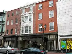 Braunstein's Building |
December 19, 1985 (#85003190) |
704-706 N. Market St. 39°44′34″N 75°32′57″W |
|
| 9 | Dr. John A. Brown House | 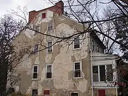 Dr. John A. Brown House |
April 24, 1979 (#79000632) |
4 7th Ave. 39°44′06″N 75°34′18″W |
|
| 10 | Florence and Isaac Budovitch House | 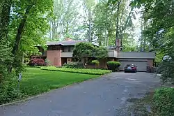 Florence and Isaac Budovitch House |
January 30, 2020 (#100004954) |
4611 Bedford Blvd. 39°47′00″N 75°31′37″W |
|
| 11 | Church Street Historic District | 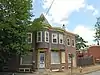 Church Street Historic District |
June 12, 1987 (#87000944) |
Bounded by Eighth, Locust, Seventh, and Church Sts. 39°44′21″N 75°32′26″W |
|
| 12 | Continental Army Encampment Site | 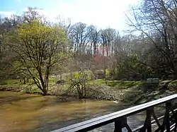 Continental Army Encampment Site |
December 18, 1973 (#73000547) |
Lovering Ave. near Broom St. 39°45′28″N 75°33′22″W |
|
| 13 | Cool Spring Park Historic District | 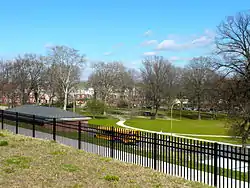 Cool Spring Park Historic District |
December 27, 1983 (#83003513) |
Bounded by Park Pl., Jackson, Van Buren, and 10th Sts. 39°45′00″N 75°33′34″W |
|
| 14 | Crosby and Hill Building | 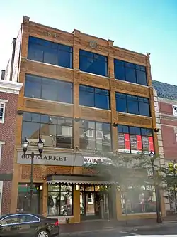 Crosby and Hill Building |
January 30, 1985 (#85000148) |
605 N. Market St. 39°44′32″N 75°33′01″W |
|
| 15 | Delaware Academy of Medicine | 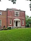 Delaware Academy of Medicine |
April 17, 2003 (#03000240) |
1925 Lovering Ave. 39°45′44″N 75°33′42″W |
|
| 16 | Delaware Avenue Historic District |  Delaware Avenue Historic District |
September 13, 1976 (#76000576) |
Delaware Ave. from N. Harrison to N. Broom Sts. (both sides) 39°45′18″N 75°33′34″W |
|
| 17 | Delaware Trust Building | 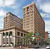 Delaware Trust Building |
April 18, 2003 (#03000238) |
900–912 N. Market St. 39°44′41″N 75°32′52″W |
Residences@Rodney Square |
| 18 | Delmarva Power and Light Building | 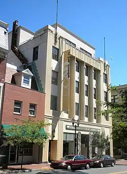 Delmarva Power and Light Building |
January 30, 1985 (#85000149) |
600 N. Market St. 39°44′31″N 75°33′00″W |
DCAD |
| 19 | Jacob Dingee House |  Jacob Dingee House |
October 16, 1970 (#70000171) |
500 Block North Market Street (formerly 105 E. 7th St.) 39°44′30″N 75°33′03″W |
|
| 20 | Obidiah Dingee House |  Obidiah Dingee House |
October 21, 1970 (#70000172) |
500 Block North Market Street (formerly 107 E. 7th St.) 39°44′30″N 75°33′03″W |
|
| 21 | Downtown Wilmington Commercial Historic District |  Downtown Wilmington Commercial Historic District |
March 24, 2017 (#100000790) |
Roughly bounded by W. 9th, N. King. W. 6th & Shipley Sts. 39°44′34″N 75°32′59″W |
|
| 22 | P. S. Dupont High School |  P. S. Dupont High School |
October 23, 1986 (#86002917) |
701 W. 34th St.,[7] 39°45′51″N 75°32′00″W |
Now used as a middle school. |
| 23 | East Brandywine Historic District | 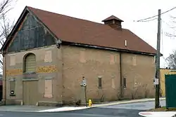 East Brandywine Historic District |
December 19, 1985 (#85003220) |
Roughly bounded by Sixteenth St., Brandywine Creek, Twelfth St., and U.S. Route 13 39°44′55″N 75°32′31″W |
|
| 24 | Eighth Street Park Historic District | 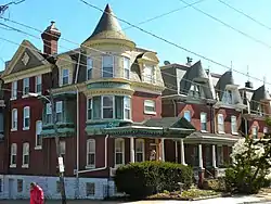 Eighth Street Park Historic District |
August 4, 1983 (#83001334) |
Roughly bounded by 6th, 10th, Harrison, and Broom Sts. 39°44′56″N 75°33′47″W |
|
| 25 | Zachariah Ferris House | 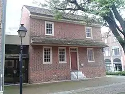 Zachariah Ferris House |
October 19, 1970 (#70000173) |
500 Block North Market Street (formerly 414 W. 2nd St.) 39°44′30″N 75°33′03″W |
|
| 26 | Foord & Massey Furniture Company Building |  Foord & Massey Furniture Company Building |
March 24, 2006 (#06000145) |
701 N. Shipley St. 39°44′35″N 75°33′01″W |
|
| 27 | Fort Christina | 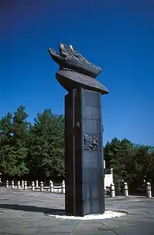 Fort Christina |
October 15, 1966 (#66000260) |
E. 7th St. and the Christina River, Fort Christina State Park 39°44′14″N 75°32′18″W |
|
| 28 | Friends Meetinghouse | 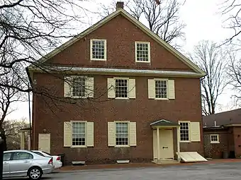 Friends Meetinghouse |
November 7, 1976 (#76000577) |
4th and West Sts. 39°44′31″N 75°33′17″W |
|
| 29 | Gibraltar | 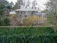 Gibraltar |
September 14, 1998 (#98001098) |
250 Pennsylvania Ave. 39°45′41″N 75°34′30″W |
DeArmond, Ashmead & Bickley, architects of 1915 alteration. |
| 30 | Govatos'/McVey Building | 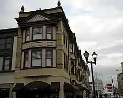 Govatos'/McVey Building |
January 30, 1985 (#85000150) |
800 N. Market St. 39°44′36″N 75°32′56″W |
|
| 31 | Grace United Methodist Church | 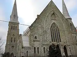 Grace United Methodist Church |
November 12, 1983 (#83001393) |
9th and West Sts. 39°44′47″N 75°33′06″W |
|
| 32 | Charles Gray Printing Shop | 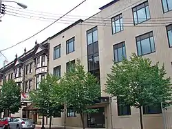 Charles Gray Printing Shop |
January 30, 1985 (#85000151) |
11 E. 8th St. 39°44′36″N 75°32′55″W |
Demolished. |
| 33 | Harlan and Hollingsworth Office Building | 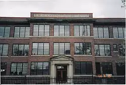 Harlan and Hollingsworth Office Building |
April 26, 1979 (#79000634) |
West St. 39°44′18″N 75°33′21″W |
|
| 34 | Holy Trinity Church | 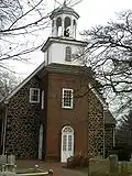 Holy Trinity Church |
October 15, 1966 (#66000261) |
7th and Church Sts. 39°44′18″N 75°32′26″W |
|
| 35 | Howard High School | 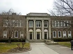 Howard High School |
February 21, 1985 (#85000309) |
13th and Poplar Sts. 39°44′48″N 75°32′30″W |
|
| 36 | Jackson-Wilson House | 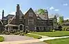 Jackson-Wilson House |
April 10, 2017 (#100000844) |
12 Red Oak Rd. 39°45′58″N 75°34′19″W |
|
| 37 | Max Keil Building | 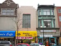 Max Keil Building |
January 30, 1985 (#85000152) |
712 N. Market St. 39°44′35″N 75°32′57″W |
|
| 38 | Max Keil Building | 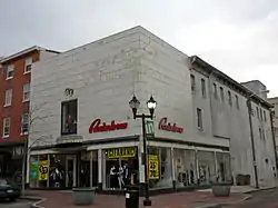 Max Keil Building |
January 30, 1985 (#85000153) |
700 N. Market St. 39°44′34″N 75°32′58″W |
|
| 39 | Kingswood Methodist Episcopal Church | 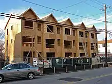 Kingswood Methodist Episcopal Church |
February 9, 1989 (#89000008) |
Fourteenth and Claymont Sts. 39°44′36″N 75°31′58″W |
Replaced by new construction. |
| 40 | Logan House | 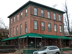 Logan House |
April 2, 1980 (#80000935) |
1701 Delaware Ave. 39°45′30″N 75°33′45″W |
|
| 41 | Charles B. Lore Elementary School |  Charles B. Lore Elementary School |
June 16, 1983 (#83001337) |
Fourth St. and Woodlawn Ave. 39°45′01″N 75°34′36″W |
|
| 42 | Lower Market Street Historic District | 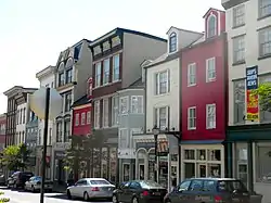 Lower Market Street Historic District |
May 15, 1980 (#80000936) |
Market St. 39°44′21″N 75°33′07″W |
|
| 43 | Main Office of the New Castle Leather Company | 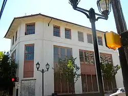 Main Office of the New Castle Leather Company |
December 19, 1985 (#85003191) |
Eleventh and Poplar Sts. 39°44′41″N 75°32′36″W |
|
| 44 | Masonic Hall and Grand Theater | 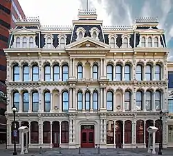 Masonic Hall and Grand Theater |
December 11, 1972 (#72000294) |
818 N. Market St. 39°44′38″N 75°32′55″W |
|
| 45 | Louis McLane House | 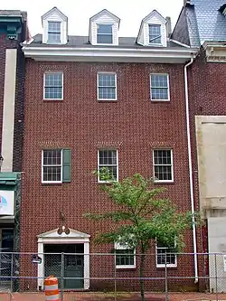 Louis McLane House |
April 24, 1973 (#73000549) |
606 Market St. 39°44′32″N 75°32′59″W |
Demolished in 2014.[8] |
| 46 | New Castle Leather Raw Stock Warehouse | 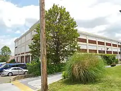 New Castle Leather Raw Stock Warehouse |
June 16, 1983 (#83001401) |
14th and Poplar Sts. 39°44′49″N 75°32′28″W |
|
| 47 | New Century Club | 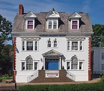 New Century Club |
June 16, 1983 (#83001336) |
1014 Delaware Ave. 39°45′06″N 75°33′22″W |
Delaware Children's Theatre |
| 48 | Old Asbury Methodist Church | .jpg.webp) Old Asbury Methodist Church |
November 7, 1976 (#76000578) |
Walnut and 3rd Sts. 39°44′18″N 75°32′56″W |
|
| 49 | Old Customshouse | 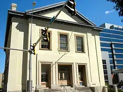 Old Customshouse |
November 21, 1974 (#74000604) |
516 N. King St. 39°44′29″N 75°32′57″W |
Wilmington University building |
| 50 | Old First Presbyterian Church of Wilmington | 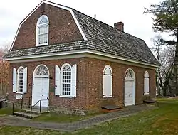 Old First Presbyterian Church of Wilmington |
April 13, 1972 (#72000295) |
West St. on Brandywine Park Dr. 39°45′03″N 75°32′51″W |
|
| 51 | Old Town Hall | 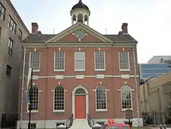 Old Town Hall |
December 31, 1974 (#74000605) |
512 Market St. 39°44′30″N 75°33′00″W |
|
| 52 | Old Town Hall Commercial Historic District | 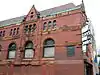 Old Town Hall Commercial Historic District |
January 30, 1985 (#85000154) |
Roughly bounded by 5th, N. King, 6th, and Shipley Sts. 39°44′30″N 75°33′02″W |
|
| 53 | Philips-Thompson Buildings |  Philips-Thompson Buildings |
April 16, 1980 (#80000937) |
200-206 E. 4th St. 39°44′22″N 75°32′59″W |
Replaced by new construction. |
| 54 | Postles House |  Postles House |
November 12, 1982 (#82001028) |
1007 N. Broom St. 39°45′09″N 75°33′43″W |
|
| 55 | Public School No. 19 |  Public School No. 19 |
December 20, 1984 (#84000453) |
801 S. Harrison St. 39°44′15″N 75°34′07″W |
Susan McLaughlin Treatment Ctr. |
| 56 | Howard Pyle Studios |  Howard Pyle Studios |
March 8, 1978 (#78000911) |
1305 and 1307 N. Franklin St. 39°45′17″N 75°33′28″W |
|
| 57 | Quaker Hill Historic District |  Quaker Hill Historic District |
September 6, 1979 (#79000635) |
Roughly bounded by Tatnall, Jefferson, 2nd and 7th Sts. 39°44′31″N 75°33′18″W |
|
| 58 | Reynold's Candy Company Building | 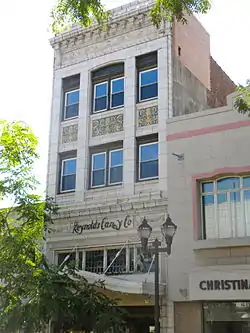 Reynold's Candy Company Building |
January 30, 1985 (#85000155) |
703 N. Market St. 39°44′34″N 75°33′00″W |
Cavanaugh's Restaurant |
| 59 | Riverview Cemetery Company of Wilmington, Delaware | 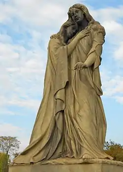 Riverview Cemetery Company of Wilmington, Delaware |
July 3, 2012 (#12000378) |
3300 & 3117 N. Market St. 39°45′31″N 75°31′51″W |
|
| 60 | Rockford Park |  Rockford Park |
September 20, 1978 (#78000912) |
Roughly bounded by Red Oak and Rockford Rds., Church and Rising Sun Lanes, and the Brandywine River 39°46′00″N 75°34′18″W |
|
| 61 | Rodney Court | 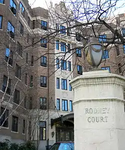 Rodney Court |
April 2, 1980 (#80000938) |
1100 Pennsylvania Ave. 39°45′09″N 75°33′25″W |
|
| 62 | Rodney Square Historic District |  Rodney Square Historic District |
August 10, 2011 (#11000522) |
Buildings fronting Rodney Square at 10th, 11th, Market & King Sts. 39°44′45″N 75°32′49″W |
|
| 63 | St. Anthony's Roman Catholic Church | 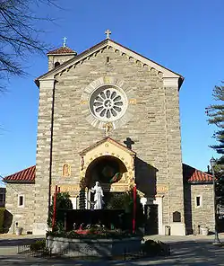 St. Anthony's Roman Catholic Church |
May 3, 1984 (#84000851) |
W. 9th and N. DuPont Sts. 39°45′09″N 75°34′00″W |
|
| 64 | St. Hedwig's Roman Catholic Church | 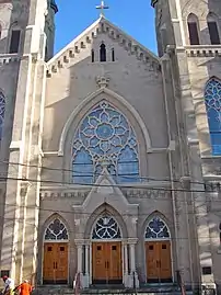 St. Hedwig's Roman Catholic Church |
November 12, 1982 (#82001024) |
Linden and S. Harrison Sts. 39°44′25″N 75°33′57″W |
|
| 65 | St. Joseph's Catholic Church | 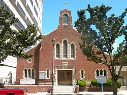 St. Joseph's Catholic Church |
January 14, 2004 (#03001385) |
1012 N. French St. 39°44′43″N 75°32′43″W |
|
| 66 | St. Mary of the Immaculate Conception Church | 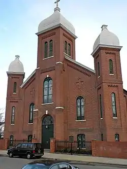 St. Mary of the Immaculate Conception Church |
December 12, 1976 (#76000580) |
6th and Pine Sts. 39°44′21″N 75°32′38″W |
|
| 67 | St. Mary's School | 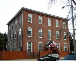 St. Mary's School |
January 5, 1983 (#83001339) |
502 Pine St. 39°44′20″N 75°32′39″W |
Elementary Workshop Montessori School |
| 68 | St. Nicholas Ukrainian Catholic Church | 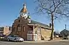 St. Nicholas Ukrainian Catholic Church |
January 25, 2021 (#100006071) |
610 South Heald St. 39°43′40″N 75°32′42″W |
|
| 68 | Charles Schagrin Building | 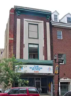 Charles Schagrin Building |
January 30, 1985 (#85000156) |
608 N. Market St. 39°44′32″N 75°32′59″W |
Demolished in 2014.[8] |
| 69 | Frank E. Schoonover Studios | 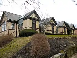 Frank E. Schoonover Studios |
April 20, 1979 (#79000636) |
1616 Rodney St. 39°45′26″N 75°33′30″W |
Four studios used by Frank Schoonover and other students of Howard Pyle |
| 70 | Shipley Run Historic District | 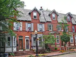 Shipley Run Historic District |
August 9, 1984 (#84000854) |
Roughly bounded by Adams, 11th, Jefferson, and 7th Sts. 39°44′49″N 75°33′21″W |
|
| 71 | Starr House | 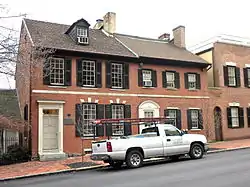 Starr House |
March 24, 1971 (#71000232) |
1310 King St. 39°44′53″N 75°32′41″W |
|
| 72 | STATE OF PENNSYLVANIA (steamboat) | 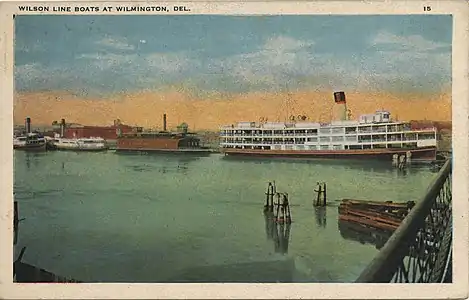 STATE OF PENNSYLVANIA (steamboat) |
April 20, 1979 (#79000637) |
Christina River 39°43′53″N 75°33′39″W |
Scrapped in 2005. |
| 73 | Torbert Street Livery Stables | 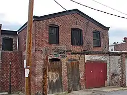 Torbert Street Livery Stables |
September 14, 1998 (#98001095) |
305-307 Torbert St. 39°44′57″N 75°32′59″W |
|
| 74 | Henry Townsend Building | 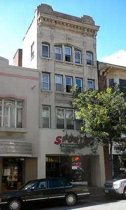 Henry Townsend Building |
January 30, 1985 (#85000157) |
709 N. Market St. 39°44′35″N 75°32′59″W |
|
| 75 | Trinity Episcopal Church | 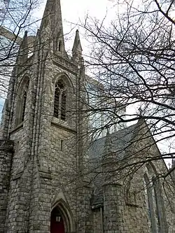 Trinity Episcopal Church |
August 16, 1984 (#84000855) |
1108 N. Adams St. 39°45′01″N 75°33′17″W |
|
| 76 | U.S. Post Office, Courthouse, and Customhouse |  U.S. Post Office, Courthouse, and Customhouse |
June 14, 1979 (#79000638) |
11th and Market Sts. 39°44′48″N 75°32′48″W |
Wilmington Trust Building |
| 77 | Water Witch Steam Fire Engine Company No. 5 | 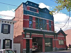 Water Witch Steam Fire Engine Company No. 5 |
September 23, 2011 (#11000697) |
1814 Gilpin Ave. 39°45′36″N 75°33′47″W |
|
| 78 | Wawaset Park Historic District | 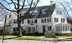 Wawaset Park Historic District |
January 3, 1986 (#86000008) |
Bounded by Pennsylvania Ave., Woodlawn Ave., Seventh St., and Greenhill Ave. 39°45′22″N 75°34′31″W |
|
| 79 | West 9th Street Commercial Historic District | 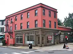 West 9th Street Commercial Historic District |
December 22, 2008 (#08001204) |
111-320 W. 9th St., 901-909 N. Orange St., 825-901 N. Tatnall St. 39°44′44″N 75°33′02″W |
|
| 80 | Wilmington Amtrak Station |  Wilmington Amtrak Station |
November 21, 1976 (#76000581) |
Front and French Sts. 39°44′12″N 75°33′04″W |
Frank Furness, architect (1908). |
| 81 | Wilmington Club | 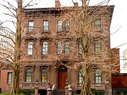 Wilmington Club |
April 19, 2006 (#06000282) |
1103 N. Market St. 39°44′49″N 75°32′51″W |
|
| 82 | Wilmington Rail Viaduct | 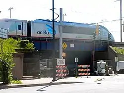 Wilmington Rail Viaduct |
November 10, 1999 (#99001276) |
Amtrak's northeast corridor through Wilmington 39°44′17″N 75°33′43″W |
|
| 83 | Wilmington Savings Fund Society | 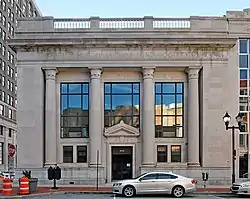 Wilmington Savings Fund Society |
January 30, 1985 (#85000158) |
838 N. Market St. 39°44′40″N 75°32′53″W |
|
| 84 | Wilmington YMCA | 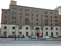 Wilmington YMCA |
February 20, 2002 (#02000035) |
501 W. 11th St. 39°44′55″N 75°33′05″W |
|
| 85 | Woodward Houses |  Woodward Houses |
April 20, 1979 (#79000639) |
701-703 West St. 39°44′39″N 75°33′10″W |
|
| 86 | F. W. Woolworth Company Building | 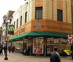 F. W. Woolworth Company Building |
January 2, 1987 (#86003755) |
839 N. Market St. 39°44′41″N 75°32′55″W |
Downtown Happy Harry's |
Former listings
| [4] | Name on the Register | Image | Date listed | Date removed | Location | Summary |
|---|---|---|---|---|---|---|
| 1 | Capt. Thomas Mendenhall House | Capt. Thomas Mendenhall House |
September 17, 1970 (#70000174) | Unknown | 205 E. Front St. 39°44′14″N 75°33′01″W |
Torn down. |
See also
References
| Wikimedia Commons has media related to National Register of Historic Places in Wilmington, Delaware. |
- "National Register Information System". National Register of Historic Places. National Park Service. April 15, 2008.
- The latitude and longitude information provided in this table was derived originally from the National Register Information System, which has been found to be fairly accurate for about 99% of listings. Some locations in this table may have been corrected to current GPS standards.
- "National Register of Historic Places: Weekly List Actions". National Park Service, United States Department of the Interior. Retrieved on January 29, 2021.
- Numbers represent an alphabetical ordering by significant words. Various colorings, defined here, differentiate National Historic Landmarks and historic districts from other NRHP buildings, structures, sites or objects.
- "National Register Information System". National Register of Historic Places. National Park Service. April 24, 2008.
- The eight-digit number below each date is the number assigned to each location in the National Register Information System database, which can be viewed by clicking the number.
- "P.S. duPont Middle School". Brandywine School District. Retrieved April 27, 2016.
- Ranaivo, Yann (June 12, 2014). "New apartments coming to downtown Wilmington". Wilmington News-Journal.
| Topics |  | |
|---|---|---|
| Lists by county | ||
| Lists by city | ||
| Other lists | ||
| ||