National Register of Historic Places listings in Kent County, Delaware
List of the National Register of Historic Places listings in Kent County, Delaware
- This National Park Service list is complete through NPS recent listings posted February 5, 2021.[1]
Contents: Divisions in Delaware
| Wilmington (New Castle) | Northern New Castle | Southern New Castle | Kent | Sussex |
Current listings
| [2] | Name on the Register | Image | Date listed[3] | Location | City or town | Description |
|---|---|---|---|---|---|---|
| 1 | Allee House | 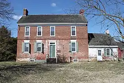 Allee House |
March 24, 1971 (#71000220) |
Off Delaware Route 9 on Dutch Neck Rd. 39°17′05″N 75°30′32″W |
Dutch Neck Crossroads | |
| 2 | Archeological Site K-875 (7K-D-37/C) | May 22, 1979 (#79003223) |
Address restricted |
Kitts Hummock | ||
| 3 | Archeological Site K-873 (7K-D-35/A, B and D) | May 22, 1979 (#79003228) |
Address restricted |
Magnolia | ||
| 4 | Archeological Site K-876 (7K-D-38/C) | May 22, 1979 (#79003222) |
Address restricted |
Kitts Hummock | ||
| 5 | Archeological Site K-880 (7K-D-42/F) | May 22, 1979 (#79003225) |
Address restricted |
Magnolia | ||
| 6 | Archeological Site K-891 (7K-D-45/A and B) | May 22, 1979 (#79003226) |
Address restricted |
Magnolia | ||
| 7 | Archeological Site K-913 (7K-D-47/C, D and E) | May 22, 1979 (#79003229) |
Address restricted |
Kitts Hummock | ||
| 8 | Archeological Site K-914 (7K-D-48/F and G) | May 22, 1979 (#79003221) |
Address restricted |
Kitts Hummock | ||
| 9 | Archeological Site K-915 (7K-D-86/C) | May 22, 1979 (#79003224) |
Address restricted |
Kitts Hummock | ||
| 10 | Archeological Site K-916 (7K-D-49/C) | May 22, 1979 (#79003230) |
Address restricted |
Kitts Hummock | ||
| 11 | Archeological Site K-920 (7K-D-52/A and C) | May 22, 1979 (#79003227) |
Address restricted |
Kitts Hummock | ||
| 12 | Archeological Site No. 7K F 4 and 23 | June 3, 1982 (#82002320) |
Address restricted |
Milford | ||
| 13 | George Arnold House | June 27, 1983 (#83001360) |
7 Hickories Road 39°13′22″N 75°39′19″W |
Kenton | Demolished in 2001 | |
| 14 | Aspendale | %252C_Kenton_vicinity%252C_(Kent_County%252C_Delaware).jpg.webp) Aspendale |
April 15, 1970 (#70000170) |
1 mile west of Kenton on Delaware Route 300 39°13′18″N 75°41′09″W |
Kenton | |
| 15 | Thomas Attix House | 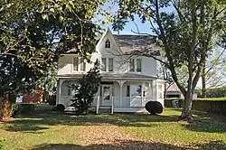 Thomas Attix House |
June 27, 1983 (#83001361) |
Road 140 39°13′31″N 75°42′28″W |
Kenton | |
| 16 | Bank House | 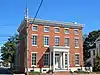 Bank House |
July 31, 1978 (#78000890) |
119 N. Walnut St. 38°54′55″N 75°25′43″W |
Milford | |
| 17 | Bannister Hall and Baynard House | 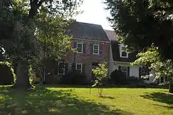 Bannister Hall and Baynard House |
April 11, 1973 (#73000503) |
South of Smyrna off Delaware Route 300 39°17′22″N 75°37′19″W |
Smyrna | |
| 18 | Barratt Hall | 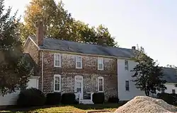 Barratt Hall |
April 13, 1973 (#73000492) |
South of Frederica off Road 372 39°01′29″N 75°26′24″W |
Frederica | |
| 19 | Barratt's Chapel | %252C_Route_113%252C_Frederica_vicinity_(Kent_County%252C_Delaware).jpg.webp) Barratt's Chapel |
October 10, 1972 (#72000281) |
North of Frederica on Delaware Route 1 39°01′29″N 75°27′34″W |
Frederica | |
| 20 | Belmont Hall | 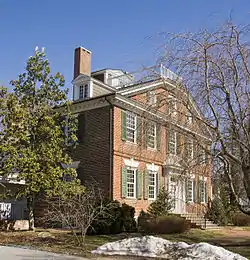 Belmont Hall |
December 16, 1971 (#71000223) |
217 Smyrna-Leipsic Rd. 39°17′40″N 75°35′45″W |
Smyrna | |
| 21 | Bethel Methodist Protestant Church | 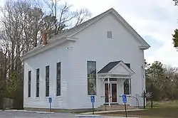 Bethel Methodist Protestant Church |
September 14, 1998 (#98001093) |
Junction of Roads 61, 114, and 304 38°51′49″N 75°38′13″W |
Andrewville | |
| 22 | J. F. Betz House |  J. F. Betz House |
August 29, 1983 (#83001362) |
Delaware Route 6 39°17′02″N 75°40′29″W |
Kenton | |
| 23 | Benjamin Blackiston House |  Benjamin Blackiston House |
June 27, 1983 (#83001363) |
Off Delaware Route 6 39°15′07″N 75°44′13″W |
Kenton | |
| 24 | Bonwell House | 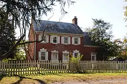 Bonwell House |
March 20, 1973 (#73000493) |
4 miles west of Frederica on Road 380 39°01′23″N 75°30′34″W |
Frederica | |
| 25 | Bradford-Loockerman House | 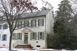 Bradford-Loockerman House |
November 30, 1972 (#72000277) |
419 S. State St. 39°09′19″N 75°31′24″W |
Dover | |
| 26 | Brecknock | 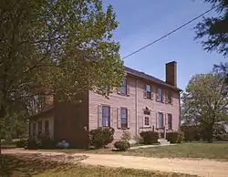 Brecknock |
December 24, 1974 (#74000596) |
0.5 miles north of Camden off U.S. Route 13 39°07′26″N 75°32′10″W |
Camden | |
| 27 | Building 1301, Dover Air Force Base | 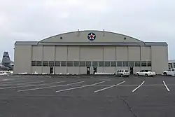 Building 1301, Dover Air Force Base |
December 7, 1994 (#94001377) |
Dover AFB, E. Dover Hundred 39°07′07″N 75°27′24″W |
Dover | |
| 28 | John Bullen House | 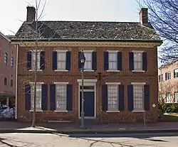 John Bullen House |
April 14, 1975 (#75000542) |
214 S. State St. 39°14′27″N 75°31′28″W |
Dover | |
| 29 | W. D. Burrows House | 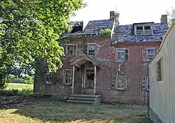 W. D. Burrows House |
June 27, 1983 (#83001364) |
Delaware Route 42 39°14′10″N 75°40′30″W |
Kenton | |
| 30 | Byfield Historic District | May 22, 1979 (#79003232) |
Address restricted |
Kitts Hummock | ||
| 31 | Byrd's AME Church | 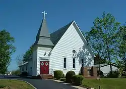 Byrd's AME Church |
October 19, 1982 (#82001023) |
Smyrna Ave. 39°17′32″N 75°37′38″W |
Clayton | |
| 32 | Camden Friends Meetinghouse | .jpg.webp) Camden Friends Meetinghouse |
April 3, 1973 (#73000485) |
Commerce St. 39°06′52″N 75°32′54″W |
Camden | |
| 33 | Camden Historic District |  Camden Historic District |
September 17, 1974 (#74000595) |
Both sides of Camden-Wyoming Ave. and Main St. 39°06′49″N 75°32′34″W |
Camden | |
| 34 | Carey Farm Site | October 20, 1977 (#77000384) |
Address restricted |
Dover | ||
| 35 | Cherbourg Round Barn | 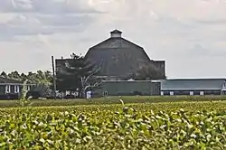 Cherbourg Round Barn |
December 22, 1978 (#78000888) |
Southwest of Little Creek off Delaware Route 9 39°09′04″N 75°27′27″W |
Little Creek | |
| 36 | Scene of Cheyney Clow's Rebellion |  Scene of Cheyney Clow's Rebellion |
January 14, 1974 (#74000598) |
West of Kenton on Delaware Route 300 39°12′15″N 75°44′35″W |
Kenton | |
| 37 | Christ Church | 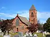 Christ Church |
May 8, 1973 (#73000502) |
3rd and Church Sts. 38°54′56″N 75°25′55″W |
Milford | |
| 38 | Christ Church | 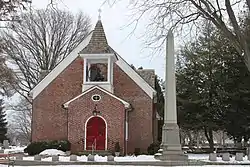 Christ Church |
December 4, 1972 (#72001500) |
S. State and Water Sts. 39°09′16″N 75°31′20″W |
Dover | |
| 39 | Clark-Pratt House | 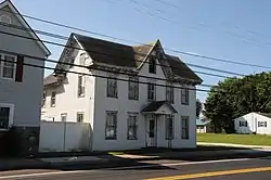 Clark-Pratt House |
June 27, 1983 (#83001365) |
Main St. 39°13′34″N 75°40′39″W |
Kenton | |
| 40 | Clayton Railroad Station | 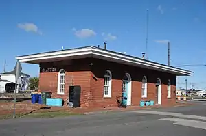 Clayton Railroad Station |
November 6, 1986 (#86003066) |
Bassett St. 39°17′28″N 75°38′00″W |
Clayton | |
| 41 | Coombe Historic District | 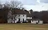 Coombe Historic District |
April 8, 1982 (#82002313) |
West of Felton on Delaware Route 12 and Road 281 39°00′09″N 75°37′10″W |
Felton | |
| 42 | Cooper House | 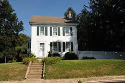 Cooper House |
March 20, 1973 (#73000495) |
Delaware Route 300 39°13′40″N 75°39′49″W |
Kenton | |
| 43 | Thomas B. Coursey House | 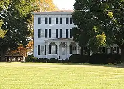 Thomas B. Coursey House |
July 23, 1990 (#90001069) |
5578 Canterbury Road 38°59′27″N 75°30′42″W |
Felton | |
| 44 | Cow Marsh Old School Baptist Church | 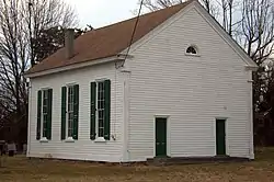 Cow Marsh Old School Baptist Church |
June 24, 1976 (#76000571) |
Northeast of Sandtown on Delaware Route 10 39°02′31″N 75°41′42″W |
Sandtown | |
| 45 | David J. Cummins House | 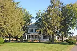 David J. Cummins House |
October 6, 1983 (#83003504) |
587 Smyrna-Leipsic Rd. 39°17′37″N 75°35′16″W |
Smyrna (Duck Creek Hundred) | |
| 46 | Timothy Cummins House | 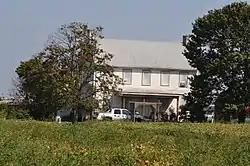 Timothy Cummins House |
October 6, 1983 (#83003505) |
3411 Smyrna-Lepsic Rd. 39°16′45″N 75°32′25″W |
Smyrna (Duck Creek Hundred) | |
| 47 | Thomas Davis House |  Thomas Davis House |
February 28, 1983 (#83001366) |
Delaware Route 6 39°17′15″N 75°39′26″W |
Kenton | |
| 48 | Delaware Boundary Markers | 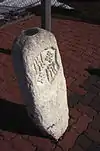 Delaware Boundary Markers |
February 18, 1975 (#75002101) |
Maryland and Pennsylvania state boundary lines |
Not applicable | |
| 49 | Delaware State Museum Buildings |  Delaware State Museum Buildings |
February 1, 1972 (#72000278) |
316 S. Governors Ave. 39°09′22″N 75°31′39″W |
Dover | |
| 50 | T.H. Denny House | 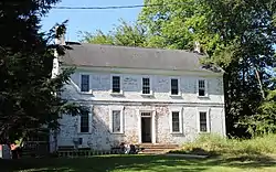 T.H. Denny House |
June 27, 1983 (#83001367) |
2466 7 Hickories Road 39°12′46″N 75°37′22″W |
Kenton | |
| 51 | John Dickinson House | .jpg.webp) John Dickinson House |
October 15, 1966 (#66000258) |
5 miles southeast of Dover and 3 miles east of U.S. Route 13 on Kitts Hummock Rd. 39°06′09″N 75°26′55″W |
Dover | |
| 52 | Dill Farm Site | October 2, 1978 (#78000893) |
Address restricted |
Sandtown | ||
| 53 | Dover Green Historic District | 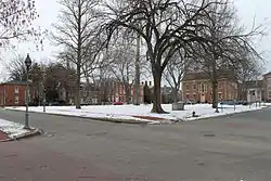 Dover Green Historic District |
May 5, 1977 (#77000383) |
Bounded by Governors Ave., North, South, and East Sts. 39°09′17″N 75°31′26″W |
Dover | |
| 54 | N. C. Downs House |  N. C. Downs House |
June 27, 1983 (#83001368) |
Road 141 39°14′04″N 75°42′03″W |
Kenton | |
| 55 | Downtown Harrington Historic District | 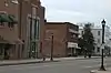 Downtown Harrington Historic District |
June 20, 2019 (#100004082) |
Various 38°55′25″N 75°34′42″W |
Harrington | |
| 56 | Duck Creek Village | 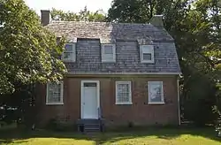 Duck Creek Village |
February 1, 1972 (#72000282) |
Road 65 between Duck Creek and Green's Branch 39°18′28″N 75°37′15″W |
Smyrna | |
| 57 | Durham-Shores House | September 21, 2001 (#01001005) |
Eastern side of Delaware Route 15 39°11′46″N 75°33′49″W |
Dupont Station | ||
| 58 | Eden Hill | 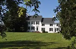 Eden Hill |
May 8, 1973 (#73000487) |
Western end of Water St. 39°09′05″N 75°32′13″W |
Dover | |
| 59 | Felton Historic District | 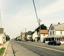 Felton Historic District |
January 26, 1988 (#87002433) |
Roughly bounded by North, Walnut, Main, and Niles Sts. 39°00′27″N 75°34′56″W |
Felton | Consists of buildings completed between 1856 and 1940, encompassing much of downtown. |
| 60 | Felton Railroad Station |  Felton Railroad Station |
July 13, 1981 (#81000191) |
E. Railroad Ave. 39°00′39″N 75°34′33″W |
Felton | |
| 61 | Fennimore Store | 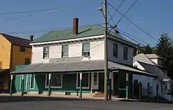 Fennimore Store |
May 24, 1982 (#82002314) |
Main, Lombard, and Front Sts. 39°14′27″N 75°30′51″W |
Leipsic | |
| 62 | Fourteen Foot Bank Light | 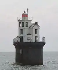 Fourteen Foot Bank Light |
March 27, 1989 (#89000286) |
On Fourteen Foot Bank in Delaware Bay, 12 miles east of Bowers 39°02′54″N 75°10′57″W |
Bowers | |
| 63 | Frederica Historic District | 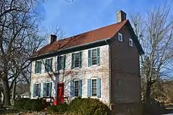 Frederica Historic District |
November 9, 1977 (#77000385) |
Market, Front, and David Sts. 39°00′27″N 75°28′03″W |
Frederica | |
| 64 | George Farmhouse | 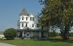 George Farmhouse |
October 19, 1982 (#82001862) |
2615 Woodland Beach Rd. 39°18′41″N 75°32′57″W |
Smyrna (Duck Creek Hundred) | |
| 65 | Golden Mine | August 24, 1978 (#78000891) |
West of Milford on Road 443 38°54′19″N 75°29′08″W |
Milford | ||
| 66 | Governor's House | .jpg.webp) Governor's House |
December 5, 1972 (#72000279) |
Kings Hwy. 39°09′41″N 75°31′25″W |
Dover | |
| 67 | Great Geneva | 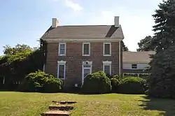 Great Geneva |
March 26, 1973 (#73000489) |
3 miles south of Dover on Road 356 39°07′03″N 75°30′32″W |
Camden | |
| 68 | Green Mansion House | 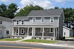 Green Mansion House |
June 27, 1983 (#83001369) |
Main St. 39°13′37″N 75°40′37″W |
Kenton | |
| 69 | Greenwold | .jpg.webp) Greenwold |
March 20, 1973 (#73000488) |
625 S. State St. 39°09′06″N 75°31′19″W |
Dover | |
| 70 | Griffith's Chapel | October 29, 1983 (#83001370) |
Junction of Roads 442 and 443 38°53′45″N 75°30′30″W |
Williamsville | ||
| 71 | Robert Hill House | August 29, 1983 (#83001371) |
Delaware Route 6 39°16′33″N 75°41′21″W |
Kenton | Demolished between 2009 and 2011. | |
| 72 | Hoffecker-Lockwood House |  Hoffecker-Lockwood House |
June 27, 1983 (#83001372) |
Delaware Route 6 39°13′36″N 75°35′53″W |
Kenton | Demolished between 1983 and 1992. |
| 73 | Alfred L. Hudson House |  Alfred L. Hudson House |
June 27, 1983 (#83001373) |
Road 90 39°16′10″N 75°37′24″W |
Kenton | |
| 74 | Hughes Early Man Sites | July 24, 1979 (#79000623) |
Address restricted |
Felton | ||
| 75 | Hughes-Willis Site | November 21, 1978 (#78000887) |
Address restricted |
Dover | ||
| 76 | Island Field Site | February 1, 1972 (#72000283) |
South of the mouth of the Murderkill River, near Delaware Bay[4]:146 39°02′34″N 75°23′17″W |
South Bowers | Includes the site of a village occupied during the ninth century AD[4]:157 | |
| 77 | Ivy Dale Farm | 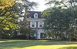 Ivy Dale Farm |
April 24, 1973 (#73000504) |
1101 Smyrna-Leipsic Rd. 39°17′13″N 75°34′46″W |
Smyrna (Duck Creek Hundred) | |
| 78 | Enoch Jones House | 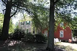 Enoch Jones House |
June 19, 1973 (#73000486) |
Southwest of Clayton off Delaware Route 300 39°16′45″N 75°39′37″W |
Clayton | |
| 79 | KATHERINE M. LEE (Schooner) | April 25, 1983 (#83001375) |
Fox's Dock at Front and Lombard Sts. 39°14′31″N 75°30′51″W |
Leipsic | ||
| 80 | Kenton Historic District |  Kenton Historic District |
August 29, 1983 (#83001396) |
Commerce St. 39°13′36″N 75°39′13″W |
Kenton | |
| 81 | Kenton Post Office | 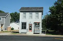 Kenton Post Office |
June 27, 1983 (#83001376) |
Main St. 39°13′38″N 75°39′54″W |
Kenton | |
| 82 | Thomas Lamb Farm | August 29, 1983 (#83001374) |
Road 130 39°17′35″N 75°41′04″W |
Kenton | ||
| 83 | Thomas Lamb House | August 29, 1983 (#83001385) |
Roads 129 and 130 39°16′53″N 75°42′26″W |
Kenton | House and milk house demolished; barn remains. | |
| 84 | Alexander Laws House | 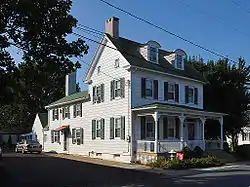 Alexander Laws House |
April 25, 1983 (#83001377) |
Front and Walnut Sts. 39°14′27″N 75°31′00″W |
Leipsic | |
| 85 | Lewis Family Tenant Agricultural Complex | 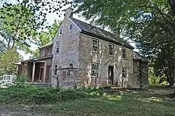 Lewis Family Tenant Agricultural Complex |
August 13, 1986 (#86001506) |
Road 227 39°06′15″N 75°36′30″W |
Wyoming | |
| 86 | Jefferson Lewis House |  Jefferson Lewis House |
June 27, 1983 (#83001349) |
2191 Seeneytown Road 39°12′48″N 75°37′58″W |
Kenton | |
| 87 | John B. Lindale House | 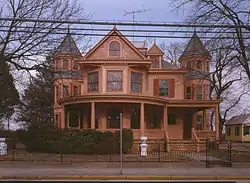 John B. Lindale House |
May 8, 1973 (#73002231) |
24 Walnut St. 39°04′12″N 75°29′11″W |
Magnolia | |
| 88 | Little Creek Hundred Rural Historic District | November 7, 1984 (#84000286) |
Delaware Route 9 39°10′47″N 75°28′31″W |
Little Creek | ||
| 89 | Little Creek Methodist Church | 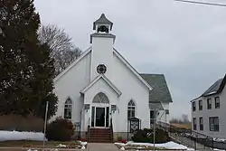 Little Creek Methodist Church |
May 24, 1982 (#82002316) |
Main St. 39°09′49″N 75°26′49″W |
Little Creek | |
| 90 | Peter Lofland House |  Peter Lofland House |
April 22, 1982 (#82002321) |
417 N. Walnut St. 38°55′03″N 75°25′43″W |
Milford | |
| 91 | Logan School House K-834 | May 22, 1979 (#79003231) |
Road 68 39°06′01″N 75°25′49″W |
Kitts Hummock | ||
| 92 | Loockerman Hall | 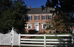 Loockerman Hall |
June 21, 1971 (#71000218) |
Delaware State University campus 39°11′06″N 75°32′44″W |
Dover | |
| 93 | Matthew Lowber House | 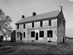 Matthew Lowber House |
April 16, 1971 (#71000221) |
East of Main St. 39°04′21″N 75°28′50″W |
Magnolia | |
| 94 | Lower St. Jones Neck Historic District | 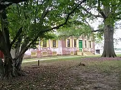 Lower St. Jones Neck Historic District |
May 22, 1979 (#79003233) |
Address restricted |
Kitts Hummock | |
| 95 | Macomb Farm | 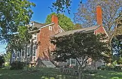 Macomb Farm |
December 2, 1974 (#74000597) |
Long Point Rd. off Delaware Route 8 39°10′58″N 75°28′38″W |
Dover | |
| 96 | MAGGIE S. MYERS (schooner) | April 25, 1983 (#83001378) |
Killen's Dock at Front and Lombard Sts. 39°14′30″N 75°30′53″W |
Leipsic | ||
| 97 | McClary House | April 25, 1983 (#83001353) |
Main and McClary Sts. 39°14′23″N 75°30′49″W |
Leipsic | ||
| 98 | James McColley House | 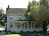 James McColley House |
January 7, 1983 (#83001354) |
500-502 NW. Front St. 38°54′46″N 75°26′07″W |
Milford | |
| 99 | Delaplane McDaniel House | June 27, 1983 (#83001379) |
Road 92 39°13′36″N 75°35′53″W |
Kenton | ||
| 100 | Mifflin-Marim Agricultural Complex | 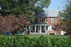 Mifflin-Marim Agricultural Complex |
November 7, 1984 (#84000269) |
Delaware Route 9 39°12′40″N 75°30′06″W |
Dover | |
| 101 | Mount Pleasant |  Mount Pleasant |
September 11, 1992 (#92001134) |
5 Margie Dr. 39°16′38″N 75°36′27″W |
Smyrna | |
| 102 | Milford New Century Club | 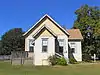 Milford New Century Club |
April 22, 1982 (#82002322) |
6 S. Church Ave. 38°54′44″N 75°25′53″W |
Milford | |
| 103 | Mill House | 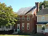 Mill House |
January 7, 1983 (#83001380) |
414 NW. Front St. 38°54′47″N 75°26′05″W |
Milford | |
| 104 | Moore House |  Moore House |
October 19, 1982 (#82001022) |
511 W. Mt. Vernon St. 39°17′45″N 75°36′51″W |
Smyrna | |
| 105 | Mordington | .jpg.webp) Mordington |
April 13, 1973 (#73000494) |
South of Frederica on Canterbury Rd. 38°58′07″N 75°29′39″W |
Frederica | |
| 106 | North Milford Historic District | 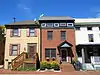 North Milford Historic District |
January 7, 1983 (#83001357) |
Roughly bounded by Mispillion River, Silver Lake, N. Walnut and NW. 3rd Sts. 38°54′53″N 75°25′52″W |
Milford | |
| 107 | Octagonal Schoolhouse | .jpg.webp) Octagonal Schoolhouse |
March 24, 1971 (#71000217) |
East of Cowgill 39°11′44″N 75°28′21″W |
Cowgill's Corner | |
| 108 | Old Fire House | 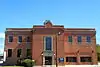 Old Fire House |
January 7, 1983 (#83001381) |
Church Ave. 38°54′52″N 75°25′50″W |
Milford | |
| 109 | Old Statehouse | 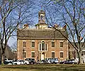 Old Statehouse |
February 24, 1971 (#71000219) |
The Green 39°09′23″N 75°31′23″W |
Dover | |
| 110 | Old Stone Tavern | 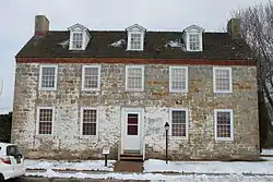 Old Stone Tavern |
July 2, 1973 (#73000499) |
Main St. 39°09′51″N 75°26′51″W |
Little Creek | |
| 111 | Palmer Home | 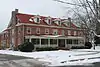 Palmer Home |
September 13, 1988 (#88001443) |
115 American Ave. 39°09′50″N 75°31′31″W |
Dover | |
| 112 | Peterson and Mustard's Hermitage Farm | 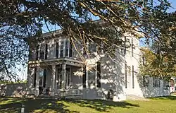 Peterson and Mustard's Hermitage Farm |
October 26, 1982 (#82001027) |
1653 Big Oak Rd. 39°17′29″N 75°34′10″W |
Smyrna | |
| 113 | Poinsett House | 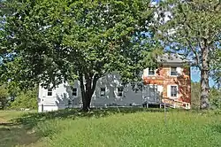 Poinsett House |
June 27, 1983 (#83001350) |
Delaware Route 6 39°15′46″N 75°44′34″W |
Kenton | |
| 114 | Port Mahon Lighthouse | .jpg.webp) Port Mahon Lighthouse |
October 25, 1979 (#79000624) |
Northeast of Little Creek 39°11′05″N 75°24′04″W |
Little Creek | |
| 115 | Rawley House | 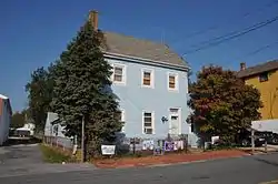 Rawley House |
April 25, 1983 (#83001352) |
Main St. 39°14′26″N 75°30′51″W |
Leipsic | |
| 116 | Raymond Neck Historic District | 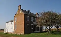 Raymond Neck Historic District |
November 8, 1982 (#82001026) |
North of Leipsic between Leipsic River and Road 85 39°14′53″N 75°30′32″W |
Leipsic | |
| 117 | Reed House | 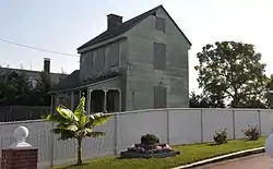 Reed House |
April 25, 1983 (#83001351) |
Lombard St. 39°14′31″N 75°30′47″W |
Leipsic | |
| 118 | Jehu Reed House | 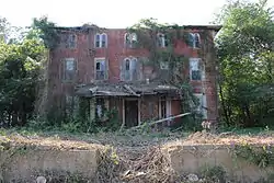 Jehu Reed House |
June 4, 1973 (#73000500) |
Delaware Route 1 39°02′30″N 75°27′27″W |
Little Heaven | |
| 119 | Ruth Mansion House | .jpg.webp) Ruth Mansion House |
April 11, 1973 (#73000496) |
Main St. 39°14′25″N 75°30′51″W |
Leipsic | |
| 120 | St. Paul A.M.E. Church | 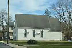 St. Paul A.M.E. Church |
October 17, 2016 (#16000726) |
103 W. Mispillion St. 38°55′21″N 75°34′58″W |
Harrington | |
| 121 | St. Joseph's Industrial School | 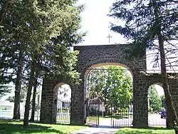 St. Joseph's Industrial School |
December 12, 2002 (#02001491) |
355 W. Duck Creek Rd. 39°17′37″N 75°38′13″W |
Clayton | |
| 122 | St. Stephen's P.E. Church | 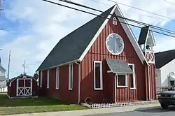 St. Stephen's P.E. Church |
October 8, 2014 (#14000825) |
110 Fleming St. 38°55′30″N 75°34′42″W |
Harrington | |
| 123 | Savin-Wilson House | 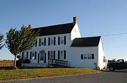 Savin-Wilson House |
September 11, 1992 (#92001135) |
551 Hurd Rd. 39°17′11″N 75°32′07″W |
Smyrna (Duck Creek Hundred) | |
| 124 | Saxton United Methodist Church | .JPG.webp) Saxton United Methodist Church |
July 23, 1990 (#90001070) |
Junction of Main and Church Sts. 39°03′30″N 75°24′14″W |
Bowers | |
| 125 | Short's Landing Hotel Complex | October 17, 1983 (#83003506) |
6180 Hay Point Landing Road 39°20′49″N 75°32′12″W |
Smyrna | ||
| 126 | Sipple House | 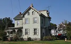 Sipple House |
May 24, 1982 (#82002315) |
Denny and Front Sts. 39°14′27″N 75°31′04″W |
Leipsic | |
| 127 | Smyrna Historic District | 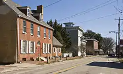 Smyrna Historic District |
May 23, 1980 (#80000930) |
Delaware Route 6 and U.S. Route 13 39°17′59″N 75°36′24″W |
Smyrna | |
| 128 | Snowland | 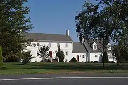 Snowland |
March 20, 1973 (#73000497) |
Delaware Route 42 39°13′46″N 75°31′39″W |
Leipsic | |
| 129 | Somerville |  Somerville |
December 31, 1974 (#74000599) |
1073 7 Hickories Road 39°13′18″N 75°38′45″W |
Kenton | |
| 130 | Star Hill AME Church | 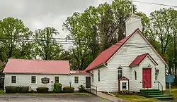 Star Hill AME Church |
November 25, 1994 (#94001389) |
Road 366 southeast of Camden 39°06′06″N 75°32′10″W |
Camden | |
| 131 | William Stevens House | August 29, 1983 (#83001406) |
Delaware Route 6 39°16′33″N 75°40′30″W |
Kenton | Demolished February 2001. | |
| 132 | Elizabeth Stubbs House | May 24, 1982 (#82002317) |
Main St. 39°09′48″N 75°26′51″W |
Little Creek | ||
| 133 | Thomas Sutton House | 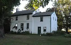 Thomas Sutton House |
April 11, 1973 (#73000505) |
Florio Road 39°19′31″N 75°30′22″W |
Woodland Beach | |
| 134 | Tharp House | 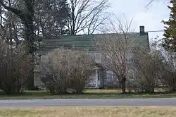 Tharp House |
March 20, 1973 (#73000491) |
East of Farmington on U.S. Route 13 38°52′17″N 75°34′35″W |
Farmington | |
| 135 | Thomas' Methodist Episcopal Chapel | 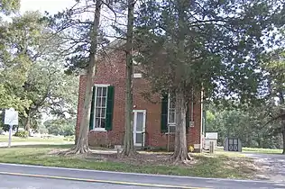 Thomas' Methodist Episcopal Chapel |
January 26, 1994 (#93001516) |
Road 206 west of Chapeltown, West Dover Hundred 39°05′55″N 75°42′15″W |
Chapeltown | |
| 136 | Parson Thorne Mansion | 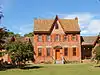 Parson Thorne Mansion |
June 21, 1971 (#71000222) |
501 NW. Front St. 38°54′49″N 75°26′07″W |
Milford | |
| 137 | Todd's Chapel | 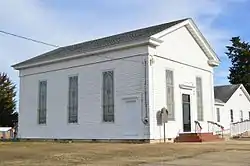 Todd's Chapel |
September 14, 1998 (#98001094) |
Junction of Todd's Chapel Rd., and Hickman Rd. 38°50′07″N 75°40′25″W |
Greenwood | |
| 138 | Town Point | 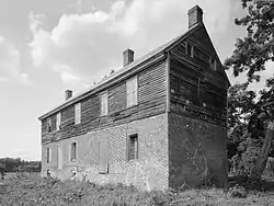 Town Point |
December 5, 1972 (#72000280) |
Kitts Hummock Rd. 39°04′53″N 75°25′44″W |
Dover | |
| 139 | Gov. George Truitt House | 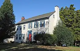 Gov. George Truitt House |
December 12, 1978 (#78000889) |
Southwest of Magnolia on Road 388 39°01′10″N 75°32′18″W |
Magnolia | |
| 140 | Tyn Head Court | March 1, 1973 (#73000490) |
East of Dover on S. Little Creek Rd. 39°09′15″N 75°28′36″W |
Dover | ||
| 141 | Victorian Dover Historic District | 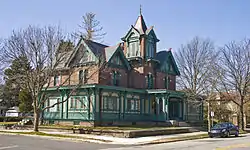 Victorian Dover Historic District |
July 16, 1979 (#79000622) |
Roughly bounded by Silver Lake, St. Jones River, North and Queen Sts. 39°09′51″N 75°31′35″W |
Dover | |
| 142 | Vogl House |  Vogl House |
November 7, 1976 (#76000570) |
West of Masten 38°57′52″N 75°37′44″W |
Masten's Corner | |
| 143 | John M. Voshell House | 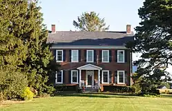 John M. Voshell House |
October 6, 1983 (#83003507) |
887 Hawkey Branch Rd. 39°18′05″N 75°31′06″W |
Smyrna (Duck Creek Hundred) | |
| 144 | Walnut Farm | 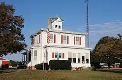 Walnut Farm |
November 10, 1982 (#82001025) |
Roosa Rd. 38°55′39″N 75°26′09″W |
Milford | |
| 145 | Gov. William T. Watson Mansion | 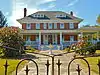 Gov. William T. Watson Mansion |
April 22, 1982 (#82002323) |
600 N. Walnut St. 38°55′12″N 75°25′47″W |
Milford | |
| 146 | Wheel of Fortune | %252C_State_Route_9%252C_Leipsic_vicinity_(Kent_County%252C_Delaware).jpg.webp) Wheel of Fortune |
April 11, 1973 (#73000498) |
South of Leipsic off Delaware Route 9 39°12′53″N 75°30′46″W |
Leipsic | |
| 147 | White-Warren Tenant House | 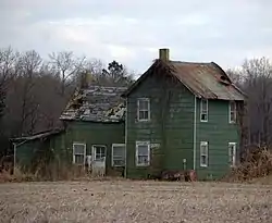 White-Warren Tenant House |
September 21, 2001 (#01001009) |
Northeastern side of Road 261 39°00′56″N 75°40′15″W |
Sandtown | |
| 148 | J. H. Wilkerson & Son Brickworks | %252C_Milford%252C_Sussex_County%252C_DE.jpg.webp) J. H. Wilkerson & Son Brickworks |
July 12, 1978 (#78000892) |
Off Road 409 38°55′08″N 75°24′50″W |
Milford | Listed as destroyed or demolished |
| 149 | James Williams House | 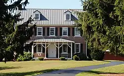 James Williams House |
June 27, 1983 (#83001382) |
1064 7 Hickories Road 39°13′12″N 75°38′48″W |
Kenton | |
| 150 | Woodlawn | 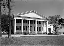 Woodlawn |
October 19, 1982 (#82001863) |
1165 DuPont Blvd. 39°17′15″N 75°35′39″W |
Smyrna (Duck Creek Hundred) | Demolished July 14th, 2017 |
| 151 | Jonathan Woodley House | 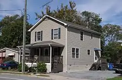 Jonathan Woodley House |
May 24, 1982 (#82002318) |
Main St. 39°09′46″N 75°26′48″W |
Little Creek | |
| 152 | Woodside Methodist Episcopal Church | 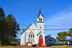 Woodside Methodist Episcopal Church |
February 16, 1996 (#96000107) |
Main St., North Murderkill Hundred 39°04′19″N 75°34′03″W |
Woodside | |
| 153 | Wright-Carry House | June 27, 1983 (#83001383) |
Commerce St. 39°13′35″N 75°39′56″W |
Kenton | ||
| 154 | Wyoming Historic District | 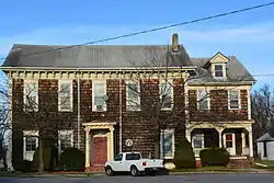 Wyoming Historic District |
February 18, 1987 (#86003037) |
Roughly bounded by Front St., Caesar Rodney Ave., Southern Blvd., and Mechanic St. 39°07′11″N 75°33′29″W |
Wyoming | |
| 155 | Wyoming Railroad Station | 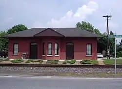 Wyoming Railroad Station |
December 4, 1980 (#80000931) |
1 N. Railroad Ave. 39°07′06″N 75°33′32″W |
Wyoming | |
| 156 | Zion African Methodist Episcopal Church | 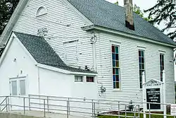 Zion African Methodist Episcopal Church |
November 25, 1994 (#94001388) |
Center St. 39°07′01″N 75°33′05″W |
Camden |
Former listing
| [2] | Name on the Register | Image | Date listed | Date removed | Location | City or town | Summary |
|---|---|---|---|---|---|---|---|
| 1 | Governor John Cook House | October 6, 1983 (#83003503) | June 5, 1986 | S of Smyrna |
Smyrna | Birthplace of former Delaware Governor John Cook |
References
- "National Register of Historic Places: Weekly List Actions". National Park Service, United States Department of the Interior. Retrieved on February 5, 2021.
- Numbers represent an alphabetical ordering by significant words. Various colorings, defined here, differentiate National Historic Landmarks and historic districts from other NRHP buildings, structures, sites or objects.
- The eight-digit number below each date is the number assigned to each location in the National Register Information System database, which can be viewed by clicking the number.
- Custer, Jay F., et al. "A Re-Examination of the Island Field Site (7K-F-17), Kent County, Delaware". Archaeology of Eastern North America 18 (1990): 145-212.
| Wikimedia Commons has media related to National Register of Historic Places in Kent County, Delaware. |
| Topics | 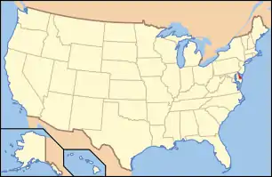 | |
|---|---|---|
| Lists by county | ||
| Lists by city | ||
| Other lists | ||
| ||
Dover (capital) | ||
| Topics |
|  |
| Society |
| |
| Cities | ||
| Towns |
| |
| Counties | ||
This article is issued from Wikipedia. The text is licensed under Creative Commons - Attribution - Sharealike. Additional terms may apply for the media files.