National Register of Historic Places listings in northern New Castle County, Delaware
This is a list of properties on the National Register of Historic Places in northern New Castle County, Delaware.
This is intended to be a complete list of the properties and districts on National Register of Historic Places in New Castle County, Delaware north of the Chesapeake and Delaware Canal, excluding the city of Wilmington. The locations of National Register properties and districts for which the latitude and longitude coordinates are included below, may be seen in a map.[1]
There are 393 properties and districts listed on the National Register in the county. Of those, 222 sites are located outside Wilmington and north of the Chesapeake and Delaware Canal, and are listed here, including five sites that are further designated as National Historic Landmarks.
- This National Park Service list is complete through NPS recent listings posted January 29, 2021.[2]
Contents: Divisions in Delaware
| Wilmington (New Castle) | Northern New Castle | Southern New Castle | Kent | Sussex |
Current listings
| [3] | Name on the Register | Image | Date listed[4] | Location | City or town | Description |
|---|---|---|---|---|---|---|
| 1 | Academy of Newark | 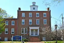 Academy of Newark |
May 24, 1976 (#76000573) |
105 E. Main St. 39°40′58″N 75°44′57″W |
Newark | University of Delaware |
| 2 | Aetna Hose, Hook and Ladder Company Fire Station No. 1 | 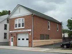 Aetna Hose, Hook and Ladder Company Fire Station No. 1 |
May 7, 1982 (#82002335) |
26 Academy St. 39°40′57″N 75°44′59″W |
Newark | |
| 3 | Aetna Hose, Hook and Ladder Company, Fire Station No. 2 | 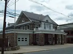 Aetna Hose, Hook and Ladder Company, Fire Station No. 2 |
May 7, 1982 (#82002334) |
31 Academy St. 39°40′56″N 75°44′57″W |
Newark | |
| 4 | Aiken's Tavern Historic District | 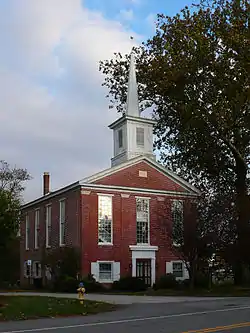 Aiken's Tavern Historic District |
December 6, 1977 (#77000388) |
Junction of U.S. Route 40 and Delaware Route 896 39°36′23″N 75°44′45″W |
Glasgow | |
| 5 | Air Service, Inc. Hangar at Bellanca Airfield |  Air Service, Inc. Hangar at Bellanca Airfield |
June 15, 2005 (#05000601) |
2 Centerpoint Blvd. 39°39′52″N 75°35′13″W |
New Castle | |
| 6 | Charles Allen House |  Charles Allen House |
August 19, 1983 (#83001348) |
855 Canoe Rd. 39°38′46″N 75°40′40″W |
Christiana | |
| 7 | Amstel House |  Amstel House |
May 12, 1977 (#77000386) |
2 E. 4th St. 39°39′38″N 75°33′53″W |
New Castle | |
| 8 | Anderson House |  Anderson House |
February 24, 1983 (#83001384) |
50 W. Park Pl. 39°40′30″N 75°45′22″W |
Newark | |
| 9 | Archmere |  Archmere |
September 9, 1992 (#92001143) |
3600 Philadelphia Pike 39°48′08″N 75°27′13″W |
Claymont | |
| 10 | Ardens Historic District |  Ardens Historic District |
May 30, 2003 (#01001245) |
Orleans Rd. at Harvey Rd. 39°48′41″N 75°29′16″W |
Arden | |
| 11 | James Armor House |  James Armor House |
August 31, 1992 (#92001141) |
3 Courtney Rd. 39°45′42″N 75°36′57″W |
Christiana Hundred | |
| 12 | Armstrong Lodge No. 26, A.F. & A.M. |  Armstrong Lodge No. 26, A.F. & A.M. |
July 14, 1993 (#93000628) |
112–114 E. Market St. 39°42′49″N 75°36′28″W |
Newport | |
| 13 | A. Armstrong Farm |  A. Armstrong Farm |
November 13, 1986 (#86003083) |
Old Wilmington Rd. west of Brackenville Rd. 39°47′11″N 75°40′28″W |
Hockessin | Farm house and barn; demolished before 2002. |
| 14 | Ashland Bridge | .jpg.webp) Ashland Bridge |
March 20, 1973 (#73000506) |
South of Ashland over Red Clay Creek 39°47′54″N 75°39′28″W |
Ashland | |
| 15 | Auburn Mills Historic District | 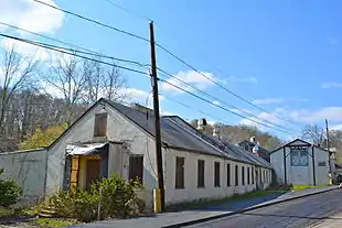 Auburn Mills Historic District |
January 22, 1980 (#80000939) |
West of Yorklyn on Delaware Route 82 and Benge Road 39°48′28″N 75°40′49″W |
Yorklyn | |
| 16 | Baily House | 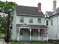 Baily House |
May 7, 1982 (#82002336) |
166 W. Main St. 39°41′03″N 75°45′32″W |
Newark | |
| 17 | Bank of Newark Building | 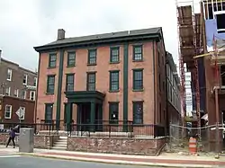 Bank of Newark Building |
February 24, 1983 (#83001345) |
102 E. Main St. 39°41′01″N 75°44′57″W |
Newark | |
| 18 | Bartley-Tweed Farm | 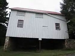 Bartley-Tweed Farm |
November 13, 1986 (#86003084) |
51 Fox Den Rd. 39°43′13″N 75°42′59″W |
Mill Creek Hundred | |
| 19 | Beaver Valley Rock Shelter Site | 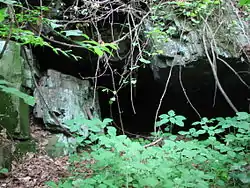 Beaver Valley Rock Shelter Site |
September 1, 1978 (#78000910) |
Address Restricted |
Brandywine Hundred | Part of the First State National Historical Park |
| 20 | Bell Farmhouse | 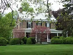 Bell Farmhouse |
February 24, 1983 (#83001344) |
401 Nottingham Rd. 39°41′15″N 75°46′12″W |
Newark | |
| 21 | Belmont Hall | 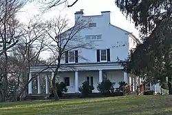 Belmont Hall |
February 24, 1983 (#83001386) |
302 W. Main St. 39°41′02″N 75°45′39″W |
Newark | University of Delaware |
| 22 | Bloomfield | 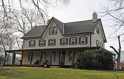 Bloomfield |
April 8, 1982 (#82002354) |
4663 Kirkwood St. Georges Road 39°33′20″N 75°39′23″W |
St. Georges | |
| 23 | Blue Hen Farm |  Blue Hen Farm |
February 24, 1983 (#83001346) |
505 Stamford Dr. 39°41′45″N 75°45′59″W |
Newark | |
| 24 | Brandywine Manufacturers Sunday School |  Brandywine Manufacturers Sunday School |
April 13, 1972 (#72000291) |
Blacksmith Hill Rd. 39°46′44″N 75°34′35″W |
Christiana Hundred | Part of the Hagley Museum |
| 25 | Brandywine Powder Mills District |  Brandywine Powder Mills District |
May 3, 1984 (#84000819) |
Delaware Route 141 and the Brandywine River 39°46′48″N 75°34′40″W |
Christiana Hundred | Hagley Museum |
| 26 | Breck's Mill Area |  Breck's Mill Area |
November 5, 1971 (#71000230) |
Breck's Lane and Creek Rd. 39°46′12″N 75°34′50″W |
Christiana Hundred | Extends slightly into Wilmington proper |
| 27 | Brindley Farm |  Brindley Farm |
September 28, 1976 (#76000575) |
3510 Kennett Pike 39°46′13″N 75°35′35″W |
Christiana Hundred | |
| 28 | Jacob Broom House |  Jacob Broom House |
December 2, 1974 (#74000602) |
402 Dean Lane 39°46′49″N 75°34′42″W |
Christiana Hundred | |
| 29 | Buena Vista |  Buena Vista |
April 16, 1971 (#71000228) |
661 South DuPont Highway 39°38′02″N 75°38′22″W |
New Castle Hundred | State of Delaware retreat center |
| 30 | Building at 28–34½ Academy Street |  Building at 28–34½ Academy Street |
May 7, 1982 (#82002338) |
28–34½ Academy St. 39°40′56″N 75°44′59″W |
Newark | |
| 31 | Building at 140 W. Main Street |  Building at 140 W. Main Street |
May 7, 1982 (#82002337) |
140 W. Main St. 39°41′02″N 75°45′28″W |
Newark | |
| 32 | Building at 34 Choate Street |  Building at 34 Choate Street |
February 24, 1983 (#83001387) |
34 Choate St. 39°41′05″N 75°44′49″W |
Newark | |
| 33 | John Carney Agricultural Complex |  John Carney Agricultural Complex |
February 25, 2009 (#09000050) |
4300 Thompson Bridge Rd. 39°49′13″N 75°34′00″W |
Rockland | Part of Brandywine Creek State Park |
| 34 | Carpenter-Lippincott House |  Carpenter-Lippincott House |
April 13, 1983 (#83001388) |
5620 Kennett Pike 39°49′06″N 75°37′00″W |
Centreville | |
| 35 | Stuart Randall & Pricilla Kellogg Carswell House |  Stuart Randall & Pricilla Kellogg Carswell House |
November 22, 2011 (#11000844) |
102 Briar Ln. 39°41′08″N 75°46′11″W |
Newark | |
| 36 | W. Casperson House |  W. Casperson House |
April 8, 1982 (#82002355) |
1600 Red Lion Rd. 39°35′25″N 75°40′26″W |
St. Georges | |
| 37 | Centre Meeting and Schoolhouse |  Centre Meeting and Schoolhouse |
December 16, 1971 (#71000224) |
311 Center Meeting Rd. 39°49′13″N 75°35′58″W |
Centreville | |
| 38 | Centreville Historic District |  Centreville Historic District |
April 13, 1983 (#83001338) |
Kennett Pike and Owls Nest/Twaddell Mill Rd. 39°49′16″N 75°37′00″W |
Centreville | |
| 39 | Chambers House |  Chambers House |
November 29, 1988 (#88003132) |
Creek and Hopkins Bridge Rds. 39°43′38″N 75°46′05″W |
White Clay Creek Hundred | Nature center for White Clay Creek State Park |
| 40 | Chambers House |  Chambers House |
February 24, 1983 (#83001389) |
196 S. College Ave. 39°40′42″N 75°45′14″W |
Newark | University of Delaware |
| 41 | Joseph Chandler House |  Joseph Chandler House |
April 13, 1983 (#83001390) |
5826 Kennett Pike 39°49′26″N 75°37′09″W |
Centreville | |
| 42 | Chelsea |  Chelsea |
April 8, 1982 (#82002325) |
910 5th St. 39°34′37″N 75°35′56″W |
Delaware City | |
| 43 | Christiana Historic District |  Christiana Historic District |
December 16, 1974 (#74000600) |
Junction of Delaware Routes 7 and 273 39°39′55″N 75°39′36″W |
Christiana | |
| 44 | Abner Cloud House |  Abner Cloud House |
August 31, 1992 (#92001144) |
14 Ravine Rd. 39°48′54″N 75°28′47″W |
Brandywine Hundred | |
| 45 | Cloud-Reese House |  Cloud-Reese House |
August 17, 2001 (#01000885) |
2202 Old Kennett Rd. 39°49′20″N 75°39′25″W |
Christiana Hundred | |
| 46 | Clyde Farm Site |  Clyde Farm Site |
July 29, 1977 (#77000391) |
Southern side of White Clay Creek, north of Interstate 95[5] 39°41′56″N 75°38′12″W |
Stanton | Paleo-Indian archaeological site |
| 47 | Coffee Run Mission Site | 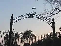 Coffee Run Mission Site |
April 11, 1973 (#73000509) |
6580 Lancaster Pike 39°46′03″N 75°39′34″W |
Hockessin | One structure destroyed in March 2010 following an arson.[6] |
| 48 | Collison House | 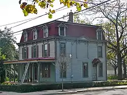 Collison House |
July 14, 1993 (#93000635) |
21 N. Walnut St. 39°42′53″N 75°36′27″W |
Newport | |
| 49 | Cooch's Bridge Historic District |  Cooch's Bridge Historic District |
April 11, 1973 (#73000528) |
South of Newark off Delaware Route 896 39°38′24″N 75°44′11″W |
Pencader Hundred | |
| 50 | Correll's Farm and Lawn Supply |  Correll's Farm and Lawn Supply |
April 8, 1982 (#82002327) |
2440 Red Lion Road 39°34′14″N 75°41′50″W |
Kirkwood | |
| 51 | Cox-Phillips-Mitchell Agricultural Complex |  Cox-Phillips-Mitchell Agricultural Complex |
March 13, 2017 (#100000729) |
1651 & 1655 Old Wilmington Rd. 39°47′43″N 75°41′54″W |
Hockessin | |
| 52 | Curtis Mansion |  Curtis Mansion |
May 7, 1982 (#82002339) |
183 W. Main St. 39°41′02″N 75°45′37″W |
Newark | English Language Institute of the University of Delaware |
| 53 | Curtis Paper Mill Workers' Houses |  Curtis Paper Mill Workers' Houses |
May 7, 1982 (#82002340) |
Curtis Lane 39°41′27″N 75°44′56″W |
Newark | |
| 54 | Darley House |  Darley House |
July 2, 1973 (#73000508) |
3701 Philadelphia Pike 39°48′18″N 75°27′15″W |
Claymont | |
| 55 | Joseph Dean & Son Woolen Mill |  Joseph Dean & Son Woolen Mill |
May 22, 1978 (#78000901) |
500 Creek View Rd. 39°41′22″N 75°44′44″W |
Newark | |
| 56 | Deer Park Farm |  Deer Park Farm |
February 24, 1983 (#83001347) |
48 W. Park Pl. 39°40′30″N 75°45′21″W |
Newark | Demolished |
| 57 | Deer Park Hotel |  Deer Park Hotel |
May 7, 1982 (#82002341) |
108 W. Main St. 39°40′59″N 75°45′22″W |
Newark | |
| 58 | Delaware Boundary Markers |  Delaware Boundary Markers |
February 18, 1975 (#75002101) |
Delaware state boundary lines with Maryland and Pennsylvania 39°43′20″N 75°47′19″W |
Not applicable | |
| 59 | Delaware City Historic District |  Delaware City Historic District |
December 15, 1983 (#83003515) |
Roughly bounded by the Delaware River, Dragon Creek, Delaware Route 9, and the Delaware and Chesapeake Canals 39°34′38″N 75°35′31″W |
Delaware City | |
| 60 | S. P. Dixon Farm |  S. P. Dixon Farm |
November 13, 1986 (#86003085) |
Barley Mill and Brackenville Rds. 39°47′45″N 75°39′27″W |
Ashland | Part of Ashland Farm (Henry B. du Pont IV estate) |
| 61 | Dragon Run Farm |  Dragon Run Farm |
April 8, 1982 (#82002328) |
2335 McCoy Rd. 39°33′47″N 75°40′23″W |
Kirkwood | |
| 62 | David Eastburn Farm |  David Eastburn Farm |
November 13, 1986 (#86003087) |
2 Bristol Ln. 39°44′48″N 75°44′09″W |
Mill Creek Hundred | |
| 63 | J. Eastburn Barn | 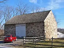 J. Eastburn Barn |
November 13, 1986 (#86003088) |
Pleasant Hill Rd. southwest of Corner Ketch Rd. 39°44′08″N 75°43′54″W |
Mill Creek Hundred | Part of White Clay Creek State Park |
| 64 | Eastburn-Jeanes Lime Kilns Historic District | 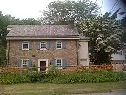 Eastburn-Jeanes Lime Kilns Historic District |
April 28, 1977 (#77000389) |
North of Newark on Limestone Rd. 39°44′30″N 75°43′00″W |
Mill Creek Hundred | |
| 65 | Eastern Lock of the Chesapeake and Delaware Canal | 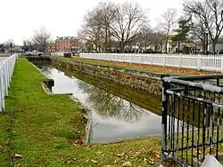 Eastern Lock of the Chesapeake and Delaware Canal |
April 21, 1975 (#75000543) |
Battery Park 39°34′44″N 75°35′14″W |
Delaware City | |
| 66 | Eleutherian Mills | 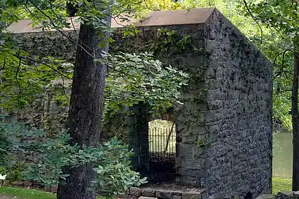 Eleutherian Mills |
November 13, 1966 (#66000259) |
North of Wilmington on Delaware Route 141 at Brandywine Creek Bridge 39°46′50″N 75°34′30″W |
Christiana Hundred | Includes most of the Hagley Museum and Library; some overlap with Breck's Mill Area |
| 67 | England House and Mill | .jpg.webp) England House and Mill |
February 23, 1972 (#72001597) |
81 Red Mill Rd. 39°41′32″N 75°42′29″W |
Mill Creek Hundred | |
| 68 | George Evans House |  George Evans House |
May 7, 1982 (#82002342) |
5 W. Main St. 39°40′58″N 75°45′14″W |
Newark | University of Delaware |
| 69 | John Evans House | 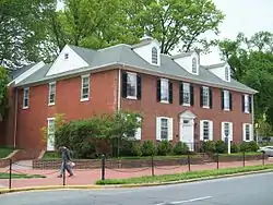 John Evans House |
February 24, 1983 (#83001392) |
14 W. Main St. 39°40′59″N 75°45′15″W |
Newark | Raub Hall of the University of Delaware |
| 70 | Exchange Building |  Exchange Building |
May 7, 1982 (#82002343) |
154–158 E. Main St. 39°41′01″N 75°44′49″W |
Newark | Klondike Kate's |
| 71 | Fairview |  Fairview |
April 8, 1982 (#82002326) |
701 Cox Neck Rd. 39°33′49″N 75°36′50″W |
Delaware City | Note that there are also Fairviews in Middletown and Odessa |
| 72 | Fell Historic District |  Fell Historic District |
June 16, 1983 (#83001335) |
Faulkland Rd. and New Fell's Lane 39°44′56″N 75°38′16″W |
Mill Creek Hundred | |
| 73 | Robert Ferguson House |  Robert Ferguson House |
July 22, 1979 (#79000628) |
636 Chestnut Hill Rd. 39°40′24″N 75°42′24″W |
White Clay Creek Hundred | Demolished |
| 74 | Andrew Fisher House |  Andrew Fisher House |
May 8, 1973 (#73000525) |
725 Art Ln. 39°39′19″N 75°45′19″W |
Newark | |
| 75 | Fort Delaware on Pea Patch Island |  Fort Delaware on Pea Patch Island |
December 16, 1971 (#71000226) |
Pea Patch Island in the Delaware River 39°35′24″N 75°34′19″W |
Delaware City | |
| 76 | Fort DuPont Historic District |  Fort DuPont Historic District |
October 28, 1999 (#99001275) |
248 Kent Ave. 39°34′17″N 75°35′06″W |
Delaware City | Currently Fort DuPont State Park and the Governor Bacon Health Center |
| 77 | Galloway-Walker House |  Galloway-Walker House |
July 14, 1993 (#93000633) |
107 John St. 39°42′44″N 75°36′38″W |
Newport | |
| 78 | Garrett Snuff Mill |  Garrett Snuff Mill |
May 22, 1978 (#78000913) |
Delaware Route 82 and Yorklyn Rd. 39°48′31″N 75°40′26″W |
Yorklyn | |
| 79 | Garrett Snuff Mills Historic District |  Garrett Snuff Mills Historic District |
January 24, 1980 (#80004486) |
Delaware Route 82 and Yorklyn Rd. 39°48′38″N 75°40′21″W |
Yorklyn | |
| 80 | Glebe House |  Glebe House |
April 3, 1973 (#73000521) |
350 Glebe Ln. 39°40′07″N 75°33′31″W |
New Castle | |
| 81 | Glynrich | 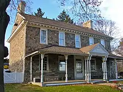 Glynrich |
November 1, 1979 (#79000633) |
Mill Rd. and Race St. 39°43′56″N 75°34′56″W |
Christiana Hundred | |
| 82 | Robert Graham House | 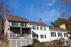 Robert Graham House |
August 1, 1997 (#97000835) |
751 Crossan Rd. 39°45′23″N 75°43′57″W |
Mill Creek Hundred | |
| 83 | Granite Mansion | 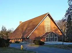 Granite Mansion |
February 24, 1983 (#83001394) |
292 W. Main St. 39°41′11″N 75°45′50″W |
Newark | Demolished, photo shows church on the site |
| 84 | Grantham-Edwards-McComb House | 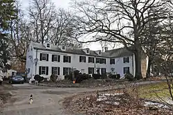 Grantham-Edwards-McComb House |
January 19, 2016 (#15000977) |
217 Park Ave. 39°38′53″N 75°36′52″W |
New Castle | |
| 85 | Graves Mill Historic District |  Graves Mill Historic District |
December 19, 1979 (#79000640) |
East of Ashland on Way Rd. 39°48′17″N 75°38′40″W |
Ashland | |
| 86 | Green Mansion | 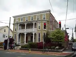 Green Mansion |
February 24, 1983 (#83001395) |
94–96 E. Main St. 39°41′01″N 75°44′58″W |
Newark | |
| 87 | Greenbank Historic Area | Greenbank Historic Area |
July 2, 1973 (#73000513) |
500 Greenbank Mill Rd.; also 2300 Newport Gap Pike 39°44′24″N 75°37′59″W |
Marshallton | "Marshallton" represents a boundary increase of July 24, 1979 |
| 88 | Hale-Byrnes House | 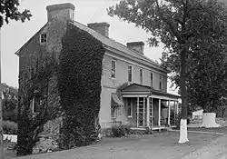 Hale-Byrnes House |
June 2, 1972 (#72000290) |
606 Stanton-Christiana Road 39°42′05″N 75°39′02″W |
Stanton | |
| 89 | Head of Christiana United Presbyterian Church | 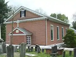 Head of Christiana United Presbyterian Church |
August 19, 1983 (#83001343) |
1100 Church Rd. 39°41′31″N 75°47′12″W |
White Clay Creek Hundred | |
| 90 | The Hermitage | 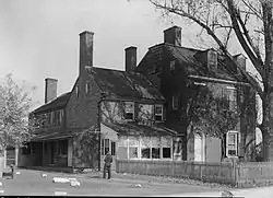 The Hermitage |
March 1, 1973 (#73000522) |
901 Delaware St. 39°39′55″N 75°34′09″W |
New Castle | Demolished in 2009 |
| 91 | Hersey-Duncan House |  Hersey-Duncan House |
November 15, 1990 (#90001714) |
2116 Duncan Rd. 39°44′06″N 75°38′27″W |
Mill Creek Hundred | |
| 92 | William Hicklen House |  William Hicklen House |
October 6, 1983 (#83003519) |
502 Beaver Valley Rd. 39°49′55″N 75°33′22″W |
Talleyville | Owned by the Woodlawn Trustees. |
| 93 | Hickman Blacksmith Shop and House |  Hickman Blacksmith Shop and House |
September 2, 1994 (#94001078) |
1201 and 1203 Greenbank Rd. 39°43′44″N 75°38′18″W |
Marshallton | |
| 94 | Hickman Row |  Hickman Row |
June 16, 2006 (#06000284) |
1–117 Hickman Rd. 39°48′57″N 75°26′42″W |
Claymont | |
| 95 | Hockessin Friends Meetinghouse | 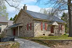 Hockessin Friends Meetinghouse |
March 20, 1973 (#73000510) |
1501 Old Wilmington Rd. 39°47′34″N 75°41′28″W |
Hockessin | |
| 96 | Holladay-Harrington House | 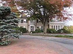 Holladay-Harrington House |
September 30, 2004 (#04001077) |
3705 Kennett Pike 39°46′28″N 75°35′34″W |
Greenville | Patterson Schwartz Realty |
| 97 | Holly Oak | 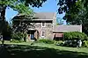 Holly Oak |
April 10, 2017 (#100000843) |
1503 Ridge Rd. 39°46′58″N 75°28′39″W |
Claymont | |
| 98 | House at 901 Mt. Lebanon Rd. |  House at 901 Mt. Lebanon Rd. |
March 28, 2017 (#100000656) |
901 Mt. Lebanon Rd. 39°47′53″N 75°34′11″W |
Rockland | |
| 99 | Iron Hill School No. 112C | 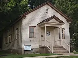 Iron Hill School No. 112C |
August 18, 1995 (#95001032) |
1335 Old Baltimore Pike 39°37′54″N 75°45′29″W |
Pencader Hundred | Iron Hill Museum |
| 100 | Ivyside Farm |  Ivyside Farm |
January 4, 1982 (#82002324) |
1301 Naaman's Rd. 39°49′17″N 75°28′37″W |
Claymont | |
| 101 | Johnson-Morris House |  Johnson-Morris House |
February 22, 2011 (#11000036) |
41 Upper Pike Creek Rd. 39°42′19″N 75°41′47″W |
Mill Creek Hundred | |
| 102 | William Julius "Judy" Johnson House |  William Julius "Judy" Johnson House |
October 10, 1995 (#95001145) |
3701 Kiamensi Ave. in Christiana Hundred 39°43′48″N 75°38′00″W |
Marshallton | |
| 103 | Thomas Justis House |  Thomas Justis House |
September 23, 1993 (#93000989) |
1001 Milltown Rd. 39°44′03″N 75°39′31″W |
Mill Creek Hundred | |
| 104 | Justis-Jones House | 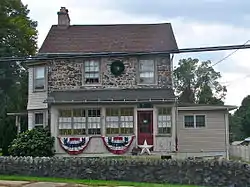 Justis-Jones House |
August 28, 1998 (#98001096) |
2606 Newport Gap Pike 39°44′36″N 75°38′25″W |
Mill Creek Hundred | |
| 105 | Andrew Kerr House |  Andrew Kerr House |
August 19, 1983 (#83001342) |
812 Elkton Rd. 39°40′16″N 75°46′13″W |
Newark | |
| 106 | Killgore Hall |  Killgore Hall |
July 14, 1993 (#93000630) |
101 N. James St. 39°42′53″N 75°36′36″W |
Newport | Demolished c. 2000 |
| 107 | Joseph Killgore House | Joseph Killgore House |
July 14, 1993 (#93000627) |
107 N. James St. 39°42′54″N 75°36′36″W |
Newport | Demolished c. 2000 |
| 108 | La Grange |  La Grange |
July 10, 1974 (#74000601) |
2467 Pulaski Highway 39°36′22″N 75°44′54″W |
Glasgow | |
| 109 | Laurel |  Laurel |
December 4, 1974 (#74000603) |
619 Shipley Rd. 39°46′25″N 75°31′00″W |
Brandywine Hundred | |
| 110 | Lesley-Travers Mansion |  Lesley-Travers Mansion |
April 3, 1973 (#73000523) |
112 W. 6th St. 39°39′39″N 75°34′11″W |
New Castle | |
| 111 | John Lewden House |  John Lewden House |
September 24, 1979 (#79003104) |
107 E. Main St. 39°39′48″N 75°39′20″W |
Christiana | |
| 112 | Charles and Edith Liedlich House |  Charles and Edith Liedlich House |
April 19, 2006 (#06000283) |
180 Welsh Tract Rd. 39°38′39″N 75°45′41″W |
Newark | |
| 113 | Linden Hill | 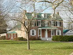 Linden Hill |
April 8, 1982 (#82002356) |
34 N. DuPont Highway 39°33′48″N 75°39′20″W |
St. Georges | |
| 114 | J. Lindsay Barn | 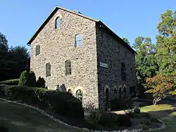 J. Lindsay Barn |
November 13, 1986 (#86003089) |
15 Middleton Dr. 39°45′04″N 75°41′16″W |
Mill Creek Hundred | Offices of Covenant Wealth Strategies. |
| 115 | Samuel Lindsey House | 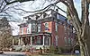 Samuel Lindsey House |
August 19, 1983 (#83001397) |
693 New London Rd. 39°42′27″N 75°46′36″W |
McClellandville | |
| 116 | Lobdell Estate, Minquadale Home | 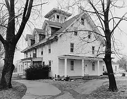 Lobdell Estate, Minquadale Home |
June 4, 1973 (#73000548) |
N. DuPont Highway 39°42′23″N 75°34′13″W |
New Castle Hundred | Demolished between 1984 and 2002. |
| 117 | Lombardy Hall |  Lombardy Hall |
December 5, 1972 (#72000292) |
1611 Concord Pike 39°46′53″N 75°32′40″W |
Brandywine Hundred | |
| 118 | Louviers | Louviers |
December 13, 1971 (#71000231) |
10 Black Gates Rd. 39°47′08″N 75°34′20″W |
Brandywine Hundred | House demolished; gatehouses remain. |
| 119 | Lower Louviers and Chicken Alley |  Lower Louviers and Chicken Alley |
February 1, 1972 (#72000293) |
1 Black Gates Rd. 39°47′06″N 75°34′26″W |
Brandywine Hundred | |
| 120 | Lum's Mill House |  Lum's Mill House |
May 22, 1973 (#73000511) |
Off Red Lion Road in Lums Pond State Park 39°33′03″N 75°42′47″W |
Kirkwood | Part of Lums Pond State Park |
| 121 | Marcus Hook Range Rear Light |  Marcus Hook Range Rear Light |
March 27, 1989 (#89000287) |
313 Light House Rd. 39°45′44″N 75°30′13″W |
Brandywine Hundred | |
| 122 | Marshallton United Methodist Church |  Marshallton United Methodist Church |
February 18, 1987 (#86002945) |
1105 Stanton Rd. 39°43′36″N 75°38′19″W |
Marshallton | |
| 123 | J. Mason Farm |  J. Mason Farm |
November 13, 1986 (#86003091) |
2272 Creek Road 39°47′53″N 75°39′04″W |
Ashland | Part of Ashland Farm (Henry B. du Pont IV estate) |
| 124 | J. McCormack Farm |  J. McCormack Farm |
November 13, 1986 (#86003093) |
Newport Gap Turnpike north of Mill Creek Rd. 39°45′17″N 75°39′24″W |
Mill Creek Hundred | Demolished between 1992 and 2002. |
| 125 | McCoy House | .jpg.webp) McCoy House |
April 24, 1973 (#73000512) |
4185 Kirkwood St. Georges Rd. 39°33′36″N 75°40′37″W |
Kirkwood | Part of an AdvoServ campus |
| 126 | J. McDaniel Farm |  J. McDaniel Farm |
November 13, 1986 (#86003094) |
112 Cardiff Court W 39°44′57″N 75°42′59″W |
Mill Creek Hundred | |
| 127 | J. McIntyre Farm |  J. McIntyre Farm |
November 13, 1986 (#86003098) |
6464 Limestone Rd. 39°46′35″N 75°43′21″W |
Mill Creek Hundred | Owned by the Robert N. Downs Memorial Conservancy |
| 128 | Meeteer House |  Meeteer House |
September 2, 1993 (#93000888) |
801 Kirkwood Highway 39°41′45″N 75°43′07″W |
Mill Creek Hundred | |
| 129 | Memorial Hall |  Memorial Hall |
May 7, 1982 (#82002344) |
University of Delaware campus 39°40′44″N 75°45′08″W |
Newark | University of Delaware |
| 130 | Merestone |  Merestone |
March 2, 1995 (#95000093) |
1610–1620 Yeatman's Mill Rd. 39°45′46″N 75°44′56″W |
Mill Creek Hundred | Extends into Chester County, Pennsylvania |
| 131 | Mermaid Tavern |  Mermaid Tavern |
December 18, 1973 (#73000529) |
4900 Limestone Rd. 39°44′34″N 75°41′40″W |
Mill Creek Hundred | |
| 132 | Meteer Store House |  Meteer Store House |
February 24, 1983 (#83001398) |
325 Paper Mill Rd. 39°41′31″N 75°45′00″W |
Newark | |
| 133 | Mill Creek Friends Meetinghouse |  Mill Creek Friends Meetinghouse |
April 3, 1973 (#73000530) |
1140 Doe Run Rd. 39°45′52″N 75°44′30″W |
Mill Creek Hundred | |
| 134 | Montchanin Historic District |  Montchanin Historic District |
June 9, 1978 (#78000900) |
Delaware Route 100 39°47′21″N 75°35′18″W |
Montchanin | |
| 135 | Montgomery House |  Montgomery House |
July 28, 1988 (#88001160) |
2900 Old Limestone Rd. 39°43′53″N 75°40′15″W |
Wilmington | |
| 136 | William Morgan Farm |  William Morgan Farm |
November 13, 1986 (#86003099) |
821–824 Doe Run Rd. 39°45′07″N 75°44′25″W |
Mill Creek Hundred | |
| 137 | James Morrow House |  James Morrow House |
August 19, 1983 (#83001399) |
1210 Ogletown Rd. 39°41′08″N 75°43′25″W |
White Clay Creek Hundred | |
| 138 | Mount Cuba |  Mount Cuba |
April 2, 2003 (#03000172) |
3120 Barley Mill Rd. 39°47′18″N 75°38′54″W |
Mount Cuba | Headquarters of Mt. Cuba Center botanical garden |
| 139 | Mount Cuba Historic District |  Mount Cuba Historic District |
December 19, 1979 (#79000627) |
Delaware Route 82 and Road 261 39°47′22″N 75°38′26″W |
Mount Cuba | |
| 140 | Mount Lebanon Methodist Episcopal Church |  Mount Lebanon Methodist Episcopal Church |
May 3, 1984 (#84000845) |
850 Mount Lebanon Rd. 39°47′55″N 75°34′04″W |
Wilmington | |
| 141 | Mount Pleasant Methodist Episcopal Church and Parsonage |  Mount Pleasant Methodist Episcopal Church and Parsonage |
August 28, 1998 (#98001097) |
1009 Philadelphia Pike 39°46′37″N 75°29′27″W |
Wilmington | Part of Bellevue State Park |
| 142 | Mt. Airy School No. 27 |  Mt. Airy School No. 27 |
April 13, 1983 (#83001400) |
2 Selborne Dr. 39°49′37″N 75°37′10″W |
Centreville | |
| 143 | Naaman's Creek School |  Naaman's Creek School |
November 15, 1990 (#90001715) |
3611 Philadelphia Pike 39°48′17″N 75°27′17″W |
Claymont | |
| 144 | New Castle and Frenchtown Railroad Right-of-Way | 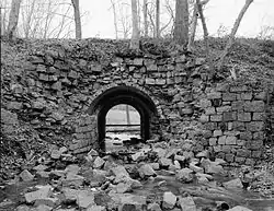 New Castle and Frenchtown Railroad Right-of-Way |
September 1, 1976 (#76002290) |
Off U.S. Route 40 between Frenchtown, Maryland and Porter 39°35′37″N 75°45′54″W |
Porter | Extends into Cecil County, Maryland |
| 145 | New Castle County Court House |  New Castle County Court House |
November 28, 1972 (#72000285) |
211 Delaware St. 39°39′35″N 75°33′49″W |
New Castle | Part of the First State National Historical Park |
| 146 | New Castle Historic District | .jpg.webp) New Castle Historic District |
December 24, 1967 (#67000003) |
Bounded by Harmony St., The Strand, 3rd St., and Delaware St.; also roughly bounded by the Delaware River, Broad Dike, and 4th, 6th, 7th, and Penn Sts. 39°39′39″N 75°33′50″W |
New Castle | Second set of boundaries represents a boundary increase of November 8, 1984 |
| 147 | New Castle Ice Piers |  New Castle Ice Piers |
February 4, 1982 (#82002333) |
Delaware River 39°39′28″N 75°33′39″W |
New Castle | |
| 148 | Newark Opera House | 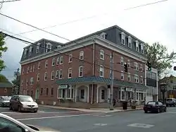 Newark Opera House |
May 7, 1982 (#82002345) |
95 E. Main St. 39°40′59″N 75°44′59″W |
Newark | |
| 149 | Newark Passenger Station | 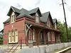 Newark Passenger Station |
May 7, 1982 (#82002346) |
429 S. College Ave. 39°40′13″N 75°45′11″W |
Newark | Newark History Museum |
| 150 | Newark Union Church and Cemetery | 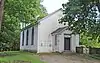 Newark Union Church and Cemetery |
February 6, 2020 (#100004955) |
8 and 20 Newark Union Public Rd. 39°47′10″N 75°30′48″W |
Wilmington vicinity | |
| 151 | Newport National Bank | 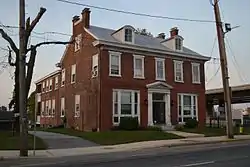 Newport National Bank |
July 14, 1993 (#93000634) |
100 E. Market St. 39°42′49″N 75°36′29″W |
Newport | |
| 152 | Newport Railroad Station | 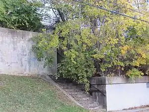 Newport Railroad Station |
January 21, 1994 (#93001515) |
112 S. James St. 39°42′44″N 75°36′32″W |
Newport | Demolished between 1995 and 2002. |
| 153 | North Saint Georges Historic District | 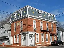 North Saint Georges Historic District |
August 22, 1995 (#95001033) |
Roughly along Main, Broad, Delaware, and Church Sts. in Red Lion Hundred 39°33′24″N 75°39′07″W |
St. Georges | |
| 154 | Old Cann Mansion House | 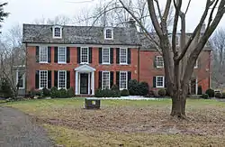 Old Cann Mansion House |
April 8, 1982 (#82002329) |
2290 Red Lion Road 39°34′26″N 75°41′33″W |
Kirkwood | |
| 155 | Old College Historic District | 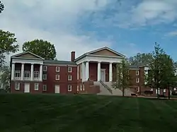 Old College Historic District |
June 4, 1973 (#73000526) |
Main and College Sts. on the University of Delaware campus 39°41′03″N 75°45′10″W |
Newark | University of Delaware |
| 156 | Old First Presbyterian Church | 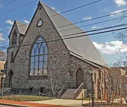 Old First Presbyterian Church |
May 7, 1982 (#82002347) |
17 W. Main St. 39°40′58″N 75°45′17″W |
Newark | University of Delaware |
| 157 | Old Fort Church | 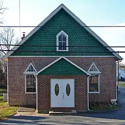 Old Fort Church |
August 19, 1983 (#83001402) |
37 N. Old Baltimore Pike 39°40′04″N 75°39′33″W |
Christiana | |
| 158 | Old Newark Comprehensive School | 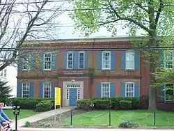 Old Newark Comprehensive School |
May 7, 1982 (#82002348) |
83 E. Main St. 39°41′00″N 75°44′58″W |
Newark | University of Delaware |
| 159 | Old Post Office | 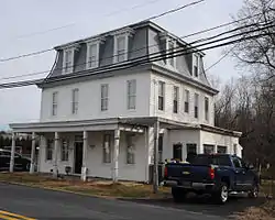 Old Post Office |
April 8, 1982 (#82002330) |
3616 Kirkwood St. Georges Rd. 39°34′16″N 75°41′47″W |
Kirkwood | |
| 160 | Ott's Chapel |  Ott's Chapel |
August 13, 1986 (#86001555) |
1655 Otts Chapel Road 39°38′03″N 75°46′43″W |
Pencader Hundred | |
| 161 | Owl's Nest Country Place |  Owl's Nest Country Place |
August 30, 2010 (#10000597) |
201 Owl's Nest Rd 39°48′55″N 75°37′25″W |
Centreville | |
| 162 | Parker's Dairy Palace |  Parker's Dairy Palace |
October 15, 2019 (#100004513) |
2 Jay Dr. 39°41′11″N 75°35′40″W |
New Castle | |
| 163 | Penn Farm of the Trustees of the New Castle Common |  Penn Farm of the Trustees of the New Castle Common |
September 11, 1997 (#97001120) |
807 Frenchtown Road 39°40′01″N 75°35′33″W |
New Castle | |
| 164 | Thomas Phillips Mill Complex | 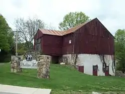 Thomas Phillips Mill Complex |
August 19, 1983 (#83001403) |
708 and 712 Nottingham Rd. 39°41′29″N 75°46′40″W |
Newark | |
| 165 | T. Pierson Farm |  T. Pierson Farm |
November 13, 1986 (#86003101) |
669 Southwood Rd. 39°47′16″N 75°42′56″W |
Hockessin | |
| 166 | Point Farm |  Point Farm |
April 8, 1982 (#82002331) |
2950 Red Lion Road 39°33′18″N 75°42′09″W |
Kirkwood | |
| 167 | Poplar Hall | Poplar Hall |
January 26, 1988 (#87002434) |
3176 Denny Rd. 39°33′22″N 75°46′28″W |
Newark | |
| 168 | Public School No. 111-C |  Public School No. 111-C |
October 18, 1979 (#79000625) |
50 N. Old Baltimore Pike 39°40′07″N 75°39′31″W |
Christiana | |
| 169 | Public School No. 29 |  Public School No. 29 |
May 22, 1978 (#78000894) |
1041 Valley Rd. 39°47′21″N 75°42′02″W |
Hockessin | |
| 170 | Joshua Pyle House and Wagon Barn |  Joshua Pyle House and Wagon Barn |
September 13, 1993 (#93000887) |
2603 Foulk Rd. 39°49′45″N 75°30′01″W |
Brandywine Hundred | |
| 171 | George Read II House |  George Read II House |
December 23, 2016 (#100000872) |
42 The Strand 39°39′35″N 75°33′41″W |
New Castle | |
| 172 | Red Clay Creek Presbyterian Church |  Red Clay Creek Presbyterian Church |
April 11, 1973 (#73000532) |
500 McKennans Church Rd. 39°45′09″N 75°39′33″W |
Newport | |
| 173 | Rhodes Pharmacy |  Rhodes Pharmacy |
February 24, 1983 (#83001404) |
36 E. Main St. 39°41′00″N 75°45′07″W |
Newark | |
| 174 | Robinson House |  Robinson House |
June 21, 1971 (#71000225) |
1 Naamans Road 39°48′37″N 75°26′31″W |
Claymont | State of Delaware |
| 175 | Rockland Historic District | 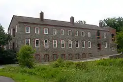 Rockland Historic District |
February 1, 1972 (#72000289) |
Town of Rockland and its environs along Rockland Rd. and Brandywine Creek 39°47′48″N 75°34′28″W |
Rockland | |
| 176 | Rockwood | 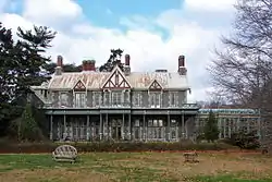 Rockwood |
July 12, 1976 (#76000579) |
610 Shipley Rd. 39°46′21″N 75°31′15″W |
Wilmington | New Castle County park |
| 177 | Rosemont | 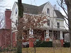 Rosemont |
February 27, 2009 (#09000051) |
15½ Cragmere Rd. 39°46′12″N 75°29′30″W |
Wilmington | |
| 178 | Rotheram Mill House | 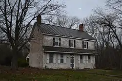 Rotheram Mill House |
January 4, 1972 (#72000287) |
318 Harmony Rd. 39°41′49″N 75°41′40″W |
Newark | |
| 179 | St. Georges Cemetery Caretaker's House | St. Georges Cemetery Caretaker's House |
April 8, 1982 (#82002357) |
4320 Kirkwood St. Georges Rd. 39°33′37″N 75°40′10″W |
St. Georges | |
| 180 | St. Georges Presbyterian Church | 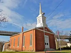 St. Georges Presbyterian Church |
November 7, 1984 (#84000263) |
120–200 N. Main St. 39°33′21″N 75°39′07″W |
St. Georges | St. Georges Historical Society |
| 181 | St. James Episcopal Church, Mill Creek | 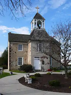 St. James Episcopal Church, Mill Creek |
May 8, 1973 (#73000543) |
2106 St. James Church Rd. 39°43′07″N 75°39′38″W |
Stanton | |
| 182 | St. John the Baptist Roman Catholic Church |  St. John the Baptist Roman Catholic Church |
May 7, 1982 (#82002349) |
200 E. Main St. 39°41′02″N 75°44′43″W |
Newark | |
| 183 | St. Joseph's on the Brandywine | 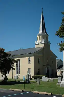 St. Joseph's on the Brandywine |
November 7, 1976 (#76000572) |
10 Barley Mill Rd. 39°46′20″N 75°35′19″W |
Greenville | |
| 184 | St. Thomas Episcopal Church | 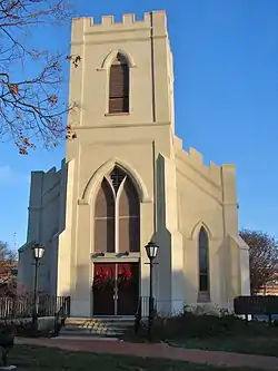 St. Thomas Episcopal Church |
May 7, 1982 (#82002350) |
21 S. Main St. 39°40′56″N 75°45′24″W |
Newark | University of Delaware |
| 185 | Charles Springer Tavern | 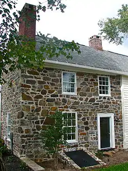 Charles Springer Tavern |
September 11, 1992 (#92001142) |
7 Stone Barn Ln. 39°45′42″N 75°37′13″W |
Christiana Hundred | |
| 186 | Springer Farm | 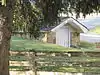 Springer Farm |
November 13, 1986 (#86003103) |
6621 Limestone Rd. 39°47′09″N 75°43′28″W |
Hockessin | |
| 187 | Springer-Cranston House | 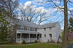 Springer-Cranston House |
September 30, 1994 (#94001177) |
1015 Stanton Rd. in Mill Creek Hundred 39°43′33″N 75°38′18″W |
Marshallton | |
| 188 | Starl House | 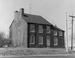 Starl House |
April 8, 1982 (#82002358) |
U.S. Route 13 39°34′44″N 75°39′30″W |
St. Georges | Demolished between 1982 and 1992. |
| 189 | State Theater |  State Theater |
February 24, 1983 (#83001405) |
39 E. Main St. 39°40′59″N 75°45′07″W |
Newark | The State Theater was demolished in 1989.[7] |
| 190 | James Steel House |  James Steel House |
August 19, 1983 (#83001341) |
1016 W. Church St. 39°41′28″N 75°47′09″W |
White Clay Creek Hundred | |
| 191 | James Stewart House |  James Stewart House |
June 11, 1986 (#86001314) |
2611 Del Laws Rd. 39°36′02″N 75°42′56″W |
Glasgow | |
| 192 | James Stewart, Jr., House |  James Stewart, Jr., House |
August 19, 1983 (#83001340) |
563 Walther Rd. 39°38′26″N 75°41′00″W |
Christiana | |
| 193 | J. Stinson Farm |  J. Stinson Farm |
November 13, 1986 (#86003080) |
750 Corner Ketch Rd. 39°44′39″N 75°43′52″W |
Newark | |
| 194 | Stockton-Montmorency |  Stockton-Montmorency |
April 3, 2012 (#12000165) |
1700 Walnut Green Rd. 39°47′30″N 75°37′50″W |
Greenville | |
| 195 | Stonum | .jpg.webp) Stonum |
November 7, 1973 (#73000524) |
900 Washington Ave. 39°39′37″N 75°34′35″W |
New Castle | |
| 196 | Strand Millas and Rock Spring |  Strand Millas and Rock Spring |
July 16, 1973 (#73000520) |
204 & 411 Rockland Rd. 39°47′32″N 75°35′02″W |
Montchanin | |
| 197 | Sutton House |  Sutton House |
April 24, 1973 (#73000542) |
10 Delaware St. 39°33′21″N 75°39′00″W |
St. Georges | |
| 198 | Swanwyck |  Swanwyck |
March 17, 1977 (#77000387) |
65 Landers Lane 39°41′31″N 75°33′50″W |
New Castle | |
| 199 | William Talley House |  William Talley House |
February 21, 1985 (#85000310) |
1813 Foulk Rd. 39°48′35″N 75°30′55″W |
Wilmington | |
| 200 | Joseph Tatnall House |  Joseph Tatnall House |
July 14, 1993 (#93000631) |
205 S. James St. 39°42′39″N 75°36′34″W |
Newport | Now part of a BASF complex |
| 201 | John C. Vansant House |  John C. Vansant House |
February 16, 1989 (#89000007) |
110 Possum Hollow Rd. 39°42′50″N 75°43′37″W |
Newark | Tri-State Bird Rescue |
| 202 | Vernacular Frame House |  Vernacular Frame House |
April 8, 1982 (#82002359) |
105 Clarks Corner Rd. 39°33′24″N 75°38′53″W |
St. Georges | |
| 203 | Village of Arden |  Village of Arden |
February 6, 1973 (#73000550) |
6 miles north of Wilmington between Marsh Rd., Naaman's Creek, and Ardentown 39°48′40″N 75°29′14″W |
Arden | |
| 204 | R. Walker Barn |  R. Walker Barn |
November 13, 1986 (#86003082) |
Rustic Ln. 39°44′16″N 75°41′47″W |
Newark | |
| 205 | Walker's Mill and Walker's Bank |  Walker's Mill and Walker's Bank |
February 1, 1972 (#72000296) |
Walkers Mill Rd. 39°46′14″N 75°34′43″W |
Wilmington | |
| 206 | Walnut Green School |  Walnut Green School |
August 19, 1994 (#94001014) |
Junction of Delaware Route 82 and Owl's Nest Rd. 39°47′37″N 75°37′31″W |
Greenville | |
| 207 | Walnut Lane |  Walnut Lane |
July 22, 1979 (#79000629) |
East of Newark at 4133 Stanton-Ogletown Rd. 39°41′02″N 75°41′03″W |
White Clay Creek Hundred | Demolished between 1979 and 1992. |
| 208 | Lewis Weldin House |  Lewis Weldin House |
July 14, 1993 (#93000632) |
7-9 W. Market St. 39°42′50″N 75°36′36″W |
Newport | Demolished between 2007 and 2009 |
| 209 | Welsh Tract Baptist Church | 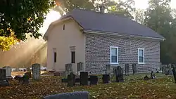 Welsh Tract Baptist Church |
March 1, 1973 (#73000527) |
Welsh Tract Rd. 39°39′01″N 75°45′07″W |
Pencader Hundred | |
| 210 | Wesley M.E. Church |  Wesley M.E. Church |
August 19, 1983 (#83001407) |
839 New London Rd. 39°42′42″N 75°46′44″W |
McClellandville | |
| 211 | White Clay Creek Presbyterian Church | .jpg.webp) White Clay Creek Presbyterian Church |
March 20, 1973 (#73000531) |
1311 Capitol Trail 39°41′56″N 75°42′36″W |
Newark | |
| 212 | White Hall |  White Hall |
July 12, 1990 (#90001072) |
130 Michael Ln. 39°34′24″N 75°43′17″W |
Bear | |
| 213 | Wilmington and Western Railroad | 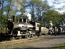 Wilmington and Western Railroad |
September 8, 1980 (#80000932) |
2201 Newport Gap Pike 39°44′19″N 75°37′58″W |
Greenbank | |
| 214 | Wilmington Trust Company Bank | 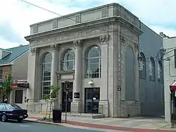 Wilmington Trust Company Bank |
May 7, 1982 (#82002351) |
82 E. Main St. 39°41′01″N 75°45′00″W |
Newark | |
| 215 | Edward R. Wilson House | 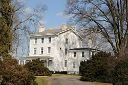 Edward R. Wilson House |
April 25, 1983 (#83001408) |
521 S. College Ave 39°40′08″N 75°45′04″W |
Newark | |
| 216 | Winterthur Museum and Gardens | 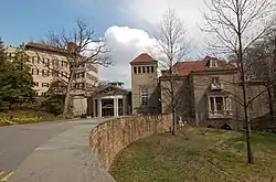 Winterthur Museum and Gardens |
February 24, 1971 (#71000233) |
6 miles northwest of Wilmington on Delaware Route 52 39°48′31″N 75°36′01″W |
Winterthur | |
| 217 | Woman's Club of Newport | 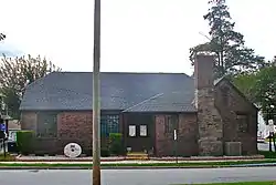 Woman's Club of Newport |
July 14, 1993 (#93000629) |
15 N. Augustine St. 39°42′53″N 75°36′22″W |
Newport | |
| 218 | Wooddale Bridge | 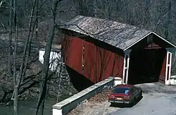 Wooddale Bridge |
April 11, 1973 (#73000552) |
Foxhill Ln. over Red Clay Creek 39°45′57″N 75°38′13″W |
Wooddale | |
| 219 | Wooddale Historic District | 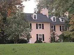 Wooddale Historic District |
August 24, 1979 (#79000630) |
Northwest of Newport on Wooddale Rd 39°46′01″N 75°38′18″W |
Wooddale | |
| 220 | Woodstock | 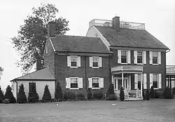 Woodstock |
September 7, 1973 (#73000551) |
102 Middleboro Rd. 39°43′19″N 75°35′24″W |
Wilmington | New Castle County park |
| 221 | Wright House | 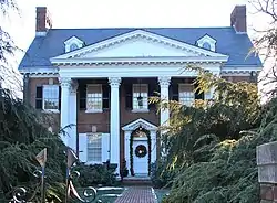 Wright House |
May 7, 1982 (#82002352) |
47 Kent Way 39°40′44″N 75°45′21″W |
Newark | University of Delaware president's house |
| 222 | William Young House |  William Young House |
October 29, 1982 (#82001029) |
507 Black Gates Road 39°47′40″N 75°33′54″W |
Rockland |
See also
| Wikimedia Commons has media related to National Register of Historic Places in New Castle County, Delaware. |
References
- The latitude and longitude information provided in this table was derived originally from the National Register Information System, which has been found to be fairly accurate for about 99% of listings. Some locations in this table may have been corrected to current GPS standards.
- "National Register of Historic Places: Weekly List Actions". National Park Service, United States Department of the Interior. Retrieved on January 29, 2021.
- Numbers represent an alphabetical ordering by significant words. Various colorings, defined here, differentiate National Historic Landmarks and historic districts from other NRHP buildings, structures, sites or objects.
- The eight-digit number below each date is the number assigned to each location in the National Register Information System database, which can be viewed by clicking the number.
- Custer, Jay F., et al. "News and Short Contributions", Journal of Field Archaeology 14.2 (1987): 229-254: 230.
- Terri Sanginiti, Robin Brown. Two Hockessin teens charged in farmhouse arson. The (Wilmington, DE) News Journal. 2010-09-22. URL:http://www.delawareonline.com/article/20100904/NEWS01/9040336/Two-Hockessin-teens-charged-in-farmhouse-arson. Accessed: 2010-09-22. (Archived by WebCite at https://www.webcitation.org/5swlwjOT2)
- "Newark timeline". The News Journal. delawareonline.com. Retrieved 2010-12-01.
| Topics |  | |
|---|---|---|
| Lists by county | ||
| Lists by city | ||
| Other lists | ||
| ||
Dover (capital) | ||
| Topics |
|  |
| Society |
| |
| Cities | ||
| Towns |
| |
| Counties | ||