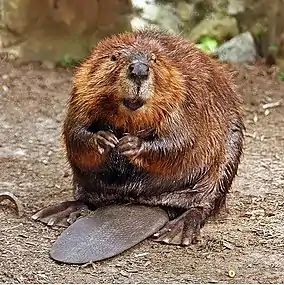
National Wildlife Area
A National Wildlife Area is a conservation status for a geographical region in Canada that restricts most human activities on that region.[1] However, land use permits may be issued "for activities that are compatible with conservation".[1] Such areas are established and managed by the Canadian Wildlife Service, a division of Environment and Climate Change Canada. They may consist of land and water features, as well as coastal areas extending up to 12 nautical miles (22 km) from shore.
| Part of a series on |
| Wildlife of Canada |
|---|
 |
The largest national wildlife area is the Scott Islands Marine National Wildlife Area in British Columbia, which covers an area of 11,570.65 km2 (4,467.45 sq mi).[2]
Protections
Each National Wildlife Area involves a management plan which specifies activities which are generally allowed within the protected area, as well as activities requiring permits.[3] Under the Wildlife Area Regulations, traditional, personal and recreational activities such as hunting, fishing or canoeing are allowed, whereas resource extraction or livestock grazing would be permitted only under the authority of a yearly permit with strict limits.[3] Some National Wildlife Area in the territories, such as Polar Bear Pass, require co-management between federal government agencies and the Inuit, per the Nunavut Land Claims Agreement.[4]
References
- "National Wildlife Areas". The Atlas of Canada. Natural Resources Canada. Archived from the original on 2007-12-14. Retrieved 2008-01-27.
- "Scott Islands Marine National Widllife Area". Protected Planet. Retrieved 2020-09-25.
- "Environment Canada's Protected Areas Network". Canadian Wildlife Service and Canadian Wildlife Federation. Archived from the original on 2008-02-13. Retrieved 2008-01-27.
- "Polar Bear Pass National Wildlife Area, Nunavut - Ramsar Site". Environment Canada. Archived from the original on 2008-05-04. Retrieved 2008-01-27.