Nebine, Queensland
Nebine is a rural locality in the Shire of Paroo, Queensland, Australia.[2] In the 2016 census Nebine had a population of 19 people.[1]
| Nebine Queensland | |||||||||||||||
|---|---|---|---|---|---|---|---|---|---|---|---|---|---|---|---|
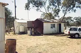 Nebine Library, 1990 | |||||||||||||||
 Nebine | |||||||||||||||
| Coordinates | 28.0645°S 146.8142°E | ||||||||||||||
| Population | 19 (2016 census)[1] | ||||||||||||||
| • Density | 0.00416/km2 (0.01077/sq mi) | ||||||||||||||
| Postcode(s) | 4488 | ||||||||||||||
| Area | 4,571.1 km2 (1,764.9 sq mi) | ||||||||||||||
| Time zone | AEST (UTC+10:00) | ||||||||||||||
| LGA(s) | Shire of Paroo | ||||||||||||||
| State electorate(s) | Warrego | ||||||||||||||
| Federal Division(s) | Maranoa | ||||||||||||||
| |||||||||||||||
Geography
The Balonne Highway passes from east to west through the centre of the locality with a junction to the Balonne Charleville Road which exits the locality in the north.[3]
The locality is flat (about 190 metres above sea level). Nebine Creek flows from north to south through the locality.[3]
History
The locality was officially named and bounded by the Minister for Natural Resources and Minister for Mines 20 July 2001.[2]
In the 2016 census Nebine had a population of 19 people.[1]
References
- Australian Bureau of Statistics (27 June 2017). "Nebine (SSC)". 2016 Census QuickStats. Retrieved 20 October 2018.

- "Nebine – locality in Shire of Paroo (entry 42659)". Queensland Place Names. Queensland Government. Retrieved 28 December 2020.
- "Queensland Globe". State of Queensland. Retrieved 30 July 2017.
This article is issued from Wikipedia. The text is licensed under Creative Commons - Attribution - Sharealike. Additional terms may apply for the media files.