Negash
Negash is a village in the Tigray Region (or kilil) of Ethiopia, which straddles the Adigrat-Mekele road (Ethiopian Highway 2) 10 kilometres (6.2 miles) north of Wukro. Located in Wukro woreda.
Negash | |
|---|---|
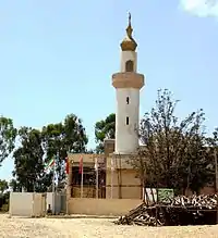 Amedin Mosque | |
 Flag | |
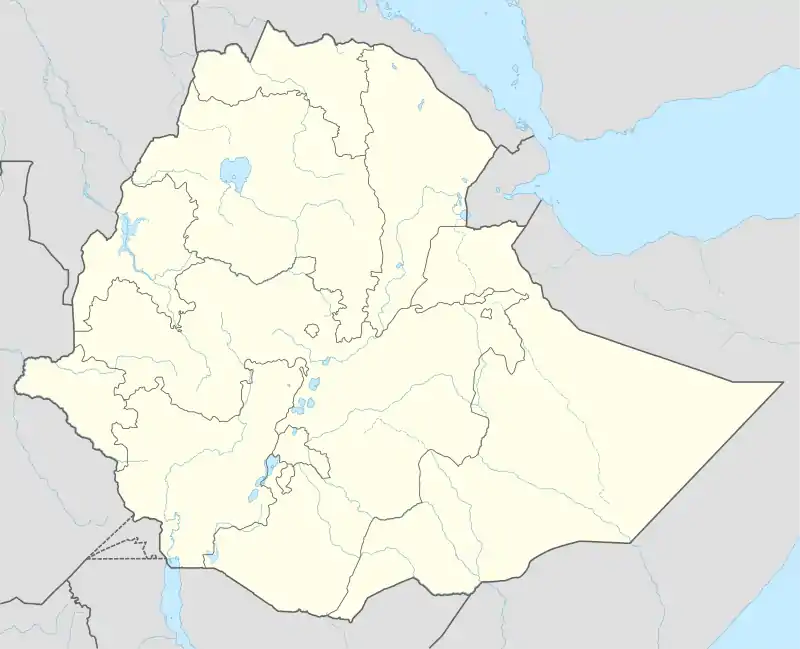 Negash Location in Ethiopia | |
| Coordinates: 13°52′53″N 39°35′56″E | |
| Country | Ethiopia |
| Region | Tigray |
| Zone | Misraqawi (Eastern) |
| Population (2007) | |
| • Total | 7,753 |
| Time zone | UTC+3 (EAT) |
Geology and soils
The following geological formations are present in this locality:[1]
- Enticho Sandstone
- Precambrian metamorphic rocks
The main geomorphic units, with corresponding soil types are:[2]
- West of Negash: Suluh plains with metavolcanic rocks
- Associated soil types
- Inclusions
- Negash geosyncline (east and especially northeast of the town)
History
Negash is considered to be the earliest Muslim settlement in Africa; a cemetery from the 7th century CE has been excavated inside the village boundaries.[3] The Futuh al-Habasha records Ahmad ibn Ibrahim al-Ghazi visited the tomb of Ashama ibn Abjar in Negash during his invasion of the province of Tigray (around 1537).[4] Negash is also known for having one of Africa's oldest mosques,[5] that is the Negash Amedin Mesgid.
21st Century
During the 2020-2021 Tigray War, attacks were carried out on Negash by the joint Ethiopian and Eritrean armies. According to an EEPA report, pictures have emerged showing the Al Negash Mosque being heavily damaged. It was reportedly bombed and looted by Ethiopian and Eritrean forces.[6]
Demographics
In the statistical tables of the 2007 census published by the Central Statistical Agency, the kebele Negash is located in is reported to have a total population of 7,753 of whom 3,607 are men and 4,146 women; they are distributed amongst 1,689 households in 1,626 housing units. Although it is known for its particular relationship with Islam, 98.2% of the population follows the Ethiopian Orthodox Tewahedo Church, the 1.1% of the population is Protestant, and the remaining 0.7% is Muslim.[7]
Gallery
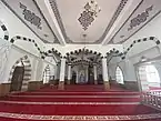 Interior of the new Amedin Mosque, completed in 2019.
References
- Sembroni, A.; Molin, P.; Dramis, F. (2019). Regional geology of the Dogu'a Tembien massif. In: Geo-trekking in Ethiopia's Tropical Mountains — The Dogu'a Tembien District. SpringerNature. ISBN 978-3-030-04954-6.
- Nyssen, Jan; Tielens, Sander; Gebreyohannes, Tesfamichael; Araya, Tigist; Teka, Kassa; Van De Wauw, Johan; Degeyndt, Karen; Descheemaeker, Katrien; Amare, Kassa; Haile, Mitiku; Zenebe, Amanuel; Munro, Neil; Walraevens, Kristine; Kindeya Gebrehiwot; Poesen, Jean; Frankl, Amaury; Tsegay, Alemtsehay; Deckers, Jozef (2019). "Understanding spatial patterns of soils for sustainable agriculture in northern Ethiopia's tropical mountains". PLOS One. 14 (10): e0224041. doi:10.1371/journal.pone.0224041. PMC 6804989. PMID 31639144.
- Paul B. Henze, Layers of Time: A History of Ethiopia (New York: Palgrave, 2000), p. 43.
- Sihab ad-Din Ahmad bin 'Abd al-Qader, Futuh al-Habasa: The conquest of Ethiopia, translated by Paul Lester Stenhouse with annotations by Richard Pankhurst (Hollywood: Tsehai, 2003), pp. 350f
- "Liste des premières mosquées au monde prophètique, rashidun et omeyyade selon les écris historique et les traces archéologiques". Histoire Islamique (in French). 2014-06-15. Retrieved 2017-09-24.
- "Situation Report EEPA Horn No. 44 - 3 January 2021" (PDF). Europe External Programme with Africa. Retrieved 3 January 2021.
- "Tigray Statistical Table", Annex Table 1B CSA website (accessed 27 August 2010)