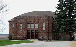
New Providence, Iowa
New Providence is a small city in Hardin County, Iowa, United States. The population was 228 at the 2010 census.
New Providence, Iowa | |
|---|---|
 | |
 Location of New Providence, Iowa | |
| Coordinates: 42°16′55″N 93°10′15″W | |
| Country | |
| State | |
| County | Hardin |
| Area | |
| • Total | 1.00 sq mi (2.59 km2) |
| • Land | 1.00 sq mi (2.59 km2) |
| • Water | 0.00 sq mi (0.00 km2) |
| Elevation | 1,129 ft (344 m) |
| Population | |
| • Total | 228 |
| • Estimate (2019)[3] | 223 |
| • Density | 223.22/sq mi (86.16/km2) |
| Time zone | UTC-6 (Central (CST)) |
| • Summer (DST) | UTC-5 (CDT) |
| ZIP code | 50206 |
| Area code(s) | 641 |
| FIPS code | 19-56415 |
| GNIS feature ID | 0459484 |
History
New Providence was laid out in 1855.[4]
New Providence was struck by a tornado in 1860 and much of its business district burned in a fire in 1910.[5]
Geography
New Providence is located at 42°16′55″N 93°10′15″W (42.281891, -93.170875).[6]
According to the United States Census Bureau, the city has a total area of 1.01 square miles (2.62 km2), all land.[7]
Demographics
| Year | Pop. | ±% |
|---|---|---|
| 1880 | 146 | — |
| 1900 | 268 | +83.6% |
| 1910 | 246 | −8.2% |
| 1920 | 255 | +3.7% |
| 1930 | 262 | +2.7% |
| 1940 | 236 | −9.9% |
| 1950 | 212 | −10.2% |
| 1960 | 206 | −2.8% |
| 1970 | 208 | +1.0% |
| 1980 | 249 | +19.7% |
| 1990 | 240 | −3.6% |
| 2000 | 227 | −5.4% |
| 2010 | 228 | +0.4% |
| 2019 | 223 | −2.2% |
| Source:"U.S. Census website". United States Census Bureau. Retrieved 2020-03-29. and Iowa Data Center Source: | ||
2010 census
As of the census[2] of 2010, there were 228 people, 91 households, and 60 families living in the city. The population density was 225.7 inhabitants per square mile (87.1/km2). There were 106 housing units at an average density of 105.0 per square mile (40.5/km2). The racial makeup of the city was 96.1% White, 0.9% African American, 0.9% Native American, 0.4% from other races, and 1.8% from two or more races. Hispanic or Latino of any race were 1.8% of the population.
There were 91 households, of which 30.8% had children under the age of 18 living with them, 53.8% were married couples living together, 6.6% had a female householder with no husband present, 5.5% had a male householder with no wife present, and 34.1% were non-families. 27.5% of all households were made up of individuals, and 9.9% had someone living alone who was 65 years of age or older. The average household size was 2.51 and the average family size was 3.02.
The median age in the city was 38.7 years. 28.1% of residents were under the age of 18; 6.6% were between the ages of 18 and 24; 23.2% were from 25 to 44; 29.5% were from 45 to 64; and 12.7% were 65 years of age or older. The gender makeup of the city was 51.3% male and 48.7% female.
2000 census
As of the census[9] of 2000, there were 227 people, 97 households, and 65 families living in the small city. The population density was 226.3 people per square mile (87.6/km2). There were 107 housing units at an average density of 106.7 per square mile (41.3/km2). The racial makeup of the city was 97.36% White, 2.64% from other races. Hispanic or Latino of any race were 2.64% of the population.
There were 97 households, out of which 27.8% had children under the age of 18 living with them, 58.8% were married couples living together, 9.3% had a female householder with no husband present, and 32.0% were non-families. 28.9% of all households were made up of individuals, and 11.3% had someone living alone who was 65 years of age or older. The average household size was 2.34 and the average family size was 2.91.
In the city, the population was spread out, with 25.6% under the age of 18, 9.7×% from 18 to 24, 23.3% from 25 to 44, 24.7% from 45 to 64, and 16.7% who were 65 years of age or older. The median age was 38 years. For every 100 females, there were 106.4 males. For every 100 females age 18 and over, there were 96.5 males.
The median income for a household in the city was $39,583, and the median income for a family was $47,708. Males had a median income of $27,000 versus $20,625 for females. The per capita income for the city was $18,514. About 7.7% of families and 6.8% of the population were below the poverty line, including 4.7% of those under the age of eighteen and none of those 65 or over.
Education
New Providence lies within the Eldora–New Providence Community School District,[10] which formed on July 1, 1980, with the merger of the Eldora and New Providence school districts.[11] As of 2019, it has a grade-sharing arrangement with Hubbard–Radcliffe Community School District and operates as "South Hardin Schools".
Water tower disaster
In July 2000, a water tower under construction in New Providence collapsed due to a falling tower crane. One worker was killed and two others injured.[12] The accident is featured on the Discovery Channel series Destroyed in Seconds.
See also
References
- "2019 U.S. Gazetteer Files". United States Census Bureau. Retrieved July 17, 2020.
- "U.S. Census website". United States Census Bureau. Retrieved 2012-05-11.
- "Population and Housing Unit Estimates". United States Census Bureau. May 24, 2020. Retrieved May 27, 2020.
- History of Hardin County, Iowa. Union Publishing Company. 1883. pp. 870.
- Moir, William J. (1911). Past and Present of Hardin County, Iowa. Unigraphic. pp. 307.
- "US Gazetteer files: 2010, 2000, and 1990". United States Census Bureau. 2011-02-12. Retrieved 2011-04-23.
- "US Gazetteer files 2010". United States Census Bureau. Archived from the original on 2012-01-25. Retrieved 2012-05-11.
- "Census of Population and Housing". Census.gov. Retrieved June 4, 2015.
- "U.S. Census website". United States Census Bureau. Retrieved 2008-01-31.
- "Eldora-New Providence" (PDF). Iowa Department of Education. Retrieved 2019-08-02.
- "REORGANIZATION & DISSOLUTION ACTIONS SINCE 1965-66." Iowa Department of Education. Retrieved on July 20, 2018.
- http://www.allbusiness.com/labor-employment/workplace-health-safety/11430944-1.html Archived March 11, 2012, at the Wayback Machine
Municipalities and communities of Hardin County, Iowa, United States | ||
|---|---|---|
| Cities | Map of Iowa highlighting Hardin County | |
| Townships | ||
| CDP | ||
| Other unincorporated communities | ||
| Ghost towns | ||
| Footnotes | ‡This populated place also has portions in an adjacent county or counties | |
| ||