Newberry, Michigan
Newberry is a village and county seat of Luce County in the U.S. state of Michigan.[7] The village is located within McMillan Township and is the only incorporated community in Luce County. The population was 1,519 at the 2010 census.
Newberry, Michigan | |
|---|---|
| Village of Newberry | |
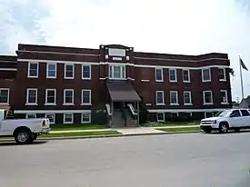 McMillan Township Hall | |
| Nickname(s): The Moose Capital of Michigan | |
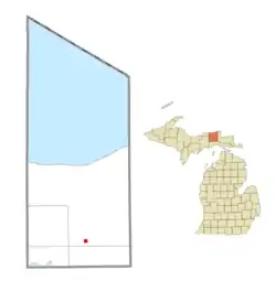 Location within Luce County | |
 Newberry Location within the state of Michigan | |
| Coordinates: 46°21′08″N 85°30′38″W | |
| Country | United States |
| State | Michigan |
| County | Luce |
| Township | McMillan |
| Founded | 1882 |
| Government | |
| • Type | Village council |
| • President | Lori Strokes |
| • Clerk | Terese Schummer |
| Area | |
| • Total | 0.98 sq mi (2.54 km2) |
| • Land | 0.98 sq mi (2.54 km2) |
| • Water | 0.00 sq mi (0.00 km2) |
| Elevation | 771 ft (235 m) |
| Population | |
| • Total | 1,519 |
| • Estimate (2019)[4] | 1,397 |
| • Density | 1,424.06/sq mi (549.55/km2) |
| Time zone | UTC−5 (Eastern (EST)) |
| • Summer (DST) | UTC−4 (EDT) |
| ZIP code(s) | 49868 |
| Area code(s) | 906 |
| FIPS code | 26-57140[5] |
| GNIS feature ID | 0633350[6] |
| Website | Official website |
The village was named in honor of John Stoughton Newberry, a U.S. Representative and industrialist from the state of Michigan.
Newberry is surrounded by miles of state and national forests and is considered one of two gateways to the Tahquamenon Falls area—the other being Paradise approximately 40 miles (64 km) northeast. Newberry was designated as the moose capital of Michigan by the state legislature, in House Resolution 2002-572 and Senate Resolution 2002-259. It is home to the Newberry Correctional Facility, operating since 1996, and Helen Newberry Joy Hospital.
In August 2007, the Sleeper Lakes Fire burned for several weeks north of Newberry, and firefighting efforts were coordinated from this village. The same was true during the Duck Lake Fire in 2012.
History
Newberry was founded in 1882 and became the county seat when Luce County was separated from Chippewa County in 1887. Its first courthouse was completed in 1890.[8]
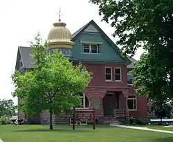
Historic preservationists lost the 1970s fight to save the county's Victorian courthouse, but managed to keep the elaborate sheriff's house, now the Luce County Historical Museum.
Geography
According to the United States Census Bureau, the village has a total area of 0.98 square miles (2.54 km2), all of it land.[9]
Transportation
Major highways
 M-28 travels west to Marquette and east to Sault Ste. Marie.
 M-123 runs northerly and northeasterly from Newberry to Tahquamenon Falls State Park and Paradise.
- Indian Trails provides daily intercity bus service between St. Ignace and Ironwood, Michigan.[10]
Rail
- Canadian National Railway provides freight rail service in the Newberry area.
Airport
Luce County Airport (KERY), provides service for Newberry and surrounding communities.
Demographics
| Historical population | |||
|---|---|---|---|
| Census | Pop. | %± | |
| 1890 | 1,115 | — | |
| 1900 | 1,015 | −9.0% | |
| 1910 | 1,182 | 16.5% | |
| 1920 | 2,172 | 83.8% | |
| 1930 | 2,465 | 13.5% | |
| 1940 | 2,732 | 10.8% | |
| 1950 | 2,802 | 2.6% | |
| 1960 | 2,612 | −6.8% | |
| 1970 | 2,334 | −10.6% | |
| 1980 | 2,120 | −9.2% | |
| 1990 | 1,873 | −11.7% | |
| 2000 | 1,686 | −10.0% | |
| 2010 | 1,519 | −9.9% | |
| 2019 (est.) | 1,397 | [4] | −8.0% |
| U.S. Decennial Census[11] | |||
2010 census
As of the census[3] of 2010, there were 1,519 people, 652 households, and 380 families residing in the village. The population density was 1,550.0 inhabitants per square mile (598.5/km2). There were 796 housing units at an average density of 812.2 per square mile (313.6/km2). The racial makeup of the village was 89.3% White, 0.4% African American, 6.3% Native American, 0.3% Asian, 0.1% Pacific Islander, and 3.6% from two or more races. Hispanic or Latino of any race were 2.8% of the population.
There were 652 households, of which 30.1% had children under the age of 18 living with them, 39.1% were married couples living together, 14.3% had a female householder with no husband present, 4.9% had a male householder with no wife present, and 41.7% were non-families. 37.6% of all households were made up of individuals, and 15.7% had someone living alone who was 65 years of age or older. The average household size was 2.26 and the average family size was 2.93.
The median age in the village was 41.1 years. 25.9% of residents were under the age of 18; 5.8% were between the ages of 18 and 24; 23.3% were from 25 to 44; 25.1% were from 45 to 64; and 19.8% were 65 years of age or older. The gender makeup of the village was 47.9% male and 52.1% female.
2000 census
As of the census[5] of 2000, there were 1,686 people, 717 households, and 456 families residing in the village. The population density was 2,737.1 per square mile (1,058.2/km2). There were 824 housing units at an average density of 839.7 per square mile (324.6/km2). The racial makeup of the village was 69.92% White, 19.29% African American, 4.95% Native American, 0.67% Asian, 0.04% Pacific Islander, 1.01% from other races, and 4.13% from two or more races. Hispanic or Latino of any race were 3.69% of the population.
There were 717 households, of which 32.6% had children under the age of 18 living with them, 46.7% were married couples living together, 12.4% had a female householder with no husband present, and 36.4% were non-families. 32.5% of all households were made up of individuals, and 18.0% had someone living alone who was 65 years of age or older. The average household size was 2.36 and the average family size was 2.95.
In the village, the population was spread out, with 18.2% under the age of 18, 12.5% from 18 to 24, 39.4% from 25 to 44, 16.4% from 45 to 64, and 13.6% who were 65 years of age or older. The median age was 34 years. For every 100 females, there were 181.0 males. For every 100 females age 18 and over, there were 215.7 males.
The median income for a household in the village was $29,052, and the median income for a family was $36,607. Males had a median income of $29,286 versus $20,956 for females. The per capita income for the village was $17,224. About 15.6% of families and 18.1% of the population were below the poverty line, including 27.5% of those under age 18 and 8.4% of those age 65 or over.
Education
Newberry is home to Newberry High School, which is a part of the Tahquamenon Area school district. Newberry High School, as of the 2017-2018 school year, has a total enrollment of 205 students. The mascot of Newberry High School is the Indians and school colors include orange and black.
Newberry High School features a variety of varsity athletic teams. Fall sports include cross country, football, and volleyball while winter and spring sports include wrestling, boys/girls basketball, track and field, baseball, and softball. School rivals include St. Ignace Lasalle High School, Munising High School, Engadine High School, and Sault Ste. Marie High School.
The Newberry High School football team formerly competed each year for the Little Brown Jug of the Upper Peninsula of Michigan, a rivalry game with Sault Ste. Marie dating back to 1913. Current football "trophy games" include the Battle for the Ax which is played against the aforementioned Munising High School.
Climate
According to the Köppen Climate Classification system, Newberry has a humid continental climate, abbreviated "Dfb" on climate maps. A humid continental climate (Köppen prefix D and a third letter of a or b) is a climatic region defined by large seasonal temperature differences, with warm to hot (and often humid) summers and cold (sometimes severely cold in the northern areas) winters. Precipitation is usually distributed throughout the year. The definition of this climate regarding temperature is as follows: the mean temperature of the coldest month must be below −3 °C (26.6 °F) and there must be at least four months whose mean temperatures are at or above 10 °C (50 °F). In addition, the location in question must not be semi-arid or arid. The Dfb, Dwb and Dsb subtypes are also known as hemiboreal.[12]
Sleeper Lakes Fire
The Sleeper Lake Fire was a wildfire that occurred north of the Village of Newberry in Luce County, Michigan. The fire most likely started with a lightning strike on August 2, 2007 near Sleeper Lake. The fire began in the vicinity of Sleeper Lake and burned towards the southeast over largely uninhabited marsh and bogs. By August 5, 2007, southeasterly winds began to push the fire towards the north, threatening structures and forcing nearby residents to evacuate.[1] By that point, the fire had burned an estimated 12,000 acres (49 km2).[1] By August 13, the burned area had increased to 18,500 acres (75 km2).[2] Several agencies cooperated in fighting the fire and providing emergency services, including the Michigan DNR, the Minnesota DNR, the Wisconsin DNR, the Bureau of Indian Affairs, the US Fish and Wildlife Service, the US Forest Service, the Ontario Ministry of Natural Resources, the Michigan National Guard, Air Guard, the Michigan State Police, Luce County Sheriff's Department, the National Weather Service, the Nature Conservancy, area volunteer fire departments, the Salvation Army, and the American Red Cross.[3] 239 persons were involved, manning bulldozers, five helicopters and a water bomber.[1][4]
Duck Lake Fire
The Duck Lake Fire occurred north of the Village of Newberry in Luce County, Michigan in the eastern half of the Upper Peninsula of Michigan. The fire started with a lightning strike on Wednesday, May 23, 2012 near Duck Lake. The Duck Lake Fire was reported 100% contained by the Michigan DNR on 15 June 2012 with 21,135 acres burned. The Duck Lake Fire was reported as the third worst fire in Michigan since 1881. It was the second major fire in Luce County within five years. On May 25, 2012, Governor Rick Snyder declared a state of disaster in Luce and Schoolcraft counties, which included a ban of fireworks and an outdoor burning ban in 49 counties, including all counties located in the Upper Peninsula and much of the northern half of the Lower Peninsula as a result of abnormally dry conditions. The fire caused the closure of Tahquamenon Falls State Park during the Memorial Day weekend. The fire began in the vicinity of Duck Lake, near Falls Road and M-123 and burned towards the north over largely uninhabited jack pine forest. By 10:00 p.m. on May 24, 2012, the fire had burned over 9,500 acres (3,800 ha).[3] By 4:00 p.m. the next day, the fire had burned nearly 18,000 acres (7,300 ha).[3] At that point, the fire affected an area slightly smaller than that of the Sleeper Lakes fire. By May 31, 2012 the most recent GPS size estimate showed the fire had burned 21,964 acres (8,889 ha). Hundreds of properties had been affected and 132 structures (including 46 homes) were lost.[4] Fire crews made progress with 51% percent containment. Several showers and thunderstorms helped during the afternoon and evening. The total cost to date for the wildfire is $450,557.[5] By June 4, the fire was reported as 72 percent contained with no smoke plume and no significant activity since May 28. Damage assessments found 136 structures lost: 49 homes/cabins (including a store and a motel), 23 garages, 38 sheds or outbuildings and 26 campers on 21,135 burnt acres.[6] By June 15, 2012, the fire was 100% contained after almost 43 miles of fire line were built. 300 people were involved in the fire response.[7]
Media
.jpg.webp)
In addition to radio stations broadcasting directly from Newberry, radio stations from the Sault Ste. Marie market can also be heard in the community.
Notable people
- Terry O'Quinn, who plays John Locke on Lost, is from Newberry.
- Rob Rubick, former Detroit Lion and analyst for Fox Sports Detroit, is from Newberry.
- Len St. Jean, a former Boston Patriot, is from Newberry.
References
- Village of Newberry (2020). "Newberry Contact Information". Retrieved April 15, 2020.
- "2019 U.S. Gazetteer Files". United States Census Bureau. Retrieved July 25, 2020.
- "U.S. Census website". United States Census Bureau. Retrieved 2012-11-25.
- "Population and Housing Unit Estimates". United States Census Bureau. May 24, 2020. Retrieved May 27, 2020.
- "U.S. Census website". United States Census Bureau. Retrieved 2008-01-31.
- U.S. Geological Survey Geographic Names Information System: Newberry, Michigan
- "Find a County". National Association of Counties. Retrieved 2011-06-07.
- Fedynksy, John (2010). Michigan's County Courthouses, p. 107. The University of Michigan Press.
- "US Gazetteer files 2010". United States Census Bureau. Archived from the original on 2012-01-25. Retrieved 2012-11-25.
- "ST. IGNACE-SAULT STE. MARIE-IRONWOOD" (PDF). Indian Trails. January 15, 2013. Archived from the original (PDF) on July 4, 2014. Retrieved 2013-02-28.
- "Census of Population and Housing". Census.gov. Retrieved June 4, 2015.
- "Newberry, Michigan Köppen Climate Classification (Weatherbase)". Weatherbase.
External links
| Wikivoyage has a travel guide for Newberry. |
- Newberry Area Chamber of Commerce
- Newberry Area Tourism Association
- House Journal containing HR 572 designating Newberry as Moose Capital of Michigan
- Senate Journal containing SR 259 designating Newberry as Moose Capital of Michigan
- Newberry Correctional Facility
- Newberry Michigan Homepage For Locals - broken link (not found on server)
Municipalities and communities of Luce County, Michigan, United States | ||
|---|---|---|
| Village | 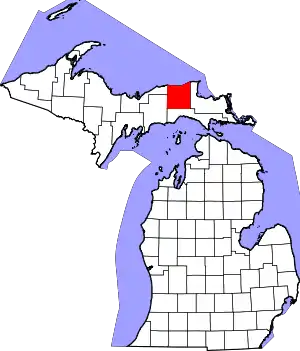 Map of Michigan highlighting Luce County.svg | |
| Civil townships | ||
| Unincorporated communities | ||
| Indian reservation | ||
| Footnotes | ‡This populated place also has portions in an adjacent county or counties | |
| ||
| Authority control |
|---|