Newton Valence
Newton Valence is a village and civil parish in the East Hampshire district of Hampshire, England. It is 4.4 miles (7.1 km) south of Alton, just off the A32 road.
| Newton Valence | |
|---|---|
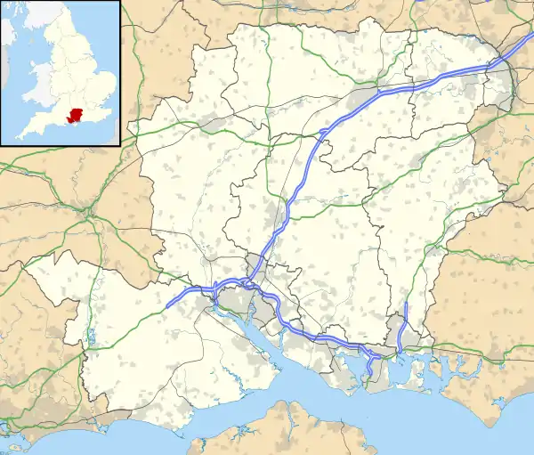 Newton Valence Location within Hampshire | |
| Population | 226 (2011 Census)[1] |
| OS grid reference | SU723326 |
| Civil parish |
|
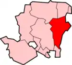
| District | |
| Shire county | |
| Region | |
| Country | England |
| Sovereign state | United Kingdom |
| Post town | Alton |
| Postcode district | GU34 |
| Police | Hampshire |
| Fire | Hampshire |
| Ambulance | South Central |
| UK Parliament | |
The nearest railway station is Liss, 4.5 miles (7.3 km) southeast of the village, although the station at Alton is a similar distance to the north.
The village sits high in the westernmost chalk hills of the South Downs: maximum elevation 191 metres (627 feet) above sea level. Much of the surrounding landscape is within the East Hampshire Area of Outstanding Natural Beauty.
Farming is the most obvious economic activity. Arable farming (mainly wheat, maize and oil-seed rape) and sheep-grazing predominate.
The church and grounds
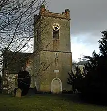
The Anglican church of St Mary's was restored in 1871 and is faced in flint. The nave and chancel are early English, about 1300; the west tower is also early English, but has an embattled top, made of brick and dated to 1812.[2] There are five bells in the tower, the largest weighing nine hundredweight (approximately 458 kilogrammes). The tower's black-faced clock was restored as a Millennium Project. There are two piscinas and a large Norman font.
Charles Wilson, 1st Baron Moran, Sir Winston Churchill's personal physician, is buried in the churchyard.
The yew tree next to the church is one of the most venerable in the district now that the famous yew at Selborne Church has died. Its age has been estimated at about 1,000 years.[3]
Adjoining the churchyard is the Manor House (17th–18th Century), now divided into two dwellings. The older portion has two storeys of coursed stone blocks with brick dressings, plinth and band, and a long ridge slate roof. There is a red brick Georgian portion, with parapet and hipped tile roof. The Victorian wing, of yellow brick, is of two storeys with a low pitched slate roof and sash windows.
Opposite the driveway to the church is a dew pond which was repuddled in the 1990s. Nearby, on a triangle of grass between Newton Lane and the track to Selborne Common, is a small sarsen stone.
Amenities
The village has a Sports and Social Centre (half of the Victorian school; the other half has been converted to a dwelling), but no shops or public house.
Prehistoric settlement
Known traces of prehistoric settlement are:
- A Bronze Age bowl barrow: 36 metres in diameter and 1.8 metres high (north-east of Lodge Farm; damaged by ploughing)
- An Iron Age field system: at the southern edge of Goldridge Plantation, comprising a series of three contour lynchets extending for nearly 1.6 km.[4]
Famous residents
- Thomas D'Oyly Snow, British Army officer
Other information
The village features in Gilbert White's Natural History of Selborne.[5] White's brother, John, used to live in Newton Valence. Gilbert would cross Selborne Common to visit him: a walk of about two miles, made easier in 1753 when they finished construction of the Zig-Zag path which, ascending from Selborne to the Common, is still in use today.
Within the parish boundary is Noar Hill, part of which is given over to a nature reserve noted for its flowers and butterflies.
References
- "Civil Parish population 2011". Neighbourhood Statistics. Office for National Statistics. Retrieved 30 December 2016.
- Quotation from Pevsner's Buildings of England
- Mr T. P. Denehy, Tree Warden, personal comment on the age of the churchyard yew
- "Treasures of Hampshire". Archived from the original on 19 February 2005. Retrieved 29 December 2005.
- The Natural History of Selborne by Gilbert White
External links
| Wikimedia Commons has media related to Newton Valence. |