Ngorongoro District
Ngorongoro District is one of the five districts of the Arusha Region of Tanzania. It is bordered to the north by Kenya, to the east by Monduli District, to the south by the Karatu District and to the west by the Mara Region.
Ngorongoro District
Wilaya ya Ngorongoro (Swahili) | |
|---|---|
 Trunk road heading towards Ngorongoro. | |
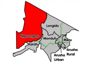 Ngorongoro District's location within Arusha region. | |
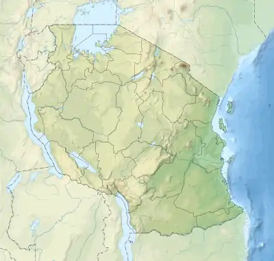 Ngorongoro District Location of Ngorongoro District 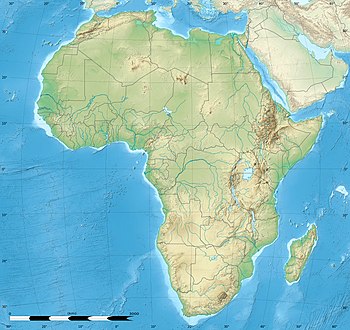 Ngorongoro District Ngorongoro District (Africa) | |
| Coordinates: 2°45′S 35°30′E | |
| Country | Tanzania |
| Zone | Northern |
| Region | Arusha |
| Area | |
| • Total | 14,036 km2 (5,419 sq mi) |
| • Land | 13,460 km2 (5,200 sq mi) |
| • Water | 576 km2 (222 sq mi) |
| Population (2012) | |
| • Total | 174,278 |
| • Density | 12/km2 (32/sq mi) |
| Time zone | UTC+3 (EAT) |
| Postcode | 237xx |
| Area code(s) | 027 |
| Website | www |
According to the 2002 Tanzania National Census, the population of the Ngorongoro Region was 129,776. [1] By 2012, the population of the district was 174,278.[2]
Within the district are the Ngorongoro Crater and active volcano Ol Doinyo Lengai. The district plays host to parts of the wildebeest migration. While not part of the park, as such, much of the district is within the same Serengeti-Mara Ecosystem, which is defined by the limits of the annual wildlife migration.
The major ethnic group in the district are the Maasai people.
The District Headquarters, including the office of the District Commissioner are located in Loliondo village.
Protected area status
The entire southern half of the district is designated as the Ngorongoro Conservation Area (NCA) which is governed by the Ngorongoro Conservation Area Authority (NCAA). The conservation area is the only one of its kind in Tanzania with all other of the country's protected areas designated as game reserves and national parks.
The NCAA uniquely allows human habitation within the protected area, but places restrictions on land-use in the NCA, including cultivation and livestock grazing. Whilst watering of cattle is permitted, human habitation and livestock grazing are forbidden in the Ngorongoro Crater which is a UNESCO World Heritage Site.
Administrative subdivisions
Constituencies
For parliamentary elections, Arusha Region is divided into constituencies. As of the 2010 elections Ngorongoro District had one constituency, Ngorongoro Constituency.
Wards
As of 2012, Ngorongoro District is administratively divided into 21 wards:[2]
- Alailelai
- Arash
- Digodigo
- Enduleni
- Engusero Sambu
- Kakesio
- Maalon
- Malambo
- Nainokanoka
- Nayobi
- Ngorongoro
- Olbalbal
- Oldonyo-Sambu
- Oloipiri
- Oloirien
- Ololosokwan
- Orgosorok
- Pinyinyi
- Sale
- Samunge
- Soit Sambu
References
- "2002 Population and Housing General Report: Arusha: Ngorongoro". Archived from the original on 18 March 2004.
- "2012 Population and Housing Census" (PDF). Development Partners Group Tanzania. Retrieved 7 August 2019.
Bibliography
- Maasailand Ecology: Pastoralist Development and Wildlife Conservation in Ngorongoro, Tanzania - K.W. Homewood and W.A. Rodgers 24 October 1991, CUP
- Deocampo, D.M., 2004. Hydrogeochemistry in the Ngorongoro Crater, Tanzania, and implications for land use in a World Heritage Site. Applied Geochemistry, volume 19, p. 755-767
- Deocampo, D.M., 2005. Evaporative evolution of surface waters and the role of aqueous CO2 in magnesium silicate precipitation: Lake Eyasi and Ngorongoro Crater, northern Tanzania. South African Journal of Geology, volume 108, p. 493-504.