Nollamara
Nollamara is a suburb of Perth, Western Australia. Its local government area is the City of Stirling.
| Nollamara Perth, Western Australia | |||||||||||||||
|---|---|---|---|---|---|---|---|---|---|---|---|---|---|---|---|
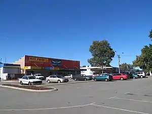
Nollamara Shopping Centre in 2012 | |||||||||||||||
 Nollamara | |||||||||||||||
| Coordinates | 31.882°S 115.846°E | ||||||||||||||
| Population | 9,888 (2011 census)[1] | ||||||||||||||
| • Density | 2,670/km2 (6,920/sq mi) | ||||||||||||||
| Postcode(s) | 6061 | ||||||||||||||
| Area | 3.7 km2 (1.4 sq mi) | ||||||||||||||
| Location | 10 km (6 mi) N of Perth CBD | ||||||||||||||
| LGA(s) | City of Stirling | ||||||||||||||
| State electorate(s) | Nollamara | ||||||||||||||
| Federal Division(s) | Stirling | ||||||||||||||
| |||||||||||||||
The name "Nollamara" is a Noongar word for the flowering plant Macropidia, commonly known as the black kangaroo paw.[2][3]
The suburb is less than 10 km (6.2 mi) away from the Perth central business district and is approximately 11 km from Trigg beach. Previously known as a lower income area, Nollamara has gone through a period of gentrification over the past decade that continues on to this day. Older homes are being replaced with new townhomes and there has been a surge in young families and professionals populating the suburb. Today, the suburb still maintains multicultural and diverse residents despite undergoing change. The cultural aspect has given the suburb community character it is known for.
Nollamara borders prominent areas such as Yokine and Dianella that are host to multimillion-dollar homes. A newly developed Flinders Street and Wanneroo Road provide easy access to Leederville, Subiaco, Northbridge and the Perth CBD.
Transport
The suburb is served by a number of Transperth bus routes operated by Swan Transit and Path Transit. The 354 (Mirrabooka-Yokine) covers Nollamara Shopping Centre and Flinders Street. The 384 (Mirrabooka-Perth) covers the Nollamara Shopping Centre and Wanneroo Road. The 370 and 970 (Mirrabooka-Perth) covers Flinders Street and inner portions of the suburb, the 389 (Wanneroo-Perth) and the 385/386 (Marangaroo-Perth) covers Wanneroo Road south to Perth, the 371 (Warwick-Mirrabooka) and 415 (Stirling-Mirrabooka) covers Ravenswood Drive in the north.
References
- Australian Bureau of Statistics (31 October 2012). "State Suburbs: Nollamara". 2011 Census QuickStats. Retrieved 4 July 2012.

- "Mooro Nyoongar Katitjin Bidi" [Mooro People’s Knowledge Trail]. City of Stirling. Retrieved 28 April 2020.
- "Perth and surrounds suburb names". Western Australian Land Information Authority. Retrieved 1 February 2020.
| Coastal |  | |
|---|---|---|
| Central | ||
| South Eastern | ||
¹ Suburb shared with other local government areas | ||