Nong Don District
Nong Don (Thai: หนองโดน, pronounced [nɔ̌ːŋ dōːn]) is a district (amphoe) in the northwestern part of Saraburi Province in central Thailand.
Nong Don
หนองโดน | |
|---|---|
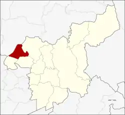 District location in Saraburi Province | |
| Coordinates: 14°40′52″N 100°42′30″E | |
| Country | Thailand |
| Province | Saraburi |
| Seat | Nong Don |
| Area | |
| • Total | 88.07 km2 (34.00 sq mi) |
| Population (2000) | |
| • Total | 13,876 |
| • Density | 160/km2 (410/sq mi) |
| Time zone | UTC+7 (ICT) |
| Postal code | 18190 |
| Geocode | 1908 |
History
Ten kilometres from Bang Khamoad (today's Ban Mo District) there is a big pond. The west side of the pond has a big tummy-wood tree (Careya sphaerica Roxb.) or in Thai Kradon (ต้นกระโดน). The people from Dong Noi and Kokko and Mueang Lop Buri moved to here and established the village Ban Nong Kradon. When the village grew bigger, the government created a separate minor district (king amphoe) Nong Don on 15 July 1968, when the three tambons Nong Don, Ban Klap, and Don Thong were split off from Ban Mo District.[1]
The minor district was upgraded to a full district on 21 August 1975.[2]
Geography
Neighbouring districts are (from the north clockwise) Mueang Lopburi of Lopburi Province, Phra Phutthabat, Ban Mo and Don Phut of Saraburi Province.
Administration
The district is divided into four sub-districts (tambons), which are further subdivided into 34 villages (mubans). Nong Don has township (thesaban tambon) status and covers 1.94 km2 of tambon Nong Don. There are three Tambon administrative organizations (TAO); Ban Klab is also responsible for tambon Ban Prong.
| No. | Name | Thai name | Villages | Pop. |
|---|---|---|---|---|
| 1. | Nong Don | หนองโดน | 11 | 5,562 |
| 2. | Ban Klap | บ้านกลับ | 10 | 4,214 |
| 3. | Don Thong | ดอนทอง | 8 | 2,792 |
| 4. | Ban Prong | บ้านโปร่ง | 5 | 1,617 |
References
- ประกาศกระทรวงมหาดไทย เรื่อง แบ่งท้องที่ตั้งเป็นกิ่งอำเภอ (PDF). Royal Gazette (in Thai). 85 (63 ง special issue): 3. July 12, 1968.
- พระราชกฤษฎีกาตั้งอำเภอแวงน้อย อำเภอป่าแดด อำเภอเรณูนคร อำเภอคูเมือง อำเภอคุระบุรี อำเภอแม่ลาน้อย อำเภอเสริมงาม อำเภอไพรบึง และอำเภอหนองโดน พ.ศ. ๒๕๑๘ (PDF). Royal Gazette (in Thai). 92 (166 ก special issue): 1–4. August 21, 1975.