Saraburi Province
Saraburi (Thai: สระบุรี) is one of the central provinces (changwat) of Thailand. Neighboring provinces are (from north clockwise) Lopburi, Nakhon Ratchasima, Nakhon Nayok, Pathum Thani, and Ayutthaya. It is believed to have been constructed in the year 1548 during the reign of King Maha Chakkraphat of Ayutthaya as a centre for recruiting troops.
Saraburi
สระบุรี | |
|---|---|
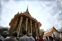 Wat Phra Phutthabat, the provincial symbol | |
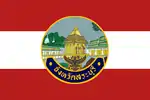 Flag  Seal | |
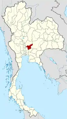 Map of Thailand highlighting Saraburi Province | |
| Country | Thailand |
| Capital | Saraburi |
| Government | |
| • Governor | Manrat Rattanasukhon (since October 2018) |
| Area | |
| • Total | 3,576 km2 (1,381 sq mi) |
| Area rank | Ranked 56th |
| Population (2018)[2] | |
| • Total | 645,024 |
| • Rank | Ranked 40th |
| • Density | 180.4/km2 (467/sq mi) |
| • Density rank | Ranked 17th |
| Human Achievement Index | |
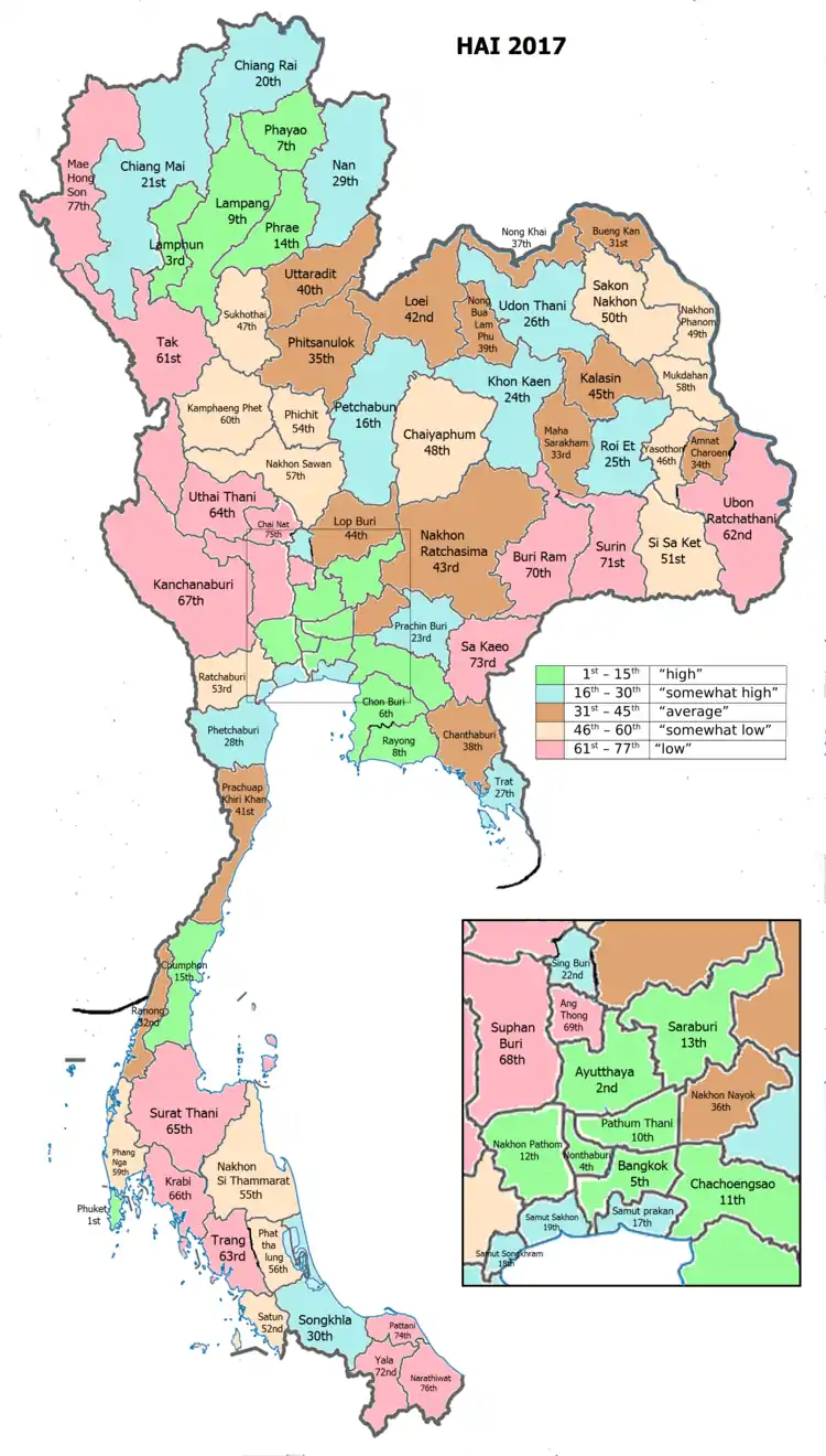
| • HAI (2017) | 0.6341 "high" Ranked 13th |
| Time zone | UTC+7 (ICT) |
| Postal code | 18xxx |
| Calling code | 036 |
| ISO 3166 code | TH-19 |
Geography
Saraburi is on the east side of the Chao Phraya River valley. The eastern part of the province is covered by high plains and plateaus, while the western part is mostly low flat plains. Saraburi Province has 2,235,304 acres of forest, including 460,522.25 acres of national forest (20.6 percent).
Two national parks are in the province. Namtok Chet Sao Noi protects 28 km2 around a scenic waterfall. Phra Puttachai protects the Khao Sam Lan Forest, which consists of hilly landscape and is the source to several rivers and waterfalls. The highest elevation is the Khao Khrok at 329 m. The 44.57 km2 area was declared a national park in 1981.
The town, as a gateway to the northeastern region, is 108 km from Bangkok. It occupies an area of 3,577 square kilometres.
History
Saraburi has been an important city since ancient times. It is assumed to have been established about 1549 during the reign of King Maha Chakkraphat of the Kingdom of Ayutthaya. It is assumed that the king ordered parts of Lopburi and Nakhon Nayok to be combined to set up Saraburi Province with the aim of mobilizing citizens during times of war. From the Ayutthaya period, the story of Saraburi is usually related to battles and wars. As for the origin of the word "Saraburi", it is assumed that due to its location near a swamp called "Bueng Nong Ngong", when the town was established a combination of sa ('swamp') and buri ('town') was suggested and the town was named "Saraburi".

Climate
Saraburi has a tropical savanna climate, Aw (Climate Classification system of Koppen) The climate is arid with little rain in winter, relatively high temperatures in summer, cool in winter, and rain from May to October, about 70–90 days
The average annual temperature is 28-29 degrees Celsius. Maximum temperatures average 33-34 degrees Celsius and minimum temperature averages 23–24 degrees Celsius. April is the hottest month of the year, while winters are cool in January.
Air quality
Saraburi has poor air quality resulting from cement production, chiefly stone crushing. In the area of Na Pra Lan Sub-district there are 133 plants, 17 mining sites, 32 stone mill plants, and 22 stone dressing plants. Air quality in the province frequently exceeds recommended limits for particulates.[4][5]
Education
There are 366 schools. There are a total of 125,255 students at all levels.
Economy
In 2007 Saraburi's population had an average income per capita 214,537 baht per year, making it tenth highest in the country, second in the central provinces. Annual GDP was 129,275 million baht.
Religion and culture
In 2007, Saraburi's population was 89.34 percent Buddhist, 597,138 people. There are 499 temples. There are total of 3,443 monks and 274 neophytes. Muslims number 953 (0.32 percent). There are five Christian churches.
Symbols
The provincial seal shows the temple Wat Phra Buddha Baat. In the 17th century a hunter found a puddle of water which looked like a large footprint. It was declared a footprint of Buddha, and a temple was built around it. Phra Phutthabat means footprint of Buddha.
The provincial tree is Lagerstroemia floribunda and the provincial flower is the yellow cotton tree (Cochlospermum regium). The endemic crab, Larnaudia larnaudii is the provincial aquatic animal.[6]
Administrative divisions
Provincial government
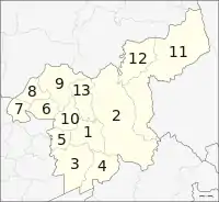
The province is divided into 13 districts (amphoe). The districts are further divided into 111 subdistricts (tambon) and 965 villages (muban).
Local government
As of 26 November 2019 there are:[7] one Saraburi Provincial Administrative Organization - PAO (ongkan borihan suan changwat) and 38 municipal (thesaban) areas in the province. Saraburi, Kaeng Khoi, Phra Phutthabat and Thap Kwang have town (thesaban mueang) status. Further 34 subdistrict municipalities (thesaban tambon).[2] The non-municipal areas are administered by 70 Subdistrict Administrative Organizations - SAO (ongkan borihan suan tambon).
Transport
Rail
Saraburi's main station is Saraburi Railway Station. There is a major rail junction at Kaeng Khoi Junction.
Road
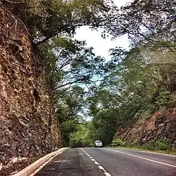
Saraburi can be reached on Phahonyothin Road (Thailand Route 1). Mittraphap Road (Thailand Route 2) is a main road in the northeastern region. It has a beginning here which is a route that separates from the right side of Phahonyothin Road.[8]
Health
The main hospital of Saraburi is Saraburi Hospital, operated by the Ministry of Public Health.
Human achievement index 2017
| Health | Education | Employment | Income |
| 26 | 25 | 24 | 11 |
| Housing | Family | Transport | Participation |
 |
 |
||
| 53 | 39 | 17 | 32 |
| Province Saraburi, with an HAI 2017 value of 0.6341 is "high", occupies place 13 in the ranking. | |||
Since 2003, United Nations Development Programme (UNDP) in Thailand has tracked progress on human development at sub-national level using the Human achievement index (HAI), a composite index covering all the eight key areas of human development. National Economic and Social Development Board (NESDB) has taken over this task since 2017.[3]
| Rank | Classification |
| 1 - 15 | "high" |
| 16 - 30 | "somewhat high" |
| 31 - 45 | "average" |
| 45 - 60 | "somewhat low" |
| 61 - 77 | "low" |
| Map with provinces and HAI 2017 rankings |
 |
Notes
Reports (data) from Thai government are "not copyrightable" (Public Domain), Copyright Act 2537 (1994), section 7.
References
- Advancing Human Development through the ASEAN Community, Thailand Human Development Report 2014, table 0:Basic Data (PDF) (Report). United Nations Development Programme (UNDP) Thailand. pp. 134–135. ISBN 978-974-680-368-7. Retrieved 17 January 2016, Data has been supplied by Land Development Department, Ministry of Agriculture and Cooperatives, at Wayback Machine.
- "ร่ยงานสถิติจำนวนประชากรและบ้านประจำปี พ.ศ.2561" [Statistics, population and house statistics for the year 2018]. Registration Office Department of the Interior, Ministry of the Interior. stat.bora.dopa.go.th (in Thai). 31 December 2018. Retrieved 20 June 2019.
- Human achievement index 2017 by National Economic and Social Development Board (NESDB), pages 1-40, maps 1-9, retrieved 14 September 2019, ISBN 978-974-9769-33-1
- Wipatayotin, Apinya (2019-01-27). "Grappling with pollution". Bangkok Post. Retrieved 2019-01-27.
- Wipatayotin, Apinya (13 January 2018). "Saraburi area hits No.1 for worst air quality". Bangkok Post. Retrieved 26 July 2018.
- "สัตว์น้ำจืดประจำจังหวัดสระบุรี (ปูน้ำตกสระบุรี)" [Saraburi provincial freshwater animal (Waterfall crab)]. 4.fisheries.go.th (in Thai). 2017-01-06. Retrieved 2020-04-22.
- "Number of local government organizations by province". dla.go.th. Department of Local Administration (DLA). 26 November 2019. Retrieved 10 December 2019.
62 Saraburi: 1 PAO, 4 Town mun., 34 Subdistrict mun., 70 SAO.
- ""สุดบรรทัด-เจนจบทิศ" สู่ "ถนนมิตรภาพ" ช่วยย่นเวลาเดินทางกทม.-โคราชจาก 10 เหลือ 3 ชม" ["Sudbanthat-Jenjopthit" to "Mittraphap Road" help shorten the travel time from Bangkok - Khorat from 10 to 3 hrs.]. Silpa Wattanatham (in Thai). 2019-12-27. Retrieved 2020-04-22.
External links
 Saraburi travel guide from Wikivoyage
- Provincial page, Tourist Authority of Thailand
- Khao Yai National Park
- Saraburi history in Thai language Archived April 9, 2008, at the Wayback Machine
Places adjacent to Saraburi Province | |
|---|---|
| Wikimedia Commons has media related to Saraburi Province. |