Nong Saeng District, Saraburi
Nong Saeng (Thai: หนองแซง, pronounced [nɔ̌ːŋ sɛ̄ːŋ]) is a district (amphoe) of Saraburi Province, central Thailand.
Nong Saeng
หนองแซง | |
|---|---|
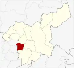 District location in Saraburi Province | |
| Coordinates: 14°29′32″N 100°47′4″E | |
| Country | Thailand |
| Province | Saraburi |
| Area | |
| • Total | 87.081 km2 (33.622 sq mi) |
| Population (2019) | |
| • Total | 15,853 |
| • Density | 180/km2 (470/sq mi) |
| Time zone | UTC+7 (ICT) |
| Postal code | 18170 |
| Geocode | 1905 |
History
Originally, the district was created as a minor district (king amphoe) under Sao Hai District in 1938.[1] It was upgraded to a full district in 1953.[2]
The most people of Nong Saeng migrated from Vientiane. They established their new town near a pond surrounded by saeng trees, so they named their new town Ban Nong Saeng.
Geography
Neighboring districts are (from the north clockwise) Sao Hai, Mueang Saraburi, Nong Khae of Saraburi Province, and Phachi and Tha Ruea of Ayutthaya Province.
Administration
Central administration
The district Nong Saeng is subdivided into 9 subdistricts (Tambon), which are further subdivided into 69 administrative villages (Muban).
| No. | Name | Thai | Villages | Pop.[3] |
|---|---|---|---|---|
| 1. | Nong Saeng | หนองแซง | 8 | 2,072 |
| 2. | Nong Khwai So | หนองควายโซ | 9 | 2,246 |
| 3. | Nong Hua Pho | หนองหัวโพ | 7 | 1,774 |
| 4. | Nong Sida | หนองสีดา | 6 | 963 |
| 5. | Nong Kop | หนองกบ | 7 | 1,675 |
| 6. | Kai Sao | ไก่เส่า | 10 | 2,409 |
| 7. | Khok Sa-at | โคกสะอาด | 7 | 2,083 |
| 8. | Muang Wan | ม่วงหวาน | 8 | 1,697 |
| 9. | Khao Din | เขาดิน | 7 | 934 |
Local administration
There is one subdistrict municipality (Thesaban Tambon) in the district:
- Nong Saeng (Thai: เทศบาลตำบลหนองแซง) consisting of the complete subdistrict Nong Saeng and parts of the subdistricts Nong Khwai So, Kai Sao.
There are 5 subdistrict administrative organizations (SAO) in the district:
- Nong Hua Pho (Thai: องค์การบริหารส่วนตำบลหนองหัวโพ) consisting of the complete subdistrict Nong Hua Pho, Nong Sida.
- Nong Kop (Thai: องค์การบริหารส่วนตำบลหนองกบ) consisting of the complete subdistrict Nong Kop and parts of the subdistrict Nong Khwai So.
- Kai Sao (Thai: องค์การบริหารส่วนตำบลไก่เส่า) consisting of parts of the subdistrict Kai Sao.
- Khok Sa-at (Thai: องค์การบริหารส่วนตำบลโคกสะอาด) consisting of the complete subdistrict Khok Sa-at.
- Muang Wan (Thai: องค์การบริหารส่วนตำบลม่วงหวาน) consisting of the complete subdistrict Muang Wan, Khao Din.
External links
References
- "ประกาศกระทรวงมหาดไทย เรื่อง ตั้งกิ่งอำเภอหนองแซง กับกิ่งอำเภอหนองหมู" (PDF). Royal Gazette (in Thai). 54 (0 ง): 2915–2916. 1938-02-28.
- "พระราชกฤษฎีกาจัดตั้งอำเภอจักราช อำเภอสัตตหีบ อำเภอศรีสงคราม อำเภอชะอวด อำเภอหนองแซง อำเภอภาชี อำเภอเขาไชยสน อำเภอชุมพลบุรี อำเภอวาริชภูมิ อำเภอสบปราบ และอำเภอสุไหงโกลก พ.ศ. ๒๔๙๖" (PDF). Royal Gazette (in Thai). 70 (17 ก): 368. 1953-03-10.
- "Population statistics 2019" (in Thai). Department of Provincial Administration. Retrieved 2020-12-27.