Nong Phai District
Nong Phai (Thai: หนองไผ่, pronounced [nɔ̌ːŋ pʰàj]) is a district (amphoe) in the southern part of Phetchabun Province, northern Thailand.
Nong Phai
หนองไผ่ | |
|---|---|
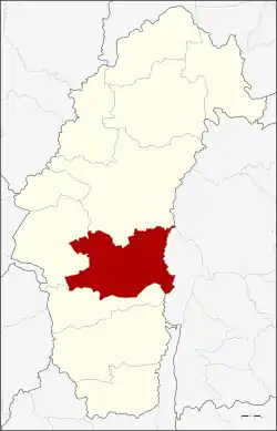 District location in Phetchabun Province | |
| Coordinates: 15°59′25″N 101°3′45″E | |
| Country | Thailand |
| Province | Phetchabun |
| Area | |
| • Total | 1,360.2 km2 (525.2 sq mi) |
| Population (2000) | |
| • Total | 115,832 |
| • Density | 85.2/km2 (221/sq mi) |
| Time zone | UTC+7 (ICT) |
| Postal code | 67140 |
| Geocode | 6707 |
History
The area was created as a minor district (king amphoe) in 1961. It was upgraded to a full district in 1963.
Geography
Neighboring district are (from the east clockwise) Nong Bua Daeng and Phakdi Chumphon of Chaiyaphum Province, Bueng Sam Phan, Chon Daen and Mueang Phetchabun of Phetchabun Province.
The main water resource is the Pa Sak River.
Administration
The district is divided into 13 sub-districts (tambons), which are further subdivided into 135 villages (mubans). There are six townships (thesaban tambons) in the district: Ban Phot, Bo Thai, Bua Watthana, Chaliang Thong, Na Chaliang, and Nong Phai, each covering parts of the same-named tambon. There are a further 13 tambon administrative organizations (TAO).
| 1. | Kong Thun | กองทูล | |
| 2. | Na Chaliang | นาเฉลียง | |
| 3. | Ban Phot | บ้านโภชน์ | |
| 4. | Tha Daeng | ท่าแดง | |
| 5. | Phet Lakhon | เพชรละคร | |
| 6. | Bo Thai | บ่อไทย | |
| 7. | Huai Pong | ห้วยโป่ง | |
| 8. | Wang Tha Di | วังท่าดี | |
| 9. | Bua Watthana | บัววัฒนา | |
| 10. | Nong Phai | หนองไผ่ | |
| 11. | Wang Bot | วังโบสถ์ | |
| 12. | Yang Ngam | ยางงาม | |
| 13. | Tha Duang | ท่าด้วง |