Phakdi Chumphon District
Phakdi Chumphon District (Thai: ภักดีชุมพล, pronounced [pʰák.dīː t͡ɕʰūm.pʰōn]) is the westernmost district (amphoe) of Chaiyaphum Province, northeastern Thailand.
Phakdi Chumphon
ภักดีชุมพล | |
|---|---|
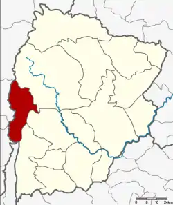 District location in Chaiyaphum Province | |
| Coordinates: 15°54′18″N 101°25′18″E | |
| Country | Thailand |
| Province | Chaiyaphum |
| Seat | Chao Thong |
| Area | |
| • Total | 900.4 km2 (347.6 sq mi) |
| Population (2000) | |
| • Total | 28,111 |
| • Density | 31.2/km2 (81/sq mi) |
| Time zone | UTC+7 (ICT) |
| Postal code | 36260 |
| Geocode | 3614 |
History
Tambons Ban Chiang, Wang Thong, and Chao Thaong of Nong Bua Daeng District were separated to create the minor district (king amphoe) Phakdi Chumphon on 1 August 1988.[1] It was upgraded to a full district on 7 September 1995.[2]
Geography
Neighboring districts are (from the north clockwise): Nong Bua Daeng, Nong Bua Rawe, and Thep Sathit of Chaiyaphum Province; Wichian Buri, Bueng Sam Phan, and Nong Phai of Phetchabun Province.
Administration
The district is divided into four subdistricts (tambons), which are further subdivided into 47 villages (mubans). There are no municipal (thesaban) areas. There are four tambon administrative organizations (TAO).
| 1. | Ban Chiang | บ้านเจียง | |
| 2. | Chao Thong | เจาทอง | |
| 3. | Wang Thong | วังทอง | |
| 4. | Laem Thong | แหลมทอง |
References
- ประกาศกระทรวงมหาดไทย เรื่อง แบ่งท้องที่อำเภอหนองบัวแดง จังหวัดชัยภูมิ ตั้งเป็นกิ่งอำเภอภักดีชุมพล (PDF). Royal Gazette (in Thai). 105 (89 ง special): 3. June 1, 1988.
- พระราชกฤษฎีกาตั้งอำเภอด่านมะขามเตี้ย อำเภอแก่งหางแมว อำเภอภักดีชุมพล อำเภอเวียงแก่น อำเภอแม่วาง อำเภอถ้ำพรรณรา อำเภอบ่อเกลือ อำเภอโนนสุวรรณ อำเภอห้วยราช อำเภอแม่ลาน อำเภอบางแก้ว อำเภอป่าพะยอม อำเภอหนองม่วงไข่ อำเภอยางสีสุราช อำเภอจังหาร อำเภอบ้านธิ อำเภอภูสิงห์ อำเภอบางกล่ำ อำเภอวังม่วง และอำเภอนายูง พ.ศ. ๒๕๓๘ (PDF). Royal Gazette (in Thai). 112 (32 ก): 1–3. August 8, 1995.