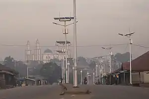
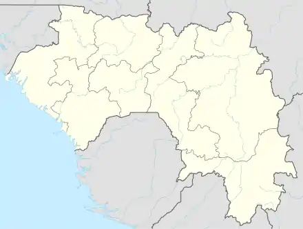
Nzérékoré
Nzérékoré (N’ko: ߒߛߙߍߜߘߺߍ߬, Adlam: 𞤟𞤫𞤪𞤫𞤳𞤮𞤪𞤫; also spelled N'Zérékoré) is the second-largest city in Guinea by population after the capital, Conakry, and the largest city in the Guinée forestière region of southeastern Guinea. The city is the capital of Nzérékoré Prefecture. Nzérékoré is a commercial and economic center and lies approximately 354 mi (570 km) southeast of Conakry.[2]
Nzérékoré
ߒߛߙߍߜߘߺߍ߬ · 𞤟𞤫𞤪𞤫𞤳𞤮𞤪𞤫 | |
|---|---|
 | |
 Nzérékoré | |
| Coordinates: 07°45′00″N 08°49′00″W | |
| Country | |
| Region | Nzérékoré Region |
| Prefecture | Nzérékoré Prefecture |
| Population (2014[1]) | |
| • Total | 195,027 |
It was the center of an uprising against French rule in 1911. It is now known as a market town and for its silverworking. The population was 107,329 according to the 1996 census. Growing dramatically since the civil wars in neighboring Liberia, Sierra Leone, and Ivory Coast, the 2014 census population was 195,027.[1]
History
There were 3 days of ethno-religious fighting in Nzerekore in July 2013.[3][4] Fighting between ethnic Kpelle, who are Christian or animist, and ethnic Konianke, who are Muslims and close to the larger Malinke ethnic group, left at least 54 dead.[4] The dead included people who were killed with machetes and burned alive.[4] The violence ended after the Guinea military imposed a curfew, and President Conde made a televised appeal for calm.[4]
Climate
Nzérékoré has a tropical savanna climate (Köppen climate classification Aw). The city features a lengthy wet season covering the months of March through November, while the remaining three months form the city's dry season. While average daily temperatures remain relatively consistent throughout the course of the year, Nzérékoré has a much higher diurnal temperature variation during its dry season with average highs around 34 degrees Celsius and average lows ranging from 10 to 13 degrees Celsius. The city averages roughly 1800 mm of precipitation annually.
| Climate data for Nzérékoré | |||||||||||||
|---|---|---|---|---|---|---|---|---|---|---|---|---|---|
| Month | Jan | Feb | Mar | Apr | May | Jun | Jul | Aug | Sep | Oct | Nov | Dec | Year |
| Average high °C (°F) | 33.7 (92.7) |
34.7 (94.5) |
34.4 (93.9) |
33.1 (91.6) |
32.1 (89.8) |
31.1 (88.0) |
29.5 (85.1) |
29.4 (84.9) |
30.0 (86.0) |
30.9 (87.6) |
31.3 (88.3) |
31.5 (88.7) |
31.8 (89.2) |
| Daily mean °C (°F) | 23.3 (73.9) |
24.7 (76.5) |
25.6 (78.1) |
25.8 (78.4) |
25.4 (77.7) |
24.4 (75.9) |
23.5 (74.3) |
23.5 (74.3) |
24.1 (75.4) |
24.5 (76.1) |
24.5 (76.1) |
23.3 (73.9) |
24.4 (75.9) |
| Average low °C (°F) | 10.8 (51.4) |
13.2 (55.8) |
16.5 (61.7) |
18.4 (65.1) |
18.4 (65.1) |
18.1 (64.6) |
18.0 (64.4) |
18.6 (65.5) |
18.3 (64.9) |
17.8 (64.0) |
16.0 (60.8) |
12.4 (54.3) |
16.4 (61.5) |
| Average precipitation mm (inches) | 10 (0.4) |
45 (1.8) |
98 (3.9) |
142 (5.6) |
154 (6.1) |
206 (8.1) |
198 (7.8) |
298 (11.7) |
324 (12.8) |
181 (7.1) |
73 (2.9) |
25 (1.0) |
1,754 (69.1) |
| Average precipitation days (≥ 1.0 mm) | 1 | 4 | 8 | 12 | 14 | 14 | 16 | 21 | 20 | 17 | 8 | 2 | 137 |
| Average relative humidity (%) | 65 | 68 | 72 | 76 | 79 | 81 | 84 | 85 | 82 | 80 | 79 | 73 | 77 |
| Source: NOAA[5] | |||||||||||||
Transportation
The N1 highway connects the city with Kankan in the north. The city is also served by Nzérékoré Airport.
References
- "Etat et Structure de la Population Recensement General de la Population et de l'habitation 2014" (PDF). Direction Nationale de la Statistique de Guinée. Retrieved 27 March 2020.
- Encyclopedia of World Populations: Nzérékoré
- "Guinea's Conde appeals for calm after 11 killed in ethnic clashes", Reuters, July 16, 2013.
- "Guinean troops deployed after deadly ethnic clashes", BBC Africa, 17 July 2013.
- "Nzérékoré Climate Normals 1961–1990". National Oceanic and Atmospheric Administration. Retrieved October 19, 2015.
External links
Capital: Nzérékoré | ||
| Sub-prefectures | 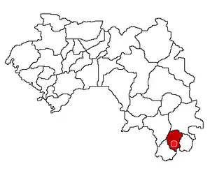 | |
| Towns and villages |
| |
| Landmarks |
| |
| Transport |
| |
| Notable people | ||