Nzérékoré Region
The Nzérékoré Region is a region in the southern part of Guinea. Its capital and largest city is Nzérékoré. It is one of the eight regions of Guinea. It is bordered by the countries of Sierra Leone, Liberia, and Ivory Coast, and the Guinean regions of Kankan and Faranah.
Nzérékoré | |
|---|---|
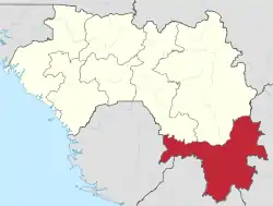 Nzérékoré Region in Guinea | |
| Country | Guinea |
| Regional capital | Nzérékoré |
| Area | |
| • Total | 37,658 km2 (14,540 sq mi) |
| Population (2014 census) | |
| • Total | 1,663,582 |
| • Density | 44/km2 (110/sq mi) |
| HDI (2017) | 0.447[1] low · 3rd of 8 |
The prefectures of Nzérékoré Region include:
Geography
Nzérékoré Region is traversed by the northwesterly line of equal latitude and longitude.
The region includes several forested highlands, including the Nimba Range, Simandou Massif, and Ziama Massif.
The region contains the headwaters of several rivers. The Milo, Sankarani, and Dion rivers flow northward to become tributaries the Niger River. The Moa, Lofa, St. Paul, St. John, Cavalla, and Sassandra rivers flow southwards through Sierra Leone, Liberia, and Ivory Coast to empty into the Atlantic Ocean.
Gallery
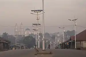 N'Zérékoré city with the Grand Mosque
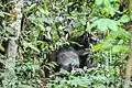 Chimpanzees (Mount Nimba)
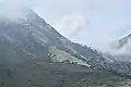 Mount Nimba
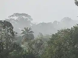 Ziama Massif
References
- "Sub-national HDI - Area Database - Global Data Lab". hdi.globaldatalab.org. Retrieved 2018-09-13.