Old Miakka, Florida
Old Miakka (or Old Myakka) is an unincorporated community in Sarasota County, Florida, United States. It is located at the bend of County Road 780, where it changes from running north–south to east–west. The community is part of the North Port–Sarasota–Bradenton, Florida Metropolitan Statistical Area.
Old Miakka, Florida | |
|---|---|
Unincorporated community | |
| Old Myakka | |
 Old Miakka, Florida Location within the state of Florida | |
| Coordinates: 27°18′47″N 82°16′00″W[1] | |
| Country | United States |
| State | Florida |
| County | Sarasota |
| Elevation | 49 ft (15 m) |
| Time zone | UTC−05:00 (EST) |
| • Summer (DST) | UTC−04:00 (EDT) |
| ZIP code | 34240 |
| Area code(s) | 941 |
| FIPS code | 12-51345[1] |
| GNIS feature ID | 294873 |
| [1] | |
History
The cornerstone is the Old Miakka United Methodist Church which was built in 1886. This is also where the historic marker is located. The area named after what the Seminole tribe called the Miarca River the name Miakka first appeared on maps in 1845.
Spelling
A letter written in 1940 by Secretary W. Stanley Hanson of the Seminole Indian Association to Project Superintendent Claude E. Ragan of the newly formed Myakka River State Park used the spelling of “Miakka River State Park.” The letter explains Secretary Hanson's attempt to discover the history and origin of the various spellings. He states that Lake Myakka was labeled as “Mayaco” on some early maps. The letter also notes the origin of the word “Miami”, as “Mayaca” is conjectured by some to have the same meaning. The “Mayaimi” Tribe lived near Lake Okeechobee, named from the Hitchiti words oki (water) and chubi (big).[2] The oldest known name for Lake Okeechobee was “Mayaimi,” (also meaning big water) as reported by Hernando de Escalante Fontaneda in the 16th century.[3]
The United States Board on Geographic Names (BGN) ruled in December 1943 on the usage of "Old Myakka" for the spelling of the geographical name as it was "both officially and locally preferred to help distinguish it from Myakka City and vice versa."[4] The ruling acknowledged the spelling Miakka to be found on various official documents such as the USGS state maps, Rand McNally Atlas, and Official State Road Map. However, both spellings appear in the area with the church and post office using the spelling Miakka.
References
- "Old Miakka". Geographic Names Information System. United States Geological Survey. October 19, 1979. Retrieved January 25, 2019.
- "Mosquito County, Florida, 1830 (map) The Okeechobee river was affected by wind and water erosion". University of South Florida. Retrieved May 17, 2018.
- "Miakka or Myakka?". Crowley Museum & Nature Center. July 10, 2017. Retrieved May 17, 2018.
- "Case Study". U.S. Board on Geographic Names. December 4, 1943. Retrieved August 8, 2019.
Municipalities and communities of Sarasota County, Florida, United States | ||
|---|---|---|
| Cities | 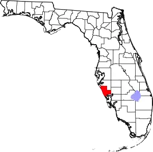 | |
| Town | ||
| CDPs | ||
| Unincorporated communities | ||
| Footnotes | ‡This populated place also has portions in an adjacent county or counties, †This populated place also has portions in the City of North Port | |
| ||
| Authority control |
|
|---|