Olivehurst, California
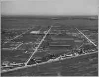
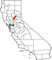
Olivehurst (formerly, Denniston)[2] is a census-designated place (CDP) in Yuba County, California, United States. The population was 13,656 at the 2010 census, up from 11,061 at the 2000 census. Olivehurst is located 4 miles (6.4 km) south-southeast of Marysville.[2]
Olivehurst, California | |
|---|---|
 Location in Yuba County and the state of California | |
 Olivehurst, California Location in the United States | |
| Coordinates: 39°05′44″N 121°33′08″W | |
| Country | |
| State | |
| County | Yuba |
| Area | |
| • Total | 7.473 sq mi (19.354 km2) |
| • Land | 7.473 sq mi (19.354 km2) |
| • Water | 0 sq mi (0 km2) 0% |
| Elevation | 66 ft (20 m) |
| Population (2010) | |
| • Total | 13,656 |
| • Density | 1,800/sq mi (710/km2) |
| Time zone | UTC-8 (Pacific (PST)) |
| • Summer (DST) | UTC-7 (PDT) |
| ZIP code | 95961 |
| Area code(s) | 530 |
| FIPS code | 06-53714 |
| GNIS feature ID | 1659301 |
History
Olivehurst was first largely settled by people from the Midwest during the Great Depression who were looking for fertile land, availability of jobs, and a better future. People from the town have been known to refer to this group of people as Okies. "Okies" is a term originally for those from Oklahoma who were escaping the "dust bowl" Oklahoma had become during the Great Depression. This is why some of the streets are named after cities in Oklahoma. These "Okies" were following migrant workers such as those of Chinese, Japanese, Filipino, Mexican, and Native American background.

The economy has been largely focused on agriculture, but since the 1950s jobs have been increasingly focused on mill and manufacturing work. Today's economy is centered on a "commuter economy" where many of the residents work outside of the town.[3]
A post office opened at Olivehurst in 1941.[2]
Olivehurst was the site of a school shooting in 1992 which left four dead.
Geography
Olivehurst is located at 39°05′44″N 121°33′08″W.[4]
According to the United States Census Bureau, the CDP has a total area of 7.5 square miles (19.4 km2), all of it land.
Demographics
2010
At the 2010 census Olivehurst had a population of 13,656. The population density was 1,827.5 people per square mile (705.6/km2). The racial makeup of Olivehurst was 8,534 (62.5%) White, 322 (2.4%) African American, 399 (2.9%) Native American, 772 (5.7%) Asian, 61 (0.4%) Pacific Islander, 2,623 (19.2%) from other races, and 945 (6.9%) from two or more races. Hispanic or Latino of any race were 4,994 persons (36.6%).[5]
The census reported that 13,610 people (99.7% of the population) lived in households, 46 (0.3%) lived in non-institutionalized group quarters, and no one was institutionalized. There were 4,120 households, 1,961 (47.6%) had children under the age of 18 living in them, 2,137 (51.9%) were opposite-sex married couples living together, 713 (17.3%) had a female householder with no husband present, 316 (7.7%) had a male householder with no wife present. There were 380 (9.2%) unmarried opposite-sex partnerships, and 29 (0.7%) same-sex married couples or partnerships. 726 households (17.6%) were one person and 243 (5.9%) had someone living alone who was 65 or older. The average household size was 3.30. There were 3,166 families (76.8% of households); the average family size was 3.71.
The age distribution was 4,339 people (31.8%) under the age of 18, 1,469 people (10.8%) aged 18 to 24, 3,767 people (27.6%) aged 25 to 44, 2,937 people (21.5%) aged 45 to 64, and 1,144 people (8.4%) who were 65 or older. The median age was 29.9 years. For every 100 females, there were 100.5 males. For every 100 females age 18 and over, there were 99.5 males.
There were 4,487 housing units at an average density of 600.5 per square mile, of the occupied units 2,538 (61.6%) were owner-occupied and 1,582 (38.4%) were rented. The homeowner vacancy rate was 3.8%; the rental vacancy rate was 5.0%. 8,029 people (58.8% of the population) lived in owner-occupied housing units and 5,581 people (40.9%) lived in rental housing units.
2000
At the 2000 census there were 11,061 people, 3,474 households, and 2,650 families in the CDP. The population density was 2,208.9 people per square mile (852.4/km2). There were 3,732 housing units at an average density of 745.3 per square mile (287.6/km2). The racial makeup of the CDP was 67.29% White, 1.65% African American, 3.67% Native American, 5.06% Asian, 0.17% Pacific Islander, 15.52% from other races, and 6.63% from two or more races. Hispanic or Latino of any race were 24.95%.[6]
Of the 3,474 households 41.5% had children under the age of 18 living with them, 54.2% were married couples living together, 15.8% had a female householder with no husband present, and 23.7% were non-families. 18.4% of households were one person and 7.4% were one person aged 65 or older. The average household size was 3.17 and the average family size was 3.58.
The age distribution was 33.5% under the age of 18, 9.8% from 18 to 24, 28.1% from 25 to 44, 19.1% from 45 to 64, and 9.5% 65 or older. The median age was 30 years. For every 100 females, there were 101.9 males. For every 100 females age 18 and over, there were 99.4 males.
The median household income was $29,854 and the median family income was $32,072. Males had a median income of $27,123 versus $21,980 for females. The per capita income for the CDP was $12,020. About 13.3% of families and 18.3% of the population were below the poverty line, including 23.1% of those under age 18 and 7.4% of those age 65 or over.
Government
In the California State Legislature, Olivehurst is in the 4th Senate District, represented by Republican Jim Nielsen, and in the 3rd Assembly District, represented by Republican James Gallagher.[7]
In the United States House of Representatives, Olivehurst is in California's 3rd congressional district, represented by Democrat John Garamendi.[8]
Education
Olivehurst is served by Marysville Joint Unified School District. There are several elementary schools located in the town in addition to Lindhurst High School, one of the two in the district.
Notable person
- Phil Baugh - musician.
References
- U.S. Census Archived 2012-01-25 at the Wayback Machine
- Durham, David L. (1998). California's Geographic Names: A Gazetteer of Historic and Modern Names of the State. Clovis, Calif.: Word Dancer Press. p. 533. ISBN 1-884995-14-4.
- Olivehurst Community Plan - History
- U.S. Geological Survey Geographic Names Information System: Olivehurst, California
- "2010 Census Interactive Population Search: CA - Olivehurst CDP". U.S. Census Bureau. Archived from the original on July 15, 2014. Retrieved July 12, 2014.
- "U.S. Census website". United States Census Bureau. Retrieved 2008-01-31.
- "Statewide Database". UC Regents. Archived from the original on February 1, 2015. Retrieved January 30, 2015.
- "California's 3rd Congressional District - Representatives & District Map". Civic Impulse, LLC. Retrieved March 1, 2013.
