Onkaparinga Hills, South Australia
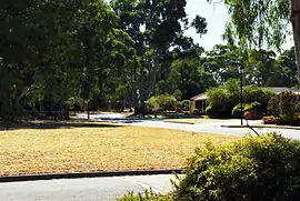
Onkaparinga Hills is a southern suburb of Adelaide, in the City of Onkaparinga. It covers an area of approximately 22 square kilometres (8.5 square miles). It has a population of 2534 people (2011 Census).[4] It is a leafy suburb that includes parts of the Onkaparinga River National Park.
| Onkaparinga Hills South Australia | |||||||||||||||
|---|---|---|---|---|---|---|---|---|---|---|---|---|---|---|---|
 Spriggs Road | |||||||||||||||
 Onkaparinga Hills | |||||||||||||||
| Coordinates | |||||||||||||||
| Population | 2,530 (2016 census)[1] | ||||||||||||||
| Established | 1840s | ||||||||||||||
| Postcode(s) | 5163 | ||||||||||||||
| Location | 33.5 km (21 mi) from Adelaide | ||||||||||||||
| LGA(s) | City of Onkaparinga | ||||||||||||||
| Region | Southern Adelaide[2] | ||||||||||||||
| County | Adelaide[3] | ||||||||||||||
| State electorate(s) | |||||||||||||||
| Federal Division(s) | Kingston | ||||||||||||||
| |||||||||||||||
Nearly 60% of families in the area are couples with children, compared to an Australian average of 45.3%. The median rent in 2006 was $230. The current median cost of a home in the area is $390 000. 93.5% of people speak English only at home (Australian average 78.5%) and 91% are Australian citizens compared to the Australian average of 86.1%. The Onkaparinga Hills are examples of folding.
History
Prior to European colonisation, the area was inhabited by the Kaurna people. The name Onkaparinga is derived from the Kaurna word ngankiparrinnga, meaning ‘The Women’s River’.
European settlement dates from the 1840s. Most of the settlers were initially farmers, with vineyards later being established. After the war there was significant development and again in the early 1990s. The population is now relatively stable. There are still sections of the area used for vineyards, farming and grazing.
Notes
- Australian Bureau of Statistics (27 June 2017). "Onkaparinga Hills (State Suburb)". 2016 Census QuickStats. Retrieved 5 February 2018.

- "Southern Adelaide SA Government region" (PDF). The Government of South Australia. Retrieved 17 April 2017.
- "Search result for "County of Adelaide, CNTY" with the following data sets selected - "Counties" and "Local Government Areas"". Property Location SA Map Viewer. Government of South Australia. Retrieved 24 April 2017.
- Australian Bureau of Statistics (31 October 2012). "Onkaparinga Hills". 2011 Census QuickStats. Retrieved 9 April 2016.
- ^ Bonzle.com
- ^ Australian Bureau of Statistics
- ^ City of Onkaparinga Council Website
- ^ Aboriginal Culture and History, City of Onkaparinga Council Website
- ^ History Overview, City of Onkaparinga Council Website
- ^ Domain Suburb Profile, Domain.com
- ^ History of the Population, City of Onkaparinga Council Website