Kangarilla, South Australia
Kangarilla is a town near Adelaide, South Australia. It lies within the City of Onkaparinga and has postcode 5157. At the 2016 census, Kangarilla had a population of 896.[1]
| Kangarilla South Australia | |||||||||||||||
|---|---|---|---|---|---|---|---|---|---|---|---|---|---|---|---|
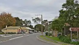 Main street of Kangarilla | |||||||||||||||
 Kangarilla | |||||||||||||||
| Coordinates | 35.148°S 138.660°E | ||||||||||||||
| Population | 896 (2016 census)[1] | ||||||||||||||
| Postcode(s) | 5157 | ||||||||||||||
| Elevation | 195 m (640 ft) | ||||||||||||||
| Location | 41 km (25 mi) from Adelaide | ||||||||||||||
| LGA(s) | City of Onkaparinga | ||||||||||||||
| Region | Southern Adelaide[2] | ||||||||||||||
| County | Adelaide[3] | ||||||||||||||
| Federal Division(s) | Division of Mayo | ||||||||||||||
| |||||||||||||||
History
The land around Kangarilla was first settled in around 1840, with wheat and vineyards the main produce. A town was founded in 1849 by John Bottrill, and properly surveyed in 1860[4] on section 875 in the Hundred of Kuitpo, named Scaldwell. It was later called Eyre Flat or Eyre's Flat,[5][4] and the name Kangarilla may have originally been the name given to the creek which ran through the area. The name Eyre's Flat stopped being used in the 1870s, when the area started to be referred to as Kangarilla.[6]
The Kaurna people who lived there called it Kangkarrilla.[7] Manning's Index reports that Norman Tindale thought that kanggarila may mean "birthplace", and that it was spelt "Kungirilla" in The South Australian on 17 March 1843. Ngarrindjeri man David Unaipon was recorded as saying that Kang means "two" and Ra'mulia means "outflow or water flowing", referring to two waterholes,[5] but more recent sources have variously reported that the meaning in the Kaurna language is "a place where something is nurtured", and possibly "a place with abundant resources",[8] "place of rest with water and trees",[9] and "shepherding place".[10]

The historic settlement of Dashwood Gully (also known as Dashwoods Gully) existed within the present-day bounded locality of Kangarilla. It was named for George Frederick Dashwood, who settled there in 1841[11] and was appointed as a member of the South Australian parliament in 1843. The first Dashwood's Gully post office opened in November 1863 and closed in 1867; a second post office opened from December 1871 to December 1930.[12][13][14]
Notes and references
- Australian Bureau of Statistics (27 June 2017). "Kangarilla (State Suburb)". 2016 Census QuickStats. Retrieved 22 June 2019.

- "Southern Adelaide SA Government region" (PDF). The Government of South Australia. Retrieved 17 April 2017.
- "Search result for "County of Adelaide, CNTY" with the following data sets selected - "Counties" and "Local Government Areas"". Property Location SA Map Viewer. Government of South Australia. Retrieved 24 April 2017.
- "Kangarilla, South Australia". Flinders Ranges Research and South Australian History. Retrieved 17 November 2020.
- Manning, Geoff (1990–2000). "Place Names of South Australia - K". Manning Index of South Australian History. State Library of South Australia. Retrieved 17 November 2020.
- City of Onkaparinga. "From Almanda to United States: Lost Localities in the City of Onkaparinga" (PDF). Retrieved 17 November 2020. Cite journal requires
|journal=(help) - Amery, Rob (2016). "Chapter 8. Kaurna in Society". Warraparna Kaurna!: Reclaiming an Australian language (PDF). University of Adelaide Press. p. 204. doi:10.20851/kaurna. ISBN 978-1-925261-25-7. Retrieved 17 November 2020.
- "Our Story". Kangarilla Road. 29 March 2019. Retrieved 17 November 2020.
- "Kangarilla Road, McLaren Vale". Kingfisher Wines. Retrieved 17 November 2020.
- Williamson, Brett (19 June 2017). "How one Indigenous man found identity through the almost-lost Kaurna language". ABC News. Australian Broadcasting Corporation. Retrieved 17 November 2020.
- "Placename Details: Dashwood Gully". Property Location Browser. 25 July 2007. SA0017978. Retrieved 22 December 2017.
Feature Type: Gully; Derivation of Name: Captain G F Dashwood, RN; Other Details: Captain Dashwood settled there in 1841.
- "'A hill's post office near Dashwood's Gully' [PRG 1316/12/150] • Photograph". State Library of South Australia. Retrieved 22 December 2017.
- "Dashwood's Gully (1)". Post Office Reference. Premier Postal. Retrieved 22 December 2017.
- "Dashwood's Gully (2)". Post Office Reference. Premier Postal. Retrieved 22 December 2017.