Ottringham
Ottringham is a village and civil parish in the East Riding of Yorkshire, England, in an area known as Holderness. It is situated approximately 12 miles (19 km) to the east of Hull city centre and 5 miles (8 km) south-west of Withernsea. It lies on the A1033 road from Hull to Withernsea.
| Ottringham | |
|---|---|
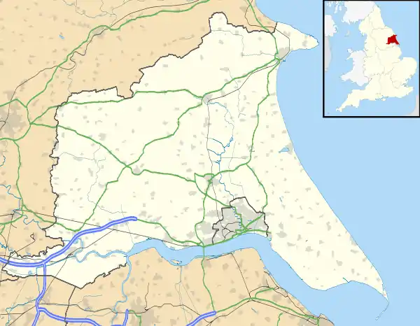 Ottringham Location within the East Riding of Yorkshire | |
| Population | 597 (2011 census)[1] |
| OS grid reference | TA268243 |
| • London | 155 mi (249 km) S |
| Civil parish |
|
| Unitary authority | |
| Ceremonial county | |
| Region | |
| Country | England |
| Sovereign state | United Kingdom |
| Post town | HULL |
| Postcode district | HU12 |
| Dialling code | 01964 |
| Police | Humberside |
| Fire | Humberside |
| Ambulance | Yorkshire |
| UK Parliament | |
According to the 2011 UK census, Ottringham parish had a population of 597,[1] a reduction on the 2001 UK census figure of 637.[2]
In 1823 parish inhabitants numbered 637. Occupations included twelve farmers, some of whom were land owners, four shoemakers, three grocers, two tailors, two wheelwrights, a blacksmith, a corn miller, a horse dealer, and the landlord of the White Horse public house. Two carriers operated between the village and Hull, South Frodingham, Holmpton, and Skeckling, on Tuesdays and Fridays. Letters were received and sent on Mondays, Wednesdays and Saturdays by Wing's caravan [accommodation coach]. A Methodist chapel existed, built in 1815.[3]
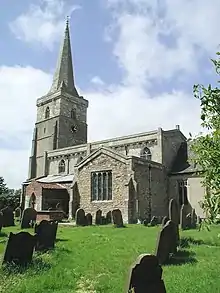
The parish church of St Wilfrid is a Grade I listed building.[4]
Ottringham was served from 1854 to 1964 by Ottringham railway station on the Hull and Holderness Railway.[5]
During the Second World War, in 1943, the BBC built a transmitting station at Ottringham, called BBC Ottringham or OSE5.[6] Its purpose was to counter the increase in German jamming signals, and to broadcast propaganda into Germany. Following the end of the war, and with lack of funds, the station was deconstructed in 1953 and its transmitters moved to Droitwich.
In 1958 a Ham class minesweeper HMS Ottringham was named after the village.[7]
Ottringham contains two public houses and a service garage. It is close to a main bus route.
References
- UK Census (2011). "Local Area Report – Ottringham Parish (1170211236)". Nomis. Office for National Statistics. Retrieved 22 February 2018.
- UK Census (2001). "Local Area Report – Ottringham Parish (00FB107)". Nomis. Office for National Statistics. Retrieved 27 February 2020.
- Baines, Edward (1823). History, Directory & Gazetteer of the County of York. pp. 374, 375. ISBN 1230139141.
- Historic England. "Church of St Wilfred (1160874)". National Heritage List for England. Retrieved 6 February 2013.
- Butt, R. V. J. (1995). The Directory of Railway Stations: details every public and private passenger station, halt, platform and stopping place, past and present (1st ed.). Sparkford: Patrick Stephens Ltd. ISBN 978-1-85260-508-7. OCLC 60251199.
- Baxter, Dale (10 September 2008). "Hidden history in Holderness". BBC Humberside. BBC. Retrieved 5 December 2009.
- Blackman, Raymond, ed. (1961). "Minesweepers". Jane's fighting ships. London: Sampson Low, Marston and Co. 64: 285. ISSN 0075-3025. OCLC 804621601.
- Gazetteer — A–Z of Towns Villages and Hamlets. East Riding of Yorkshire Council. 2006. p. 9.
External links
![]() Media related to Ottringham at Wikimedia Commons
Media related to Ottringham at Wikimedia Commons
