Pōrangahau
Pōrangahau, a township close to the Pacific Ocean coast in the south-east of the North Island of New Zealand, has a very small population. It lies in the southernmost part of Hawke's Bay, 45 kilometres south of Waipukurau, and close to the mouth of the Porangahau River. There settlement includes a marae and a school.
Pōrangahau | |
|---|---|
| |
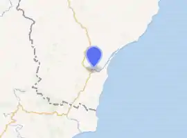
| Coordinates: 40°18′07″S 176°36′45″E | |
| Country | New Zealand |
| Region | Hawke's Bay |
| Territorial authority | Central Hawke's Bay District |
| Ward | Aramoana/Ruahine |
| Population (2018)[1] | |
| • Total | 141 |
The Māori name Pōrangahau expresses the idea of a night (pō) of pursuit or of retreat (rangahau).[2]
Six kilometres northeast of the township stands an insubstantial hill, with the longest place name in the world: Taumatawhakatangihangakoauauotamateaturipukakapikimaungahoronukupokaiwhenuakitanatahu.[3][4]
The area west of the main township, known as Mangaorapa, was used for sheep farming during the 20th century.[5] The area has more recently been used for cattle farming and wine growing.[6] The 2370 hectare Mangaorapa Station was the most expensive farm in Central Hawke's Bay when it was sold in 2005.[7]
Demographics
The population of Pōrangahau was 141 in the 2018 census, an increase of 39 from 2013. There were 72 males and 69 females. 42.6% of people identified as European/Pākehā, 70.2% as Māori and 12.8% as Pacific peoples. 23.4% were under 15 years old, 12.8% were 15–29, 44.7% were 30–64, and 21.3% were 65 or older.[1]
| Year | Pop. | ±% p.a. |
|---|---|---|
| 2006 | 1,758 | — |
| 2013 | 1,662 | −0.80% |
| 2018 | 1,893 | +2.64% |
| Source: [8] | ||
The statistical area of Taurekaitai, which at 1154 square kilometres is much larger than this township, had a population of 1,893 at the 2018 New Zealand census, an increase of 231 people (13.9%) since the 2013 census, and an increase of 135 people (7.7%) since the 2006 census. There were 714 households. There were 966 males and 927 females, giving a sex ratio of 1.04 males per female. The median age was 44.6 years (compared with 37.4 years nationally), with 417 people (22.0%) aged under 15 years, 225 (11.9%) aged 15 to 29, 900 (47.5%) aged 30 to 64, and 354 (18.7%) aged 65 or older.
Ethnicities were 86.4% European/Pākehā, 19.5% Māori, 2.5% Pacific peoples, 0.3% Asian, and 1.1% other ethnicities (totals add to more than 100% since people could identify with multiple ethnicities).
The proportion of people born overseas was 9.2%, compared with 27.1% nationally.
Although some people objected to giving their religion, 50.4% had no religion, 40.6% were Christian, 0.3% were Buddhist and 1.7% had other religions.
Of those at least 15 years old, 261 (17.7%) people had a bachelor or higher degree, and 285 (19.3%) people had no formal qualifications. The median income was $31,900, compared with $31,800 nationally. The employment status of those at least 15 was that 753 (51.0%) people were employed full-time, 279 (18.9%) were part-time, and 42 (2.8%) were unemployed.[8]
Marae
The local Rongomaraeroa Marae and its meeting house, Te Poho o Kahungunu, are affiliated with the Ngāti Kahungunu hapū of Ngāti Hinetewai, Ngāti Kere, Ngāti Manuhiri, Ngāti Pihere and Tamatea Hinepare o Kahungunu.[9][10]
Education
Porangahau School is a Year 1–8 co-educational state primary school.[11] It is a decile 4 school with a roll of 73 as of March 2020.[12][13]
Mangaorapa School merged with Porangahau School at the end of 2014.[14]
Notable people
- Max Christie, politician and local farmer
- George Hunter, politician and local landowner
- Piri Sciascia, Māori leader and kapa haka exponent
References
- "Age and sex by ethnic group (grouped total response), for census usually resident population counts, 2006, 2013, and 2018 Censuses (urban rural areas)". Statistics New Zealand. Retrieved 2 February 2021.
- Reed, Alexander Wyclif (2002) [1975]. Peter Dowling (ed.). The Reed dictionary of New Zealand place names. Max Cryer (2002 ed.). Auckland: Reed. p. 402. ISBN 0-7900-0761-4.
The inhabitants of Heretaunga once had to make a hurried retreat from their enemies at this place.
- Reed New Zealand atlas (2004). Auckland: Reed Publishing. Map 50.
- "Porangahau – Home to the longest place name in the world"
- Pascoe, John (January 1943). "Land girls on horseback, Mangaorapa, Hawke's Bay". natlib.govt.nz. National Library of New Zealand.
- "About Mangaorapa Estate". mangaorapa.co.nz. Mangaorapa Estate.
- "HB farm may have sold for $27m". Hawke's Bay Today. The New Zealand Herald. 15 August 2005.
- "Statistical area 1 dataset for 2018 Census". Statistics New Zealand. March 2020. Taurekaitai (216100). 2018 Census place summary: Taurekaitai
- "Te Kāhui Māngai directory". tkm.govt.nz. Te Puni Kōkiri.
- "Māori Maps". maorimaps.com. Te Potiki National Trust.
- "Ministry of Education School Profile". educationcounts.govt.nz. Ministry of Education.
- "New Zealand Schools Directory". New Zealand Ministry of Education. Retrieved 26 April 2020.
- "Education Review Office Report". ero.govt.nz. Education Review Office.
- "Merger of Porangahau School (2646) and Mangaorapa School (2596)". gazette.govt.nz. Department of Internal Affairs. 18 December 2014.
