Pader, Uganda
Pader is a town in Pader District in the Northern Region of Uganda. The town is administered by the Pader Town Council, an urban local government. It is the largest metropolitan area in the district and the site of the district headquarters.[2]
Pader | |
|---|---|
 Pader Map of Uganda showing the location of Pader | |
| Coordinates: 02°52′40″N 33°05′06″E | |
| Country | |
| Region | Northern Uganda |
| Sub-region | Acholi sub-region |
| District | Pader District |
| Elevation | 1,020 m (3,350 ft) |
| Population (2014 Census) | |
| • Total | 14,080[1] |
| Time zone | UTC+3 (EAT) |
Location
Pader is bordered by Pajule to the north, Parabong to the northeast, Lira Palwo to the east, Puranga to the south, and Awere to the west. The town is approximately 60 kilometres (37 mi), by road, southeast of Kitgum, the nearest large town.[3] Pader is approximately 133 kilometres (83 mi), by road, east of Gulu, the largest city in the Northern Region of Uganda.[4] The coordinates of the town are 2°52'43.0"N, 33°05'06.0"E (Latitude:2.8786; Longitude:33.0850).[5]
Overview
Pader sprang up in 2000, the same year that Pader District was formed. The town soon became a center of foreign relief agencies assisting the civilian population affected by the Lord's Resistance Army insurgency. While over US$2 million has been poured into this effort, there is little to show for it because of corruption, poor planning, poor implementation, poor follow up, poor management, lack of accountability, and a hands-off approach by many of the donor agencies.[6][7]
Population

The 2002 national census estimated the population of the town at about 8,700. The Uganda Bureau of Statistics (UBOS) estimated the population at 12,800 in 2010. In 2011, UBOS estimated the mid-year population at 13,500.[8] In August 2014, the national population census enumerated the population of the town at 14,080.[1]
Points of interest
The following additional points of interest lie within or near the town of Pader:
- headquarters of the 5th Division of the Uganda People's Defence Force
- Kalongo Hospital, a 200-bed community hospital administered by the Roman Catholic Archdiocese of Gulu and located 25 kilometres (16 mi), by road, northeast of town[9]
- Olwor Nguur Primary School
- Pader Girls Academy
- Archbishop Flynn Secondary School
- Paipir Primary School
- Pader Kilak Primary School
- Pader central market
References
- UBOS (27 August 2014). "The Population of The Regions of the Republic of Uganda And All Cities And Towns of More Than 15,000 Inhabitants". Citypopulation.de Quoting Uganda Bureau of Statistics (UBOS). Retrieved 12 December 2015.
- ReliefWeb (11 November 2004). "Uganda: Tough life for IDPs in Pader camp". ReliefWeb Internatonal. Retrieved 5 January 2020.
- Google (5 January 2021). "Distance Between Pader, Uganda And Kitgum, Uganda With Map" (Map). Google Maps. Google. Retrieved 5 January 2021.
- Google (5 January 2021). "Road Distance Between Gulu, Uganda And Pader, Uganda" (Map). Google Maps. Google. Retrieved 5 January 2021.
- Google (5 January 2021). "Location of Pader, Northern Region, Uganda" (Map). Google Maps. Google. Retrieved 5 January 2021.
- Ann Mugisa, and Raymond Baguma (2 November 2012). "OPM Fraud: More Donors Cut Aid". New Vision. Retrieved 4 June 2014.
- Butagira, Tabu (9 January 2013). "Government Raids Treasury to Refund Stolen Aid". Daily Monitor. Retrieved 4 June 2014.
- UBOS. "Estimated Population of Pader In 2002, 2010 And 2011". Uganda Bureau of Statistics (UBOS). Archived from the original (PDF) on 2019-04-11. Retrieved 4 June 2014.
- "Distance Between Pader And Kalongo With Map". Globefeed.com. Retrieved 4 June 2014.
External links
| Authority control |
|
|---|
Capital: Pader | ||
| Towns and villages | 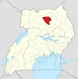 | |
| Economy | ||
| Energy | ||
| Education |
| |
| Transport | ||
| Notable people |
| |
