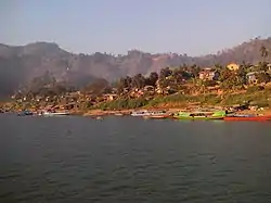
Paletwa
Paletwa (Burmese: ပလက်ဝမြို့; MLCTS: pa. lak wa. mrui., pronounced [pəlɛʔwa̰ mjo̰]) is one of the westernmost towns of Myanmar, in Chin State 18 kilometres from the border with Bangladesh. Its population in 2014 was about 97,000.[1]
Paletwa
ပလက်ဝမြို့ | |
|---|---|
Town | |
 | |
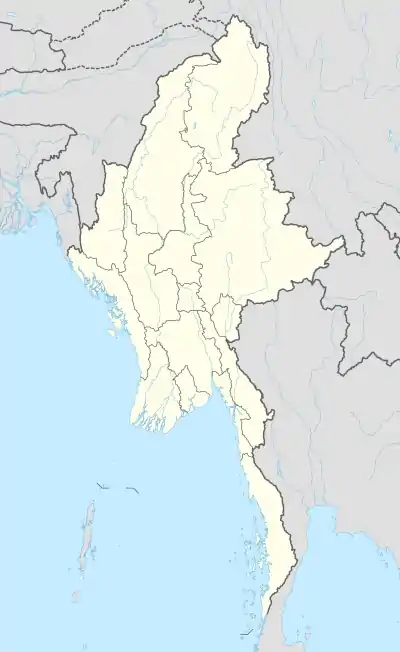 Paletwa Location in Myanmar | |
| Coordinates: 21°18′N 92°51′E | |
| Country | |
| State | |
| District | Mindat District |
| Township | Paletwa Township |
| Area | |
| • Total | 1,368 sq mi (3,543 km2) |
| Population (2014) | 96,899 |
| Time zone | UTC+6.30 (MST) |
| Climate | Am |
Demographics
Rakhine is the Lingua Franca of the region, while Kuki-Chin languages are spoken mostly in the hills.[2] The west of the town hosts many refugees that have fled from Rakhine state.[3] The literacy rate is 65% (2017).[4]
Neighboring villages such as Kan Lay (ကန်းလေ) can be reached only by foot in about an hour.
Connectivity
Paletwa is connected to the Rakhine state only by boat. It leaves Kyauktaw every morning and reaches Paletwa in the afternoon, running up the Kaladan River.[5]
The road to Matupi is reported to be on the brink of completion [6][7]
Paletwa is part of an ongoing infrastructure project Kaladan Multi-Modal Transit Transport Project that will connect it to the Indian state of Mizoram.[2]
Tourism
Despite its serene natural surroundings, tourism is under developed. The town has one hotel, but due to the restrictions on foreigners and accessibility problems for domestic tourists, tourism is almost non existent.
References
- http://www.mrtv3.net.mm/newpaper/99newsn.pdf%5B%5D Page 10 Column 1
- "The Limits of Development and Control in the Borderlands of Burma (Part I)". Tea Circle. 2018-05-17. Retrieved 2020-08-23.
- "Hundreds of villagers flee fighting in sourthern Chin". Myanmar NOW. Retrieved 2020-08-23.
- "The 2014 Myanmar Population and Housing CensusDepartment of PopulationMinistry of Labour, Immigration and PopulationOctober 2017CHIN STATE, MINDAT DISTRICT" (PDF).
- "The Abduction of AA over the Paletwa MP confirmed by the Chin State Govt". Burma News International. Retrieved 2020-08-23.
- "Farmers' land destroyed to make way for Paletwa to Matupi road – Chin Human Rights Organization". Retrieved 2020-08-23.
- "Civilians pay the price of conflict in southern Chin". Frontier Myanmar. 2020-03-10. Retrieved 2020-08-23.
External links
Capital: Paletwa | |
|
Capital: Hakha | ||
| Falam District |  | |
| Hakha District | ||
| Matupi District | ||
| Mindat District | ||
| Cities and towns | ||