Kyauktaw
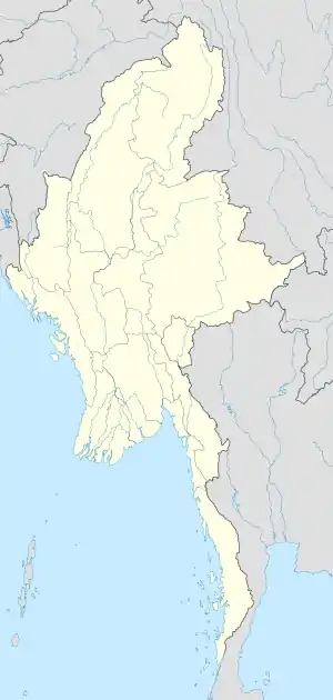
Kyauktaw (Burmese: ေက်ာက္ေတာ္ၿမိဳ႕ [tɕaʊʔtɔ̀ mjo̰]) is a town in northern Rakhine State, in the westernmost part of Myanmar. The famous Mahamuni Buddha image was originally situated near Kyauktaw, in the ruins of the old city of Dhanyawadi.
Kyauktaw
ေက်ာက္ေတာ္ၿမိဳ႕ | |
|---|---|
Town | |
 Kyauktaw Location in Myanmar | |
| Coordinates: 20°50′38″N 92°58′03″E | |
| Country | |
| Division | |
| District | Sittwe District |
| Township | Kyauktaw Township |
| Population | |
| • Religions | Buddhism ဗုဒၶဘာသာ Christianity ခရစ္ယန္ဘာသာ and Hinduism ဟိႏၵဳဘာသာ Islam အစၥလာမ္ဘာသာ |
| Time zone | UTC+6.30 (MMT) |
Location
Kyauktaw is situated 65 miles (105 km) from the north of Sittwe, the capital city of Rakhine State. It is located approximately between latitudes 20° 37' north and 21° 11' north and longitudes 92° 50' east and 93° 88' east from the north of Kaladan River. The Kispanadi Bridge is located at the entrance to Kyauktaw, traversing the Kaladan River.
Area
The area of Kyauktaw Township is nearly 675.55 square miles (1,749.7 km2). Kyauktaw is bordered by Mrauk U, around 27 miles (43 km) from the east, Buthidaung, around 30 miles (48 km) from the west, Ponnagyun, 45 miles (72 km) from the south and Pallawa Township of Chin State, around 40 miles (64 km) from the north. It stretches 19 miles (31 km) from east to west and 35 miles (56 km) from north to south.
Rivers
- Kaladan River (Kispanadi) (ကုလားတန္ျမစ္)
- Pi Chung (ပီေခ်ာင္း)
- Priang Chung (ၿပိဳင္းေခ်ာင္း)
- Thari Chung (သရီေခ်ာင္း)
- Pigauk Chung (ပီေကာက္ေခ်ာင္း)
- Yoo Chung (ယိုးေခ်ာင္း)
- Minne Chung (မီးေခ်ာင္း)
- Ywar Ma Pyin (ရြာမျပင္)
Climate
Kyauktaw has three seasons; the monsoon or rainy season is from May to October; the cool season or winter from November to February and the hot season or summer from March to May. The average temperature range during the summer is from 32 to 40 °C. The average rainfall range during the rainy season is from 431 to 482 centimeters. There was a flood in July 2011.[1]
Economy
Kyauktaw has many sugar mills and sugar-cane plantations.
Religious buildings
- Buddhist monasteries
- Downtown (5)
- Uptown (201)
- Mosques
- Downtown (3)
- Uptown (102)
- Churches
- Downtown (3)
- Uptown (5)
- Hindu temple
- Downtown (1)
References
- mizzima.com/news/inside-burma/5650-seven-townships-in-arakan-state-flooded-by-record-heavy-rain.html
External links
Capital: Sittwe | ||
| Kyaukpyu District |  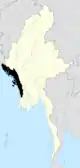 | |
| Maungdaw District | ||
| Sittwe District | ||
| Thandwe District |
| |
| Mrauk-U District | ||
| Main cities and towns | ||