Palominas, Arizona
Palominas is a census-designated place located along the San Pedro River in the southern portion of Cochise County in the state of Arizona. Palominas is located very close to the community of Miracle Valley along Arizona State Highway 92. The population of Palominas as of the 2010 U.S. Census was 212.[3]
Palominas, Arizona | |
|---|---|
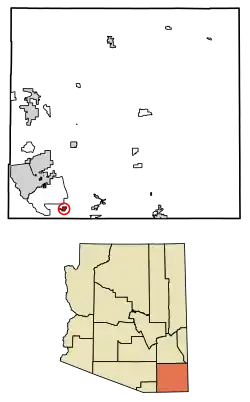 Location of Palominas in Cochise County, Arizona. | |
 Palominas Location in Arizona | |
| Coordinates: 31°22′47.36″N 110°7′6.27″W | |
| Country | United States |
| State | Arizona |
| County | Cochise |
| Area | |
| • Total | 1.93 sq mi (5.00 km2) |
| • Land | 1.93 sq mi (4.99 km2) |
| • Water | 0.00 sq mi (0.01 km2) |
| Population (2010) | |
| • Total | 7,247 |
| • Estimate (2016)[2] | N/A |
| Time zone | UTC-7 (MST (no daylight saving time)) |
| ZIP code | 85615 |
| Area code(s) | 520 |
| FIPS code | 04-52230 |
| Website | |
Transportation
Cochice Connection provides bus connections between Douglas, Bisbee, and Sierra Vista, with a stop in Palominas.[5]
References
- "2016 U.S. Gazetteer Files". United States Census Bureau. Retrieved Jul 18, 2017.
- "Population and Housing Unit Estimates". Retrieved June 9, 2017.
- "AZ - Palominas CDP". U.S. Census Bureau. Archived from the original on 30 March 2014. Retrieved 3 April 2014.
- "Census of Population and Housing". Census.gov. Retrieved June 4, 2016.
- "Schedule | Douglas, AZ". Retrieved 2018-10-20.
Municipalities and communities of Cochise County, Arizona, United States | ||
|---|---|---|
| Cities | 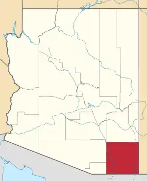 | |
| Towns | ||
| CDPs | ||
| Populated places |
| |
| Ghost towns | ||
| ||
This article is issued from Wikipedia. The text is licensed under Creative Commons - Attribution - Sharealike. Additional terms may apply for the media files.