Panchapuri
Panchapuri (Nepali: पञ्चपुरी) is an urban municipality located in Surkhet District of Karnali Province of Nepal.[1]
Panchapuri
पञ्चपुरी | |
|---|---|
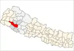
 Panchapuri Location in Nepal | |
| Coordinates: 28.792°N 81.387°E | |
| Country | |
| Province | Karnali |
| District | Surkhet |
| No. of wards | 11 |
| Established | 10 March 2017 |
| Government | |
| • Type | Mayor-council |
| • Mayor | Mr. Upendra Bahadur Thapa (NC) |
| • Deputy mayor | Mrs. Muktidevi Regmi (Puri) (NC) |
| Area | |
| • Total | 329.9 km2 (127.4 sq mi) |
| Population (2011) | |
| • Total | 32,231 |
| • Density | 98/km2 (250/sq mi) |
| Time zone | UTC+5:45 (NST) |
| Website | official website |
The total area of the municipality is 329.9 square kilometres (127.4 sq mi) and the total population of the municipality as of 2011 Nepal census is 32,231 individuals. The municipality is divided into total 11 wards. [2]
The municipality was established on 10 March 2017, when Government of Nepal restricted old administrative structure and announced 744 local level units as per the new constitution of Nepal 2015.[3][4]
Salkot, Babiyachaue, Chapre, Bidyapur and Tatopani Village development committee were Incorporated to form this new municipality. The municipality is divided into 11 wards and the headquarters of municipality situated at Babiyachaur[2]
References
- "स्थानीय तहहरुको विवरण" [Details of the local level bodies]. www.mofald.gov.np/en (in Nepali). Ministry of Federal Affairs and Local Development. Archived from the original on 31 August 2018. Retrieved 17 July 2018.
- "District Corrected Last for RAJAPATRA" (PDF). www.mofald.gov.np. Retrieved 17 July 2018.
- "New local level structure comes into effect from today". www.thehimalayantimes.com. The Himalayan Times. 10 March 2017. Retrieved 17 July 2018.
- "New local level units come into existence". www.kathmandupost.ekantipur.com. 11 March 2017. Retrieved 18 July 2018.