Payson Airport
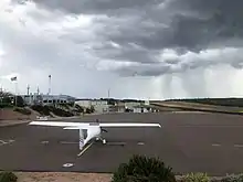
Payson Airport (IATA: PJB, ICAO: KPAN, FAA LID: PAN) is a public airport located 1 mile (0.87 nmi; 1.6 km) west of the central business district of Payson, a town in Gila County, Arizona, United States. The airport covers 80 acres (32 ha) and has one runway and one helipad.[1] It is mostly used for general aviation, and is host to a number of fire-fighting aircraft during the summer fire season.
Payson Airport | |||||||||||
|---|---|---|---|---|---|---|---|---|---|---|---|
| Summary | |||||||||||
| Airport type | Public | ||||||||||
| Owner | Town of Payson | ||||||||||
| Location | Payson, Arizona | ||||||||||
| Elevation AMSL | 5,157 ft / 1,572 m | ||||||||||
| Coordinates | 34°15′25″N 111°20′21″W | ||||||||||
| Website | www | ||||||||||
| Map | |||||||||||
 Payson Airport  Payson Airport | |||||||||||
| Runways | |||||||||||
| |||||||||||
| Helipads | |||||||||||
| |||||||||||
| Statistics (2011) | |||||||||||
| |||||||||||
Facilities and aircraft
Facilities
Payson Airport covers an area of 80 acres (32 ha) which contains one asphalt paved runway, and one concrete helipad:
- Runway 6/24 measuring 5,504 x 75 ft (1,678 x 23 m)
- Helipad 1 (H1) measuring 50 x 50 ft (15 x 15 m)
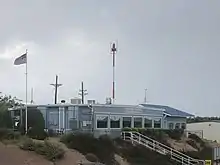
The airport does not have an air traffic control tower.
For the period ending 27, April 2011, the airport had 41,245 operations at an average of 113 a day. 60% transient general aviation, 36% local general aviation, 4% air taxi and <1% military.
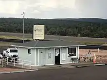
Payson Aviation is the main provider of fixed-based operations. Payson Air also provides some services such as aircraft maintenance. They are the airport's only flight training school.
Aircraft
There are 35 aircraft based on the field. These include 30 single-engine, 3 multi-engine and 2 ultra-light gliders. [3]
Cargo Airline
| Airlines | Destinations |
|---|---|
| Ameriflight | Phoenix-Sky Harbor, Show Low[4] |
References
- FAA Airport Form 5010 for PAN PDF, effective 2007-07-05
- "Payson Airport Overview (Payson, AZ) [KPAN/PAN]". FlightAware. Retrieved 20 January 2013.
- https://w3.ameriflight.com/wp-content/uploads/2019/11/Complex-Bases-with-Destinations-Lines-and-Airport-Codes-all-white-text-2-e1573666934751.png
External links
- Payson Airport (PAN) at Arizona DOT airport directory
- Resources for this airport:
- FAA airport information for KPAN
- AirNav airport information for KPAN
- ASN accident history for PJB
- FlightAware airport information and live flight tracker
- SkyVector aeronautical chart for KPAN