Peak Hill, New South Wales
Peak Hill is a town in Parkes Shire in the Central West of New South Wales, Australia. At the 2016 census, Peak Hill had a population of 1,106 people.[1] It is located on the Newell Highway and the Dubbo to Parkes railway line.
| Peak Hill New South Wales | |||||||||
|---|---|---|---|---|---|---|---|---|---|
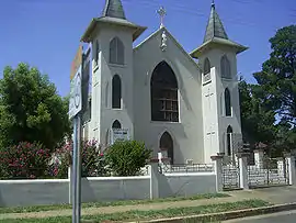 Peak Hill Catholic church | |||||||||
Peak Hill | |||||||||
| Coordinates | 32°43′S 148°11′E | ||||||||
| Population | 1,106 (2016 census)[1] | ||||||||
| Established | 1889 [2] | ||||||||
| Postcode(s) | 2869 | ||||||||
| Elevation | 285 m (935 ft) | ||||||||
| Location | |||||||||
| LGA(s) | Parkes Shire | ||||||||
| State electorate(s) | Orange | ||||||||
| Federal Division(s) | Calare | ||||||||
| |||||||||
History
Before the arrival of Europeans, the Peak Hill area was part of the Wiradjuri people's lands.[3] In 1817, the explorer John Oxley and his party were the first Europeans in the region.[3] In 1889, Gold was discovered in the area, and later that year Peak Hill was gazetted in November 1889.[4] The Post office opened on 7 November 1889, and the Bureau of Meteorology's weather station began in 1965.[5][6] The first public wheat silo built in Australia was constructed at Peak Hill in 1918 after government surveys indicated the district had great potential as a wheat-producing region.[7][8]
Agriculture
The district is also a renowned sheep producing area, particularly medium-woolled merinos. There are also four merino studs actively operating in the area, namely Cora Lynn, Genanegie, Towalba, and Westray. Rams from these studs have been sold throughout Australia, and they all have on-property hoggett ram sales in September, supplying commercial sheep breeders with high-quality young rams to breed from.
Climate
| Climate data for Peak Hill Post Office | |||||||||||||
|---|---|---|---|---|---|---|---|---|---|---|---|---|---|
| Month | Jan | Feb | Mar | Apr | May | Jun | Jul | Aug | Sep | Oct | Nov | Dec | Year |
| Record high °C (°F) | 44.5 (112.1) |
46.0 (114.8) |
39.7 (103.5) |
36.0 (96.8) |
28.2 (82.8) |
24.7 (76.5) |
23.4 (74.1) |
28.4 (83.1) |
35.9 (96.6) |
39.0 (102.2) |
43.8 (110.8) |
42.9 (109.2) |
46.0 (114.8) |
| Average high °C (°F) | 33.4 (92.1) |
32.6 (90.7) |
29.5 (85.1) |
25.2 (77.4) |
20.1 (68.2) |
16.3 (61.3) |
15.4 (59.7) |
17.1 (62.8) |
20.7 (69.3) |
24.9 (76.8) |
28.4 (83.1) |
31.5 (88.7) |
24.6 (76.3) |
| Average low °C (°F) | 19.4 (66.9) |
19.3 (66.7) |
16.5 (61.7) |
12.4 (54.3) |
8.7 (47.7) |
6.1 (43.0) |
4.8 (40.6) |
5.7 (42.3) |
7.9 (46.2) |
11.5 (52.7) |
14.6 (58.3) |
17.4 (63.3) |
12.0 (53.6) |
| Record low °C (°F) | 7.4 (45.3) |
7.8 (46.0) |
4.3 (39.7) |
1.5 (34.7) |
−0.7 (30.7) |
−2.5 (27.5) |
−3.0 (26.6) |
−3.6 (25.5) |
−1.0 (30.2) |
1.7 (35.1) |
3.8 (38.8) |
6.2 (43.2) |
−3.6 (25.5) |
| Average rainfall mm (inches) | 58.9 (2.32) |
50.3 (1.98) |
50.5 (1.99) |
41.8 (1.65) |
44.3 (1.74) |
43.3 (1.70) |
44.4 (1.75) |
42.3 (1.67) |
39.1 (1.54) |
48.0 (1.89) |
47.4 (1.87) |
51.5 (2.03) |
561.4 (22.10) |
| Average rainy days (≥ 0.2mm) | 5.2 | 4.9 | 4.7 | 4.4 | 5.8 | 7.5 | 7.6 | 6.9 | 6.2 | 6.4 | 5.4 | 5.3 | 70.3 |
| Source: Bureau of Meteorology[6] | |||||||||||||
Facilities
Peak Hill has a Catholic primary school St Joseph's, and a public central school.
Peak Hill has three motels, one hotel and two caravan parks. It also has a post office, RSL club, bowling club, golf club, cafes, antique shops, newsagency, supermarket, butcher shop, art gallery, book shop, hairdressers and beauty salons. There is a showground that has harness races and an annual agricultural show.
Peak Hill offers many tourist attractions such as the open cut gold mine, flora and fauna reserve nature walk, Bogan Weir, Australia's first upright wheat silo, heritage listed hospital, arts and crafts, Big Fish fossil hut, and a unique street facade which takes visitors back in time.
The local community operates a volunteer-run radio station: PeakHillFM89.5. The station provides a round-the-clock service of classic hits seven days per week.[9]
Peak Hill styles itself as 'The Town With a Heart of Gold'.[10] to reflect its proximity to the goldmine, and lends its facilities as a base for tourists of Wiradjuri Country.
Silos
Peak Hill's central position in the New South Wales wheat belt may have been the reason why Peak Hill became the site for Australia's first upright bulk wheat silo in 1918. It was not until 1927 that the next stage, the six-bin silos and weighbridge complex, was completed at Peak Hill. In 1950 the construction of three additional 50,000-bushel bins was carried out and the bulkhead was completed in 1959.
After viewing the current silo, it will become apparent that they have grown substantially over the years to cope with the local grain production. A lot of locally grown grain is also taken over to the Parkes silo.
The Peak Hill silo can be viewed from Lindner Avenue, which runs parallel with the railway line.
Notable People
- Graham Murray, rugby league player and coach
References
- Australian Bureau of Statistics (27 June 2017). "Peak Hill (Urban Centre/Locality)". 2016 Census QuickStats. Retrieved 9 April 2015.

- "Government Gazette Proclamations and Legislation". New South Wales Government Gazette (630). New South Wales, Australia. 30 November 1889. p. 8528. Retrieved 25 April 2019 – via National Library of Australia.
- "Peak Hill History". Peak Hill NSW. Peak Hill Visitor Information Centre. Retrieved 27 April 2019.
- "Government Gazette Proclamations and Legislation". New South Wales Government Gazette (630). New South Wales, Australia. 30 November 1889. p. 8528. Retrieved 27 April 2019 – via National Library of Australia.
- "Peak Hill Post Office". Retrieved 27 April 2019.
- "Peak Hill Post Office". Climate statistics for Australian locations. Bureau of Meteorology. April 2019. Retrieved 27 April 2019.
- "A History of Peak Hill and District", published by the Peak Hill Centenary book committee, 1989.
- "Peak Hill Silos mark 100 years". Parkes Shire Council. Retrieved 27 April 2019.
- https://www.peakhillfm.com.au. Retrieved 29 May 2015. Missing or empty
|title=(help) - https://www.peakhill.nsw.au. Retrieved 29 May 2015. Missing or empty
|title=(help)
![]() Media related to Peak Hill, New South Wales at Wikimedia Commons
Media related to Peak Hill, New South Wales at Wikimedia Commons
| Authority control |
|---|