Tullamore, New South Wales
Tullamore is a small town in Parkes Shire in the Central West of New South Wales, Australia. At the 2011 census, Tullamore had a population of 210.[1]
| Tullamore New South Wales | |||||||||
|---|---|---|---|---|---|---|---|---|---|
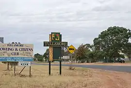 Entering Tullamore | |||||||||
Tullamore | |||||||||
| Coordinates | 32°38′0″S 147°34′0″E | ||||||||
| Population | 424 (2016 census)[1] | ||||||||
| Postcode(s) | 2874 | ||||||||
| Elevation | 239 m (784 ft) | ||||||||
| Location |
| ||||||||
| LGA(s) | Parkes Shire | ||||||||
| State electorate(s) | Orange | ||||||||
| Federal Division(s) | Calare | ||||||||
| |||||||||
It lies in wheat-growing country. Tullamore has a railway station on the Bogan Gate–Tottenham Branch line. It is served by a newly constructed medical centre and a K-12 central school. Tullamore is home to the Tullamore Irish Festival, which is held each Easter long weekend.
Tullamore is the first town mentioned in the original (Australian) version of the song "I've Been Everywhere".
History
The area known as Tullamore was first settled as "Bullock Creek" in 1870. The post office opened under that name on 1 April 1890.[2] It was then renamed Gobondery. In 1895 Jim Tully, whose family came from Tullamore in Ireland, built a hotel and called it "Tullie's Exchange Hotel". The Kerley family, also from the Tullamore area in Ireland, settled on a nearby property and called it Tullamore Station. It is believed that the town obtained its name from this property.[3] The post office was officially renamed "Tullamore" in 1895.[2]
Climate
| Climate data for Tullamore (Kitchener St.) (1970–1988); 244 m AMSL; 32° 38′ 04.02″ S | |||||||||||||
|---|---|---|---|---|---|---|---|---|---|---|---|---|---|
| Month | Jan | Feb | Mar | Apr | May | Jun | Jul | Aug | Sep | Oct | Nov | Dec | Year |
| Record high °C (°F) | 45.3 (113.5) |
42.7 (108.9) |
39.0 (102.2) |
36.3 (97.3) |
28.5 (83.3) |
26.3 (79.3) |
24.0 (75.2) |
28.5 (83.3) |
35.7 (96.3) |
37.0 (98.6) |
43.1 (109.6) |
42.0 (107.6) |
45.3 (113.5) |
| Average high °C (°F) | 33.1 (91.6) |
32.4 (90.3) |
29.5 (85.1) |
24.7 (76.5) |
19.9 (67.8) |
16.1 (61.0) |
15.3 (59.5) |
17.2 (63.0) |
20.5 (68.9) |
24.6 (76.3) |
28.4 (83.1) |
32.2 (90.0) |
24.5 (76.1) |
| Average low °C (°F) | 17.8 (64.0) |
17.9 (64.2) |
14.4 (57.9) |
10.1 (50.2) |
6.6 (43.9) |
3.2 (37.8) |
2.4 (36.3) |
3.4 (38.1) |
5.8 (42.4) |
9.6 (49.3) |
12.6 (54.7) |
15.7 (60.3) |
10.0 (49.9) |
| Record low °C (°F) | 8.1 (46.6) |
7.5 (45.5) |
4.5 (40.1) |
−2.0 (28.4) |
−3.5 (25.7) |
−3.7 (25.3) |
−5.6 (21.9) |
−3.0 (26.6) |
−2.2 (28.0) |
0.8 (33.4) |
1.5 (34.7) |
5.5 (41.9) |
−5.6 (21.9) |
| Average precipitation mm (inches) | 51.4 (2.02) |
47.5 (1.87) |
41.4 (1.63) |
36.7 (1.44) |
37.6 (1.48) |
38.7 (1.52) |
34.8 (1.37) |
37.0 (1.46) |
31.9 (1.26) |
43.3 (1.70) |
43.9 (1.73) |
45.8 (1.80) |
490.0 (19.29) |
| Average precipitation days (≥ 0.2 mm) | 5.0 | 4.8 | 4.4 | 4.2 | 5.5 | 6.4 | 6.7 | 6.4 | 5.3 | 6.2 | 5.4 | 5.0 | 65.3 |
| Source: Australian Bureau of Meteorology; Tullamore (Kitchener St.) | |||||||||||||
References
- Australian Bureau of Statistics (31 October 2012). "Tullamore (L) (Urban Centre/Locality)". 2011 Census QuickStats. Retrieved 9 April 2015.

- Premier Postal History. "Post Office List". Premier Postal Auctions. Retrieved 26 May 2011.
- "Tullamore Township, in the heart of NSW" Archived 2012-03-17 at the Wayback Machine. tullamoreinc.com.au. Retrieved 7 March 2012.
External links
![]() Media related to Tullamore, New South Wales at Wikimedia Commons
Media related to Tullamore, New South Wales at Wikimedia Commons