Pease, Minnesota
Pease is a city in Mille Lacs County, Minnesota, United States. The population was 242 at the 2010 census.[6]
Pease | |
|---|---|
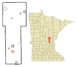 Location of Pease, Minnesota | |
| Coordinates: 45°41′53″N 93°38′54″W | |
| Country | United States |
| State | Minnesota |
| County | Mille Lacs |
| Area | |
| • Total | 0.53 sq mi (1.37 km2) |
| • Land | 0.53 sq mi (1.37 km2) |
| • Water | 0.00 sq mi (0.00 km2) |
| Elevation | 1,037 ft (316 m) |
| Population | |
| • Total | 242 |
| • Estimate (2019)[3] | 229 |
| • Density | 433.71/sq mi (167.53/km2) |
| Time zone | UTC-6 (Central (CST)) |
| • Summer (DST) | UTC-5 (CDT) |
| ZIP code | 56363 |
| Area code(s) | 320 |
| FIPS code | 27-50056[4] |
| GNIS feature ID | 0649215[5] |
History
A post office called Pease was established in 1894, and remained in operation until 1994.[7] Pease was named by railroad officials.[8]
Geography
According to the United States Census Bureau, the city has a total area of 0.91 square miles (2.36 km2), all land.[9]
Pease is located between Milaca and Princeton on U.S. Route 169, approximately 60 miles north-northwest of Minneapolis.[10]
Demographics
| Historical population | |||
|---|---|---|---|
| Census | Pop. | %± | |
| 1930 | 133 | — | |
| 1940 | 126 | −5.3% | |
| 1950 | 179 | 42.1% | |
| 1960 | 191 | 6.7% | |
| 1970 | 187 | −2.1% | |
| 1980 | 174 | −7.0% | |
| 1990 | 178 | 2.3% | |
| 2000 | 163 | −8.4% | |
| 2010 | 242 | 48.5% | |
| 2019 (est.) | 229 | [3] | −5.4% |
| U.S. Decennial Census[11] | |||
2010 census
As of the census[2] of 2010, there were 242 people, 86 households, and 63 families residing in the city. The population density was 265.9 inhabitants per square mile (102.7/km2). There were 93 housing units at an average density of 102.2 per square mile (39.5/km2). The racial makeup of the city was 97.9% White, 0.8% Asian, 0.8% from other races, and 0.4% from two or more races. Hispanic or Latino of any race were 1.7% of the population.
There were 86 households, of which 44.2% had children under the age of 18 living with them, 50.0% were married couples living together, 12.8% had a female householder with no husband present, 10.5% had a male householder with no wife present, and 26.7% were non-families. 19.8% of all households were made up of individuals, and 5.8% had someone living alone who was 65 years of age or older. The average household size was 2.81 and the average family size was 3.11.
The median age in the city was 29.3 years. 31.8% of residents were under the age of 18; 8.6% were between the ages of 18 and 24; 26.8% were from 25 to 44; 26.6% were from 45 to 64; and 6.2% were 65 years of age or older. The gender makeup of the city was 51.2% male and 48.8% female.
2000 census
As of the census[4] of 2000, there were 163 people, 62 households, and 40 families residing in the city. The population density was 376.4 people per square mile (146.4/km2). There were 67 housing units at an average density of 154.7 per square mile (60.2/km2). The racial makeup of the city was 100.00% White. Hispanic or Latino of any race were 1.23% of the population.
There were 62 households, out of which 41.9% had children under the age of 18 living with them, 54.8% were married couples living together, 9.7% had a female householder with no husband present, and 33.9% were non-families. 27.4% of all households were made up of individuals, and 11.3% had someone living alone who was 65 years of age or older. The average household size was 2.63 and the average family size was 3.22.
In the city, the population was spread out, with 31.9% under the age of 18, 6.7% from 18 to 24, 36.8% from 25 to 44, 12.9% from 45 to 64, and 11.7% who were 65 years of age or older. The median age was 30 years. For every 100 females, there were 111.7 males. For every 100 females age 18 and over, there were 113.5 males.
The median income for a household in the city was $35,833, and the median income for a family was $40,000. Males had a median income of $30,179 versus $23,333 for females. The per capita income for the city was $17,344. About 12.5% of families and 10.2% of the population were below the poverty line, including 7.8% of those under the age of eighteen and 12.5% of those 65 or over.
References
- "2019 U.S. Gazetteer Files". United States Census Bureau. Retrieved July 26, 2020.
- "U.S. Census website". United States Census Bureau. Retrieved 2012-11-13.
- "Population and Housing Unit Estimates". United States Census Bureau. May 24, 2020. Retrieved May 27, 2020.
- "U.S. Census website". United States Census Bureau. Retrieved 2008-01-31.
- "US Board on Geographic Names". United States Geological Survey. 2007-10-25. Retrieved 2008-01-31.
- "2010 Census Redistricting Data (Public Law 94-171) Summary File". American FactFinder. U.S. Census Bureau, 2010 Census. Retrieved 23 April 2011.
- "Mille Lacs County". Jim Forte Postal History. Retrieved 21 July 2015.
- Upham, Warren (1920). Minnesota Geographic Names: Their Origin and Historic Significance. Minnesota Historical Society. p. 345.
- "US Gazetteer files 2010". United States Census Bureau. Archived from the original on January 12, 2012. Retrieved 2012-11-13.
- https://www.google.com/maps/place/Pease,+MN/@46.3015664,-94.1916729,7.75z/data=!4m5!3m4!1s0x52b39076a8a2bc11:0x7024dfe729619bca!8m2!3d45.6980214!4d-93.6480191
- "Census of Population and Housing". Census.gov. Retrieved June 4, 2015.
External links
Municipalities and communities of Mille Lacs County, Minnesota, United States | ||
|---|---|---|
| Cities | 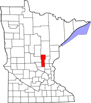 Map of Minnesota highlighting Mille Lacs County | |
| Townships | ||
| CDP | ||
| Unincorporated communities | ||
| Indian reservation | ||
| Footnotes | ‡This populated place also has portions in an adjacent county or counties | |
| ||
| Authority control |
|
|---|