Pellston, Michigan
Pellston is a village in Emmet County in the U.S. state of Michigan. The population was 822 at the 2010 census. The village is the home of Pellston Regional Airport. Its motto is "Icebox of the Nation"; Pellston recorded the state of Michigan's record low temperature, at −53 °F (−47 °C), in 1933, and every winter is regularly called out in national weather reports, along with towns such as Big Piney, Wyoming, Fraser, Colorado and International Falls, Minnesota, as one of the coldest spots in the nation.
Pellston, Michigan | |
|---|---|
| Village of Pellston | |
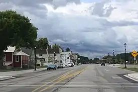 Downtown Pellston along U.S. Route 31 | |
| Nickname(s): Ice Box of the Nation | |
%252C_MI_location2.png.webp) Location within Emmet County | |
 Pellston Location within the state of Michigan | |
| Coordinates: 45°33′14″N 84°47′04″W | |
| Country | United States |
| State | Michigan |
| County | Emmet |
| Townships | Maple River and McKinley |
| Government | |
| • Type | Village council |
| • President | James Gillett |
| • Clerk | Lisa Fought |
| Area | |
| • Total | 1.95 sq mi (5.05 km2) |
| • Land | 1.95 sq mi (5.05 km2) |
| • Water | 0.00 sq mi (0.00 km2) |
| Elevation | 699 ft (213 m) |
| Population | |
| • Total | 822 |
| • Estimate (2019)[3] | 843 |
| • Density | 432.31/sq mi (166.91/km2) |
| Time zone | UTC-5 (Eastern (EST)) |
| • Summer (DST) | UTC-4 (EDT) |
| ZIP code(s) | 49769 |
| Area code(s) | 231 |
| FIPS code | 26-63300[4] |
| GNIS feature ID | 0634571[5] |
| Website | Official website |
The village lies on the boundary between Maple River and McKinley townships on US Highway 31. Interstate 75 is about 10 miles (16 km) east of Pellston. Mackinaw City and the Mackinac Bridge are approximately 18 miles (29 km) north and Petoskey is about 20 miles (32 km) southwest of the village. The University of Michigan Biological Station is on nearby Douglas Lake.
Demographics
| Historical population | |||
|---|---|---|---|
| Census | Pop. | %± | |
| 1910 | 1,089 | — | |
| 1920 | 915 | −16.0% | |
| 1930 | 810 | −11.5% | |
| 1940 | 562 | −30.6% | |
| 1950 | 442 | −21.4% | |
| 1960 | 429 | −2.9% | |
| 1970 | 469 | 9.3% | |
| 1980 | 565 | 20.5% | |
| 1990 | 583 | 3.2% | |
| 2000 | 771 | 32.2% | |
| 2010 | 822 | 6.6% | |
| 2019 (est.) | 843 | [3] | 2.6% |
| U.S. Decennial Census[6] | |||
The University of Michigan has its biological station in Pellston.
2010 census
As of the census[2] of 2010, there were 822 people, 308 households, and 216 families residing in the village. The population density was 430.4 inhabitants per square mile (166.2/km2). There were 364 housing units at an average density of 190.6 per square mile (73.6/km2). The racial makeup of the village was 86.5% White, 0.2% African American, 8.0% Native American, 0.1% Asian, 0.2% from other races, and 4.9% from two or more races. Hispanic or Latino of any race were 1.9% of the population.
There were 308 households, of which 41.9% had children under the age of 18 living with them, 47.1% were married couples living together, 16.6% had a female householder with no husband present, 6.5% had a male householder with no wife present, and 29.9% were non-families. 24.0% of all households were made up of individuals, and 7.4% had someone living alone who was 65 years of age or older. The average household size was 2.67 and the average family size was 3.13.
The median age in the village was 34.1 years. 30.8% of residents were under the age of 18; 7.6% were between the ages of 18 and 24; 25.4% were from 25 to 44; 26.9% were from 45 to 64; and 9.2% were 65 years of age or older. The gender makeup of the village was 48.8% male and 51.2% female.
2000 census
As of the census[4] of 2000, there were 771 people, 260 households, and 199 families residing in the village. The population density was 402.8 per square mile (155.9/km2). There were 308 housing units at an average density of 160.9 per square mile (62.3/km2). The racial makeup of the village was 89.75% White, 0.65% African American, 6.49% Native American, 0.26% Asian, 0.13% Pacific Islander, and 2.72% from two or more races. Hispanic or Latino of any race were 0.78% of the population.
There were 260 households, out of which 43.5% had children under the age of 18 living with them, 60.0% were married couples living together, 11.2% had a female householder with no husband present, and 23.1% were non-families. 16.9% of all households were made up of individuals, and 5.8% had someone living alone who was 65 years of age or older. The average household size was 2.97 and the average family size was 3.33.
In the village, the population was spread out, with 33.3% under the age of 18, 6.9% from 18 to 24, 32.6% from 25 to 44, 18.3% from 45 to 64, and 8.9% who were 65 years of age or older. The median age was 31 years. For every 100 females, there were 98.7 males. For every 100 females age 18 and over, there were 94.0 males.
The median income for a household in the village was $37,292, and the median income for a family was $39,911. Males had a median income of $25,956 versus $20,013 for females. The per capita income for the village was $13,047. About 10.8% of families and 13.7% of the population were below the poverty line, including 14.0% of those under age 18 and 13.0% of those age 65 or over.
Geography
According to the United States Census Bureau, the village has a total area of 1.91 square miles (4.95 km2), all land.[7]
Climate
Pellston is known regionally for its cold temperatures. It is often mentioned on television and radio because of its nightly lows. According to the Köppen Climate Classification system, Pellston has a humid continental climate, abbreviated "Dfb" on climate maps.[8]
| Climate data for Pellston | |||||||||||||
|---|---|---|---|---|---|---|---|---|---|---|---|---|---|
| Month | Jan | Feb | Mar | Apr | May | Jun | Jul | Aug | Sep | Oct | Nov | Dec | Year |
| Record high °F (°C) | 53 (12) |
60 (16) |
87 (31) |
91 (33) |
93 (34) |
99 (37) |
98 (37) |
98 (37) |
96 (36) |
87 (31) |
74 (23) |
64 (18) |
99 (37) |
| Average high °F (°C) | 26 (−3) |
29 (−2) |
38 (3) |
51 (11) |
66 (19) |
75 (24) |
79 (26) |
77 (25) |
68 (20) |
56 (13) |
42 (6) |
31 (−1) |
53 (12) |
| Average low °F (°C) | 9 (−13) |
8 (−13) |
17 (−8) |
30 (−1) |
40 (4) |
49 (9) |
55 (13) |
53 (12) |
46 (8) |
36 (2) |
28 (−2) |
17 (−8) |
32 (0) |
| Record low °F (°C) | −35 (−37) |
−53 (−47) |
−34 (−37) |
−14 (−26) |
11 (−12) |
25 (−4) |
28 (−2) |
29 (−2) |
20 (−7) |
4 (−16) |
−23 (−31) |
−31 (−35) |
−53 (−47) |
| Average precipitation inches (mm) | 2.41 (61) |
1.64 (42) |
2.32 (59) |
2.63 (67) |
2.70 (69) |
2.55 (65) |
2.71 (69) |
3.25 (83) |
3.90 (99) |
3.21 (82) |
2.96 (75) |
2.45 (62) |
32.73 (833) |
| Source: The Weather Channel[9] | |||||||||||||
Transportation
Indian Trails provides daily intercity bus service between St. Ignace and East Lansing, Michigan.[10]
Delta Air Lines provides airline service to Detroit, Michigan.[11]
Images
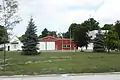 Fire department
 Sign on US 31
 City welcome sign
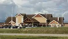
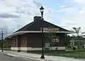 Pellston Historical Society Museum
References
| Wikimedia Commons has media related to Pellston, Michigan. |
- "2019 U.S. Gazetteer Files". United States Census Bureau. Retrieved July 25, 2020.
- "U.S. Census website". United States Census Bureau. Retrieved 2012-11-25.
- "Population and Housing Unit Estimates". United States Census Bureau. May 24, 2020. Retrieved May 27, 2020.
- "U.S. Census website". United States Census Bureau. Retrieved 2008-01-31.
- "US Board on Geographic Names". United States Geological Survey. 2007-10-25. Retrieved 2008-01-31.
- "Census of Population and Housing". Census.gov. Retrieved June 4, 2015.
- "US Gazetteer files 2010". United States Census Bureau. Archived from the original on 2012-07-02. Retrieved 2012-11-25.
- Climate Summary for Pellston, Michigan
- "Average Weather for Pellston, MI - Temperature and Precipitation". Archived from the original on 2012-10-23. Retrieved January 31, 2011.
- "EAST LANSING-PETOSKEY-ST. IGNACE" (PDF). Indian Trails. January 15, 2013. Archived from the original (PDF) on June 29, 2014. Retrieved 2013-02-27.
- Delta Air Lines. "July 2014 Worldwide Flight Schedule" (PDF).
Municipalities and communities of Emmet County, Michigan, United States | ||
|---|---|---|
| Cities | 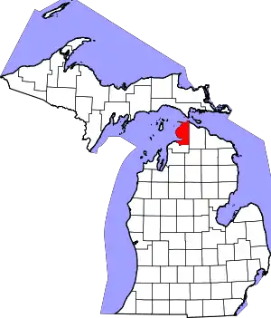 Map of Michigan highlighting Emmet County.svg | |
| Villages | ||
| Civil township | ||
| CDPs | ||
| Ghost towns | ||
| Indian reservations | ||
| Footnotes | ‡This populated place also has portions in an adjacent county or counties | |
| ||
| Authority control |
|
|---|