Perekop
Perekop (Ukrainian & Russian: Перекоп; Crimean Tatar: Or Qapı; Greek: Τάφρος and Τάφραι[1] and Τάφρη[1]) is an urban-type settlement located on the Perekop Isthmus connecting the Crimean peninsula to the Ukrainian mainland. It is known for the fortress Or Qapi that served as the gateway to Crimea. The village currently is part of Armyansk Municipality. Population: 919 (2014 Census).[2]
Perekop
Перекоп Or Qapı | |
|---|---|
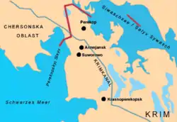 A map showing the location of Perekop | |
.jpg.webp) Perekop Location of Perekop within the Crimea 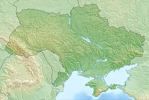 Perekop Perekop (Ukraine) .jpg.webp) Perekop Perekop (European Russia) 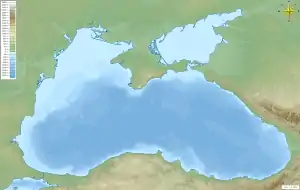 Perekop Perekop (Black Sea) | |
| Coordinates: 46°9′42″N 33°41′34″E | |
| Country | Disputed: |
| Republic | Crimea |
| Region | Armyansk municipality |
| Elevation | 5 m (16 ft) |
| Population (2015) | |
| • Total | 919 |
| Time zone | UTC+4 (MSK) |
| Postal code | 96011 |
| Area code(s) | +380-6567 |
| Former names | Or Qapı, Tafgros |
| Climate | Cfa |
Name
The original name was of the Greek settlement of Taphros (Ancient Greek: Τάφρος) which means a dug-out locality. The people were called Taphrians (Ancient Greek: Τάφριοι)[3]
Thereafter was the equivalent name of Or Qapı in the Crimean Tatar language meaning Or - trench and Qapı - gate, and subsequently the name Perekop in the Slavic languages which literally means an over-dug locality.
History
Due to its key position, over the history Perekop was under many sieges.
During the Russo-Turkish War (1735–1739), Russian Field Marshal Burkhard Christoph von Munnich successfully stormed the fortifications on June 17, 1736 and left the Tatar fortress in ruins. This was a serious, if not mortal, blow to the independence of the Crimean Khanate.
The town was virtually wiped out during the Siege of Perekop by the Red Army in 1920. The siege was a key episode of the Russian Civil War. The success of the Bolsheviks allowed them to oust Pyotr Wrangel's White Army from the Crimea. Twelve years later, the Soviets founded the new town of Krasnoperekopsk 32 km (20 mi) to the south.
During World War II, Perekop was occupied by the German Army from September 27, 1941 to November 1, 1943. The capture of Perekop (by both the Wehrmacht in 1941 and the Red Army in 1943) was used to cut off Crimea from Ukraine.
References
- Stephanus of Byzantium, Ethnica, §T609.9
- Russian Federal State Statistics Service (2014). "Таблица 1.3. Численность населения Крымского федерального округа, городских округов, муниципальных районов, городских и сельских поселений" [Table 1.3. Population of Crimean Federal District, Its Urban Okrugs, Municipal Districts, Urban and Rural Settlements]. Федеральное статистическое наблюдение «Перепись населения в Крымском федеральном округе». ("Population Census in Crimean Federal District" Federal Statistical Examination) (in Russian). Federal State Statistics Service. Retrieved January 4, 2016.
- Strabo, Geography, §7.3.19
External links
- Registration card at Verkhovna Rada
- Description of Perekop at the geographical dictionary of Polish Kingdom
- Perekop's Coat of Arms
- A website dedicated to Perekop
| Cities | Coat of arms of Armyansk municipality | |
|---|---|---|
| Settlements |
| |